Bici de carretera
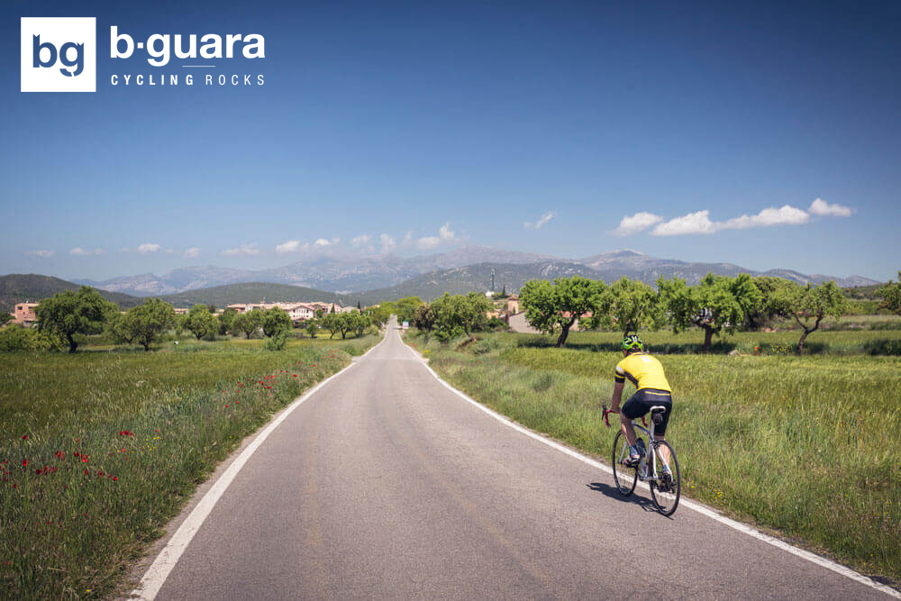
BGuara Cycling Rocks es un gran espacio cicloturista en plena Sierra de Guara que ofrece diferentes rutas cicloturistas con las que descubrir los rincones más inaccesibles de esta tierra y entre ellas diferentes opciones para disfrutar de la bici de carretera:
- Vuelta a Guara: 207,5Km | 3500m
- Circular desde Alquézar por el Somontano: 59,1km | 900m
- Biello Sobrarbe: 163,2Km | 2580m
Technical information
Type of route: circular
Departure point: Barbastro
KM: 90
Duration: 4 h
Gradient: 400 m
Difficulty:
Itinerary
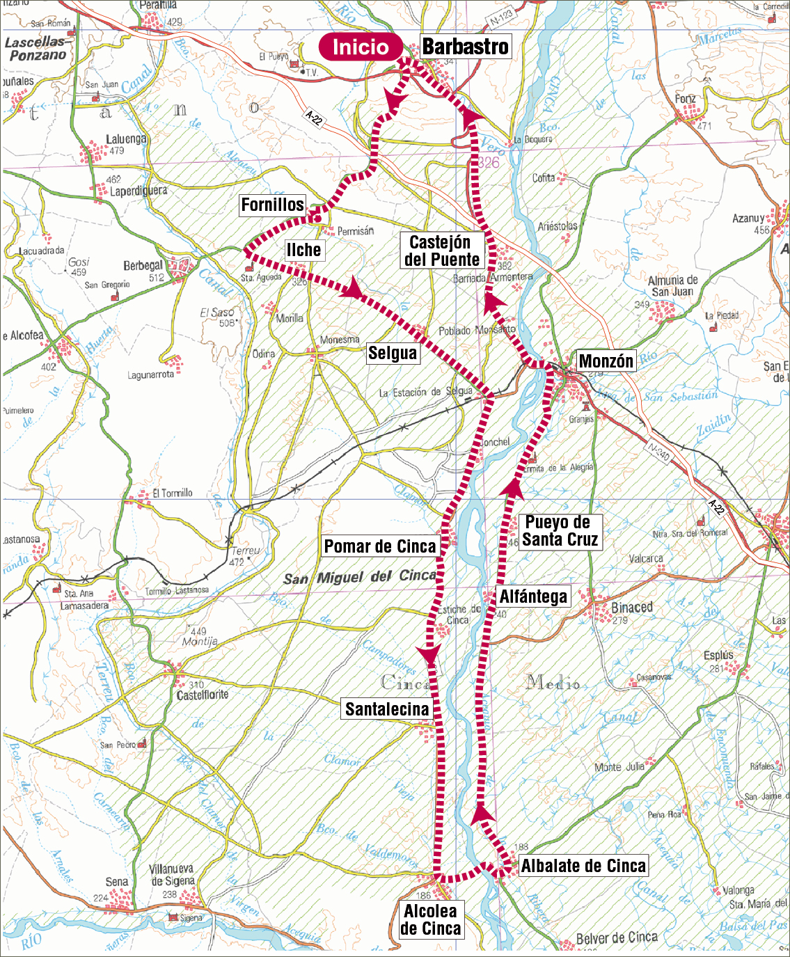
Barbastro - Ilche - Pomar de Cinca - Albalate de Cinca - Monzón - Barbastro
Route description
This relatively flat path takes us from Barbastro and crosses various villages in the southern part of Somontano, such as Fornillos, Ilche and Permisán. It then heads on to the neighbouring region of Cinca Medio. After the town of Selgua, the path continues parallel to the Cinca riverbed, a river that gives name to many surrounding villages: Pomar de Cinca, Estiche de Cinca, Alcolea de Cinca and Albalate de Cinca. The landscape, characterised by irrigated cultivations is practically flat and dotted with land reliefs with flat tops called “muelas” and smaller ones called “cerros testigo”. The path continues on towards Alfántega, Pueyo de Santa Cruz and Monzón whose urban centre is dominated by its magnificent Templar castle. From here the path heads back to Barbastro passing Castejón del Puente, an important communication hub from long ago.
Photo gallery
Map
Technical information
Type of route: circular
Departure point: Barbastro
KM: 111
Duration: 4,5 h
Gradient: 600 m
Difficulty:
Itinerary
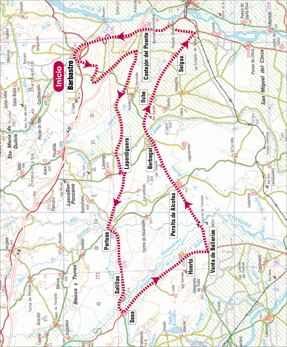
Barbastro - Laperdiguera - Pertusa - Huerto - Berbegal - Castejón del Puente - Barbastro
Route description
This track circulates through the regions of Somontano, Hoya de Huesca and Monegros, its surroundings are characterised by vast cultivated plains.
Departing from Barbastro, the capital of Somontano, the path heads toward Laperdiguera, where you can’t afford to miss its magnificent spring well. It then continues on towards Pertusa, a village where the Catalan branch of the St. James Way passes through. The next towns on the route are Salillas, Sesa and then Huerto, Venta de Ballerías and Peralta de Alcofea where one can admire the impressive Roman church’s portal, declared a historical and artistic monument. The track extends on to Berbegal, a magnificent lookout over Somontano and the Pyrenees Mountains and then finally on to the towns of Ilche, Selgua and Castejón del Puente from where we make our way back to Barbastro.
Photo gallery
Map
Technical information
Type of route: circular
Departure point: Barbastro
KM: 103,2
Duration: 5 h
Gradient: 800 m
Difficulty:
Itinerary
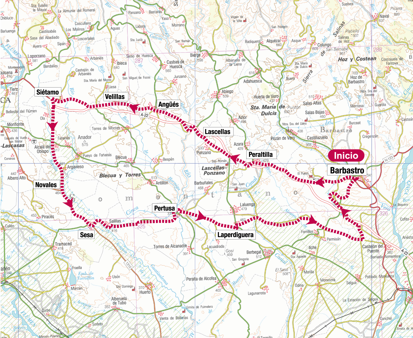
Barbastro - Peraltilla - Siétamo - Sesa - Laperdiguera - Barbastro
Route description
This trail circulates through the southern area of the Somontano and Hoya de Huesca region.
Setting off from the town of Barbastro, the itinerary fi rst takes us past Peraltilla, with its compact, traditional and modern town centre, and then off to Lascellas, famous for its clock tower factory. It continues on towards Angüés fi rst and then Siétamo, a village from Roman times. It later heads south to the towns of Novales, Sesa and Salillas, which are located on the river Guatizalema, then Pertusa, on the old path that used to link Osca and Ilerda and which still conserves vestiges of the Roman period. We then reach Laperdiguera, where one can see its spring well and the path then returns again to Barbastro, where it is highly recommended to visit all the historical sites there, such as the Cathedral, Diocesan Museum, Renaissance Palaces, Ensemble of Saint Julián and the Wine Centre.
Photo gallery
Map
