Descenso de barrancos
Fondo

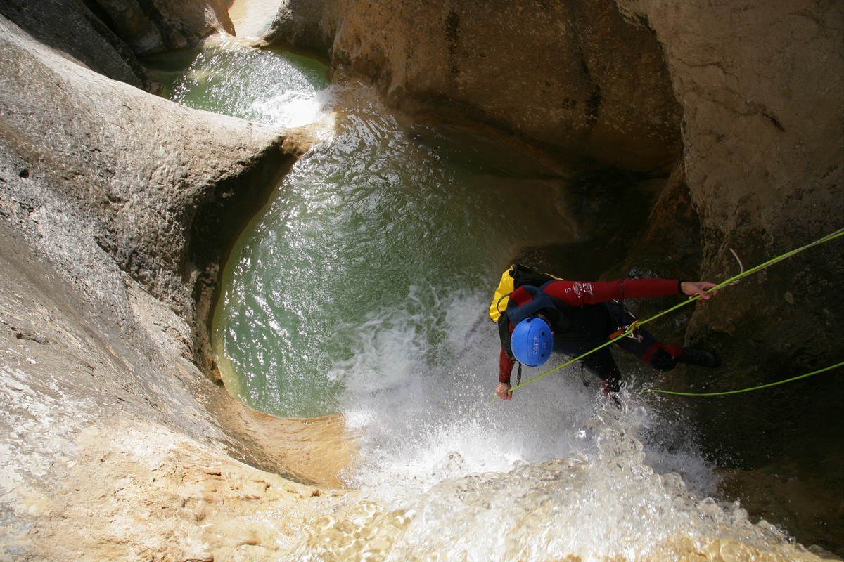
This is one of the tributaries to the right of the Balced canyon. This canyon has been patiently chiselled from conglomerate rock over thousands of years. It is a little known but very interesting canyon and should only be tackled by experienced canyoners as several of the drops are tricky and require technical abseiling techniques.
The scenery along the route is spectacular as the river bed is located at the bottom of a very deep, narrow and enclosed canyon. It is dry along most of the way, except for the last few pools, which have plenty of water that seeps from the rock.
Technical information
Approach: 5 minutes from the car park. The car park is located between the 9 and 10km mark of the HU-341road from Bierge to Rodellar, just at the fork from the knoll known as the “Collado Fondo.” (signposted) The closest village is Las Almunias de Rodellar. Leave the car near to the start of the forest track at the side of the wooden shelter for rubbish bins. Nearest village: Las Almunias de Rodellar
Descent: 3h - 3h:30 min KM: 1200m
Return
- 2 hours if not using two cars.
- 1 ½ hours if a car has been left at the end of the forest track.
- Follow the Balced River back upstream, in the water or along the footpath that follows the river on the right hand bank, until reaching the exit from the Oscuros de Balced canyon (“Tranco de las Olas”) Take the same footpath to return to the track that leads back to the car park.
- During or after heavy rain, the level and speed of the water flow in the Balced should be checked carefully.
Escape routes: There is an escape route for extreme emergencies but it is not recommended as it is very exposed and dangerous and requires rock climbing techniques to be used.
Car combination:It is not really necessary to take two cars unless you wish to save 30 minutes on the return journey. In this case, leave a second car at the end of the forest track (the same place used for the descent of the Oscuros de Balced.)
Difficulty level: very high in any season of the year. The use of a local guide with experience is highly recommended.
Minimum equipment requirements:
- Helmet
- Harness
- Double anchor lanyard
- Ropes
- Equipment for abseiling (figure-of-eight descender)
- 2 ropes of at least 30m in length.
- Self-braking descender
- Wetsuit:
- Full wetsuit with neoprene socks in during cold periods.
- Neoprene trousers and bib in the summer.
Points of interest
- Las Almunias de Rodellar
- Tranco de las Olas
- Sierra de Balced
- Somontano Nature Route
Photo gallery


Mascún
The Mascún canyon is widely considered to be one of the most beautiful in Europe and is emblematic of the Sierra de Guara national park. It is strongly recommended that persons wishing to descend this canyon contract a professional and experienced guide due to the great physical exertion required and danger involved during periods of high water levels. A total of 9 hours are needed, meaning that only those in peak physical condition and with plenty of canyoning experience should attempt it.
Since canyoning became popular in the Guara region, the Mascún canyon has succeeded in stirring up great interest with those who visit. It is, without doubt, one of the most spectacular descents due to its sheer cliffs, which almost touch in places such as “El Puntarrón,” and its astonishing stone architecture. Although the flow of water dries up at certain times of the year to offer a different aspect, the descent with water offers a fantastic spectacle of light and colour. The canyon is also one of the most diverse in terms of its attractions; 9 rappels, numerous jumps, underground stretches etc. As if all this wasn’t enough, the descent boasts one of the most unusual and mythical landscapes of the area with famous landmarks such as la Ciudadela, the oak groves and uninhabited village of Otín and the Saltador de las Lañas.
Mascún offers a magnificent descent along a river bed chiselled from rock with deep pools of turquoise water, exciting rappels and technical jumps, all of which add up to an unforgettable experience.
Downloads
Technical information
Aproximación: 2h:45 min. Leave the car in Rodellar; from here it is a 3 hour walk to the start of the canyon. From Rodellar go down to the river bed along the well marked path, and once there, follow the river upstream for around 45 minutes. Here, a fork in the path branches off to the left and is signposted as Otín and Mascún. Then follows an arduous climb to reach the abandoned village of Otín; follow the path as it skirts the village and take the path towards the north. Arriving at a poplar grove indicates the entrance to the Raisen canyon; continue on until you reach a fork to the right (not very well signed) that goes to the entrance to the Mascún canyon. Nearest village: Rodellar
Descent: 3 - 4 hours KM: 8,3km
Retour: 2 - 3 horas
Escape routes:
- Saltadero as Lañas waterfall in the direction of Raisen
- Waterfalls of Peña Guara
- 100m before the “Oscuros” it is possible to cross a stony pit to leave the canyon; once in the Oscuros there are no escape routes.
- El Sendero d’o Turno is the best route out of the canyon
Car combination n/a
Difficulty level: very high in any season of the year
Minimum equipment requirements:
- Full wetsuit and neoprene socks or canyoning shoes.
- Neoprene gloves
- Helmet
- Harness
- Double anchor lanyard
- Ropes
- Equipment for abseiling (figure-of-eight descender)
- 2 ropes of at least 35m in length.
- Waterproof canyoning backpack
- Watertight barrel
- Picnic
Points of interest
- Oak Groves of Otín, with magnificent specimens
- The uninhabited village of Otín
- Cuca Bellostas. A towering rock spire, which is one of the most recognised landmarks in the area. Its name is phallic in origin and makes reference to a big headed villager from Otín of old.
- La Ciudadela and the natural rock architecture of the canyon. The extreme shapes and forms, such as obelisks, spires, gigantic monoliths, natural bridges, hollows and ledges, give the valley an aspect of an enchanted city in ruins. This landscape once intimidated walkers and villagers and was said to produce overpowering sensations in the depths of the gorge due to its marked silence and solitude. The name Mascún derives from a Moorish name meaning “a place inhabited by spirits.”
- Surgencia de Mascún. A famous and quite spectacular spring, which provides the gorge with a permanent supply of water.
- Saltadero' as Lañas. A temporary waterfall in the rocky hollow at the entrance to the canyon; it falls 30m over smooth, terraced rocks.
- Birdwatching. See vultures around La Ciudadela and Egyptian Vultures from the start of the canyon to the “caos.”
Photo gallery


Otín
The Otin canyon provides one of most challenging descents in the whole of the Sierra de Guara in terms of physical exertion and technique. In the form of a steep staircase, the canyon is often dry but can be subject to torrential water flow after periods of rain. It offers 16 steep drops for abseiling, some of which require “mid-air” descent without touching the canyon walls. Otín is a great choice after rainy spells, although as with all canyons, it is necessary to evaluate the risk in the case of sudden water rises after heavy storms. When the canyon is dry, some of the water pools dry out to create deep traps with smooth sides; they are difficult to get out of and usually require a good knowledge and sound experience of rock climbing.
It is an essential descent for lovers of canyoning but should only be undertaken buy professionals and those people who are well prepared both in terms of physical condition and technical ability. The use of a professional guide is highly recommended.
It is necessary to check the access restrictions due to environmental issues (express authorization is needed for the decrease between March 1 and June 30, inclusive).
Technical information
Approach: 2 hours. From Rodellar, take the well marked path down to the river bed, and once there follow the river upstream for around 45 minutes until reaching a fork to the left signed as Otín and Mascún. After an arduous climb and before arriving at the abandoned village of Otín, the canyon can be seen to the right. Two large oak trees indicate the start of a path to the right, which takes you down to the water. Nearest village: Rodellar
Descent: 4 - 5 hours KM: 500m
Retour: 1h:30min (return via the last stretch of the Mascún canyon (avoidable if necessary) until arriving at Beso. This is a famous formation of two large rocks at the end of the Mascún canyon that appear to be “kissing”.
Escape routes: There are various places to shelter out of the water but no decent escape route until the final rappel; the path that connects with Mascún.
Car combination n/a
Difficulty level: very high in any season of the year
Minimum equipment requirements:
- Full wetsuit.
- Helmet
- Harness
- Double anchor lanyard
- Ropes
- Equipment for abseiling (figure-of-eight descender)
- 2 ropes of at least 50m in length.
- Waterproof canyoning backpack
- Watertight barrel
- Picnic and water
Points of interes
- Rodellar
- Barranco del Mascún
- Saltadero O Palomar
- Despoblado de Otín
Foto gallery


Oscuros de Balced

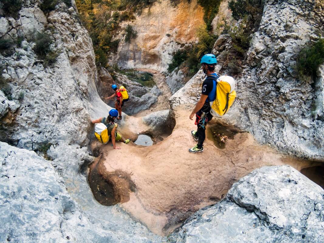
The canyon of the Oscuros de Balced is one of the prettiest and most popular in the Sierra de Guara. It is a relatively short but comprehensive in terms of attractions, offering jumps, drops and “chaos” (piles of large blocks of fallen rocks) as well as narrow passageways, siphons and pools of turquoise water. It is ideal for newcomers to the sport of canyoning although always taking the necessary security precautions and evaluating the strength and height of the water flow.
As this is one of the most popular routes in Guara, you should also take into consideration the amount of people in the canyon, especially in summer.
Downloads
Technical information
Approach: 1 hour. Arriving by car, the exit is signposted as “Collado Fondo” around the 9-10km mark on the road from Bierge to Rodellar. Follow the forest track that leaves from a small hillock (at the side of a rubbish bin covered with wood) and follow it for around 2.5km until arriving at the “Collado de Colmenares.” This is a small knoll with ruins to the right. You will see a footpath signposted to “Tranco de las Olas” which is the path used at the end of the descent. Continue on foot by following the path to the fence. Once you arrive at a curve in the path (which is closed off to the left) there is a well marked path to the right, which goes to the start of the descent. Nearest village: Las Almunias de Rodellar
Descent: 2 - 3 hour KM: 1500m
Retour: 45 minutos. From “Tranco de las Olas” take the return footpath to the forest track where you left your car.
Escape routes: None. During rainy periods, be vigilant regarding the water flow in the “Oscuros” as there are stretches that can become very dangerous with high water levels, especially the first rappel. Be prepared to make this descent under a flow of water.
Car combination n/a
Difficulty level: Medium in summer. Very high during and after heavy rain as this canyon is very susceptible to change after storms and the water flow can increase considerably.
Minimum equipment requirements:
- Full wetsuit and neoprene socks or canyoning shoes.
- Helmet
- Harness
- Double anchor lanyard
- Ropes
- Equipment for abseiling (figure-of-eight descender)
- 2 ropes of at least 15m in length.
- Waterproof canyoning backpack
- Watertight barrel
- Picnic and water
Points of interest
- Las Almunias de Rodellar
- Tranco de las Olas
- Somontano Natural Route
Photo gallery


