Patrimonio Hidráulico
Aljibe de la Bella. Castejón del Puente
The abundance of old water tanks in the area around Castejón del Puente indicates the ancestral necessity of man to store water in places were it was difficult to access.
The La Bella tank is located close to the chapel. It is rectangular in shape and made from huge ashlars. The channels carved from the rock carry rain water down into the tank and locals say that the 2 metre-deep structure is often full to the brim after storms.
To prevent animals and people falling into its depths, it is surrounded by a wall. Stairs made from immense blocks of sandstone allowed villagers to reach the water to fill their pitchers, an occurrence that continued until just a few years ago.


Waterwheel. Castejón de Puente
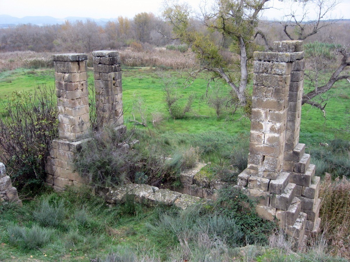
A network of ancient irrigation channels criss-cross the fields of Castejón del Puente and carry water to the farthest corners of the municipality. Local people have maintained these man-made channels well over the centuries to ensure water for their crops.
Although the wheel itself is no longer visible, the formidable stone structure that held it in place gives an idea of the size of the waterwheel that once stood here. Known as Huerta Vieja, it used pail-like paddles to scoop up water while the cequiero, or operator, kept watch to ensure the mechanism functioned well. Behind the water wheel are the remains of the house where the operator lived.
The remains of the Castejón wheel, together with the remnants of a similar wheel in Almudevar, are the only remaining evidence of waterwheels in the Alto Aragon region.


Bridge. Castejón del Puente
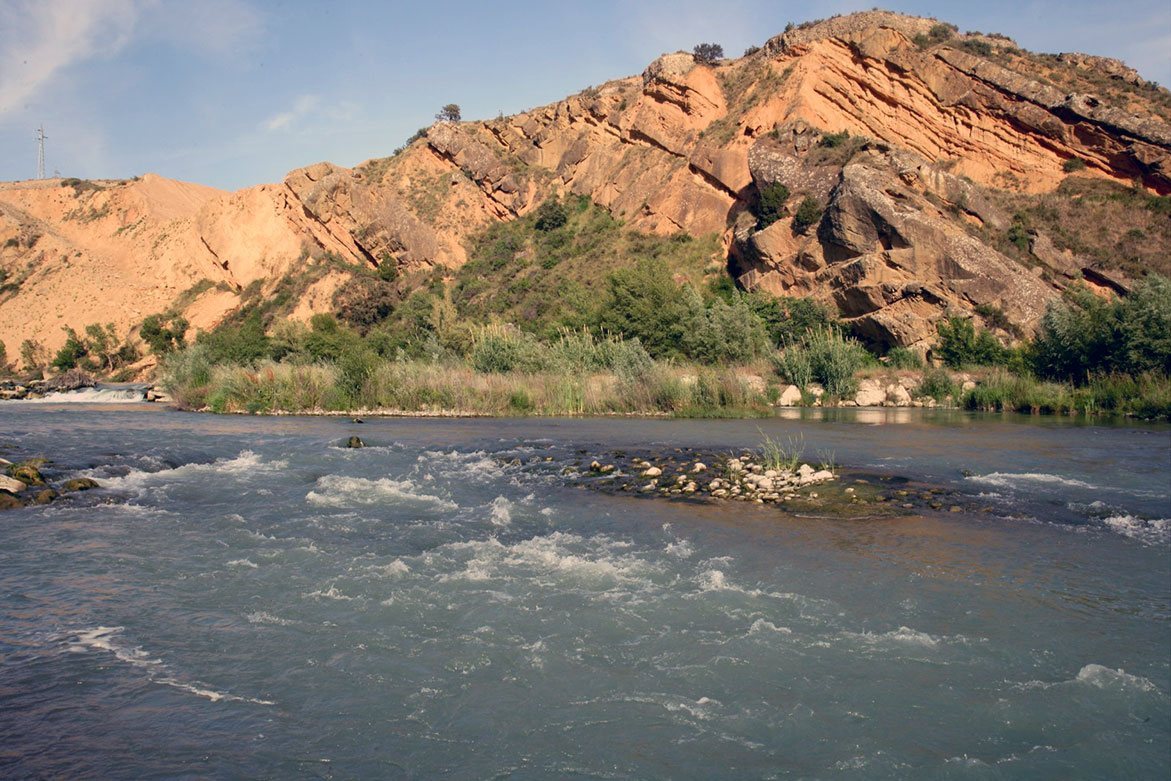
The region of Somontano was inhabited during the Roman era. The municipality of Tolous was founded close to here, in the place where the Santuario de la Alegría (Shrine of Happiness) now stands in Monzón. In his book, “Geografía,” the Latin geographer, Estrabón, mentions the road that ran between IIerda (Lérida) and Osca (Huesca) which crossed the fields belonging to Castejón del Puente.
In those days, the River Cinca was known as Cinga Rapax, meaning voracious Cinca, due to the violent nature of the swollen river, which was capable of destroying bridges.
The Roman road crossed the Cinca via a bridge, whose remains (twelve pilasters and two buttresses) can still be seen close to Castejón. It was a long bridge (around 500 metres long with a total of twenty arches) and part of the structure was built away from the river bed as a precaution against floods.
The Castejón bridge was, without doubt, a key element in communication. This is reflected in the establishment of a small village in the environs of the bridge called “El Pon” derived from the Latin word for bridge.
This magnificent work was still used throughout the medieval era and well into the 16th century. Its final destruction took place during the Carlist wars in the 19th century, which consequently brought about the need for an alternative method of crossing the river. The solution was to construct a pier next to the ancient viaduct. Both it and the boatman’s house were made from ashlars taken from the ruins of the old Roman bridge.
A boat would leave the pier to transport people and goods from one side of the river to the other. It was moved with the use of a rope and pulley and also relied on the strength of the boatman. A steel towrope replaced the old rope (which was made from the fibres of a local plant known as esparto grass) a few years before new transport methods condemned the boat to memory.


Los Doce Caños fountain. Estadilla
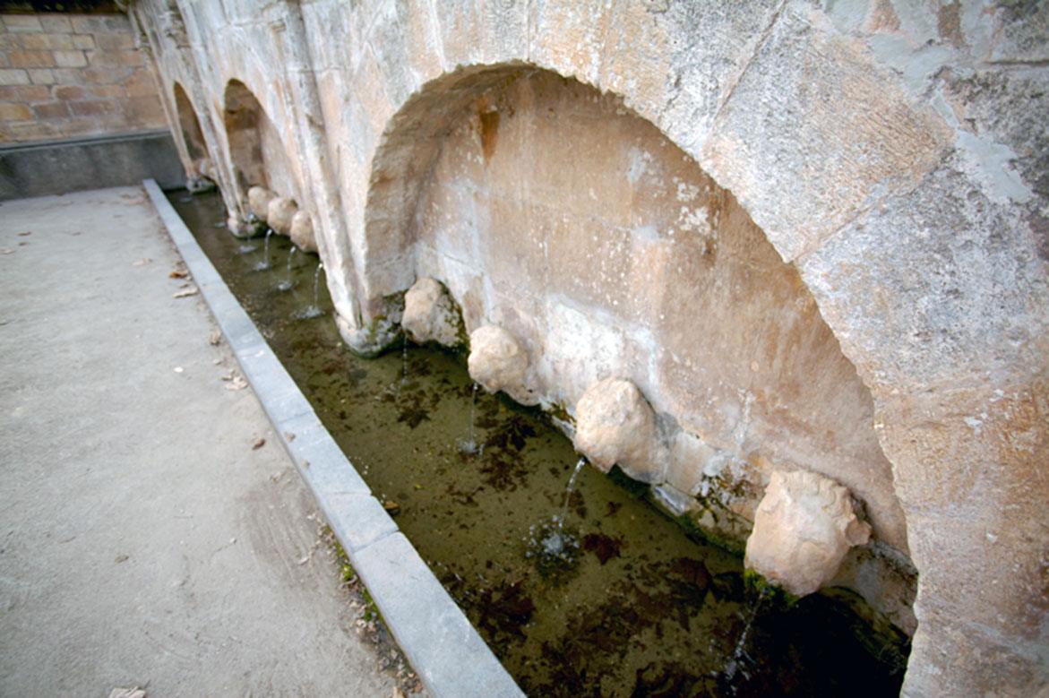
The fountain lies near to the vegetable gardens and village allotments. It stands on the site of the most important spring in the area providing more than 60 litres of water per second. The water maintains a temperature of 15-16ºC throughout the year.
The water is brought to the surface by means of a 35 metre tunnel excavated from the rock. It is used to water the vegetable gardens in the immediate vicinity and, by means of underground irrigation channels, also carries water to olive groves, orchards and vineyards.
The fountain dates to 1735 as can be seen from the date etched on its façade and was one of the biggest to be constructed in the Somontano region. In addition to moulded pilasters, capitals with rosettes, chunky leaves and scrolls, it also boasts twelve lions’ heads that open up into water spouts. This style denotes a significant knowledge of classicism on the part of the stone masons.
Due to its structure and decoration it is more representative of an ornamental model of fountain rather than the traditional and more functional style. These were built with a decorative and symbolic function in villages and towns, representing the pride of a society and of the municipal authorities who built them. The patronage of this model is reflected in the coat of arms that crowns the structure, leaving no doubt who was responsible for bringing water and prosperity to the villagers.


