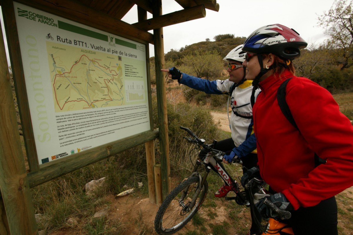
BTT
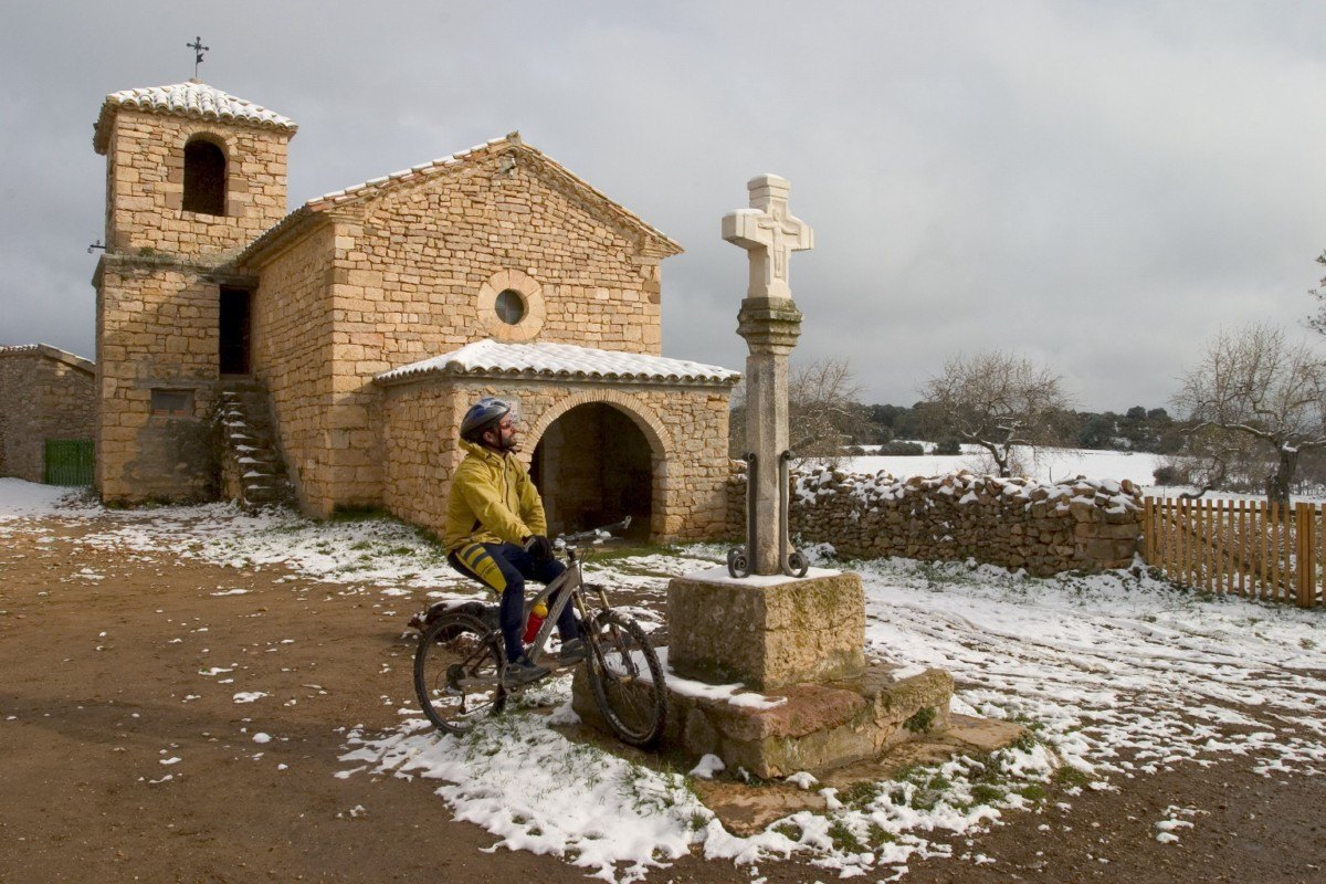
Route Alquézar-Buera-Colungo
Technical information
Type of route: circular/ Rally/ Gravel
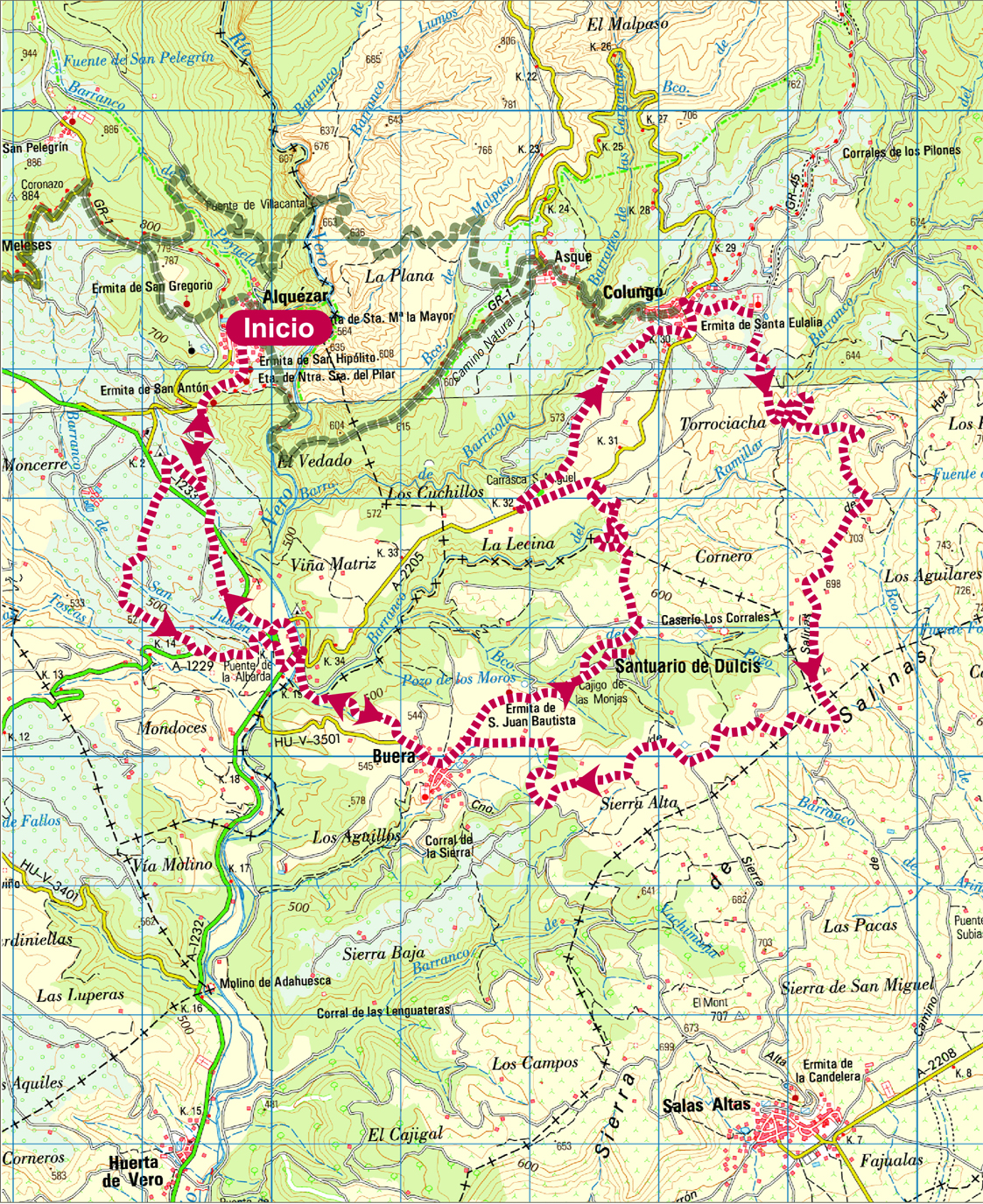
Itinerary: Alquézar-Buera-colungo
KM: 30,4
Duration: 3 h
Gradient: 600 m
Level:

Points of interest
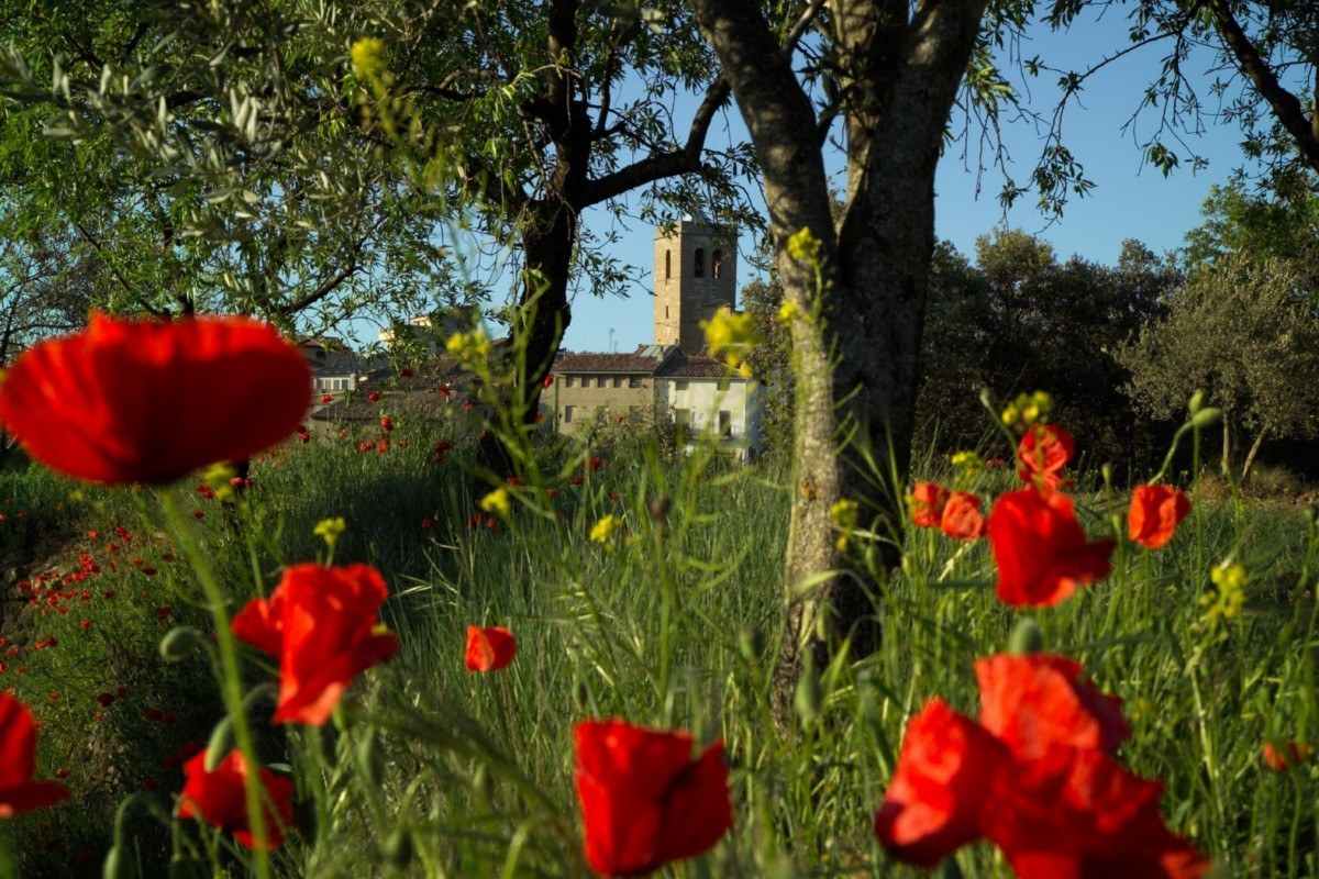
Medieval village of Alquézar, Villacantal Bridge, village of Buera, Sanctuary of Dulcis, town of Colungo, the Rock Art Center.
Route decription
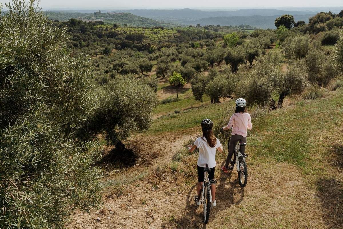
This is a circular route connecting the villages of Alquézar, Buera and Colungo. The bicycle path follows large parts of the walking track, some of them quite steep, especially around the Vero River and the Ramillar Canyon. Other parts consist of gentle slopes and are practically flat in the Sierra Alta Plateau and the surroundings of Buera and Colungo.
The route gives us the opportunity to visit the village of Buera, in which we will find beautiful paved patios and to discover the nearby Santa María de Dulcis Sanctuary and the olive forest.
We can also discover Colungo, a gateway to the prehistoric universe of the Rio Vero Cultural Park, Unesco World Heritage Listed. Along the path we are greeted by typical Somontano landscapes and spectacular views of Alquezar and the Sierra.
Photo gallery
Map
Route Villages around Alquézar
Technical information
Type of route: circular/ Rally/ Gravel
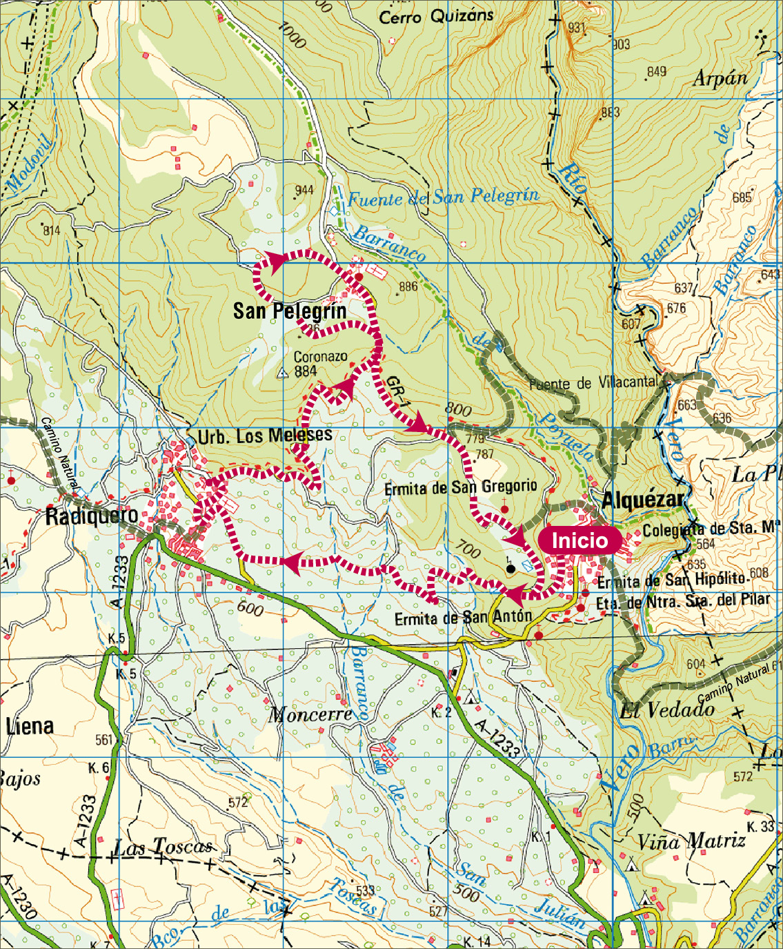
Itinerary: Alquézar-San Pelegrín-Radiquero
KM: 10,7
Duration: 1 h/1h 30 min
Gradient: 350 m
Level:
Points of interest
Medieval village of Alquézar, hermitage de San Gregorio, village of San Pelegrin and Radiquero town.
Description route
This is a circular route joining the villages of Alquezar, San Pelegrin and Radiquero. The circuit, which starts and finishes in Alquezar, mainly consists of dirt paths, alternating between gentle and steep slopes. Cyclists are greeted by a mosaic of Mediterranean cultivation whilst enjoying spectacular views of Alquezar as well as the rock faces of the canyon and of the mountain foothills, under the watchful eyes of birds of prey in the Guara walls, a perfect sanctuary.
Whilst going through the village of San Pelegrín, one will be surprised by its small parish church from the 18th century, built with limestone and by its sculptured wayside cross. Radiquero, surrounded by olive, almond and wine plantation, offers us to discover its village, at the foothills of the Sierra de Sevil.
Photo gallery
Map
Puerta de Guara route
Technical information
Type of route: circular/ Rally
Itinerary: Alberuela de Laliena-Radiquero-San Pelegrín-Alberuela de Laliena
KM: 19,1
Duration: 3 h
Gradient: 535 m
Level:
Points of interest
The village of San Pelegrín, the shrine of Virgen de Viña, the shrine of San Fabián and San Sebastián, panoramic views.
Route description
Starting in Alberuela de Laliena, the route runs along the old GR-1 hiking trail until it reaches the neighbouring village of Radiquero. From there it skirts the foot of an area of high ground known as O Coronazo and leads up to the small village of San Pelegrín, where several houses border a square overlooked by a stone cross.
The route continues to lead upwards, running along the old path to the Sevil refuge, at which point it drops down again to Alberuela de Laliena, partly following the trail herdsmen used to take in summertime when leading livestock to the high pasturelands of the Pyrenees.
The route was once frequented by shepherds, traders and wayfarers who used to bring down ice from the ice wells in summer, and also by local people as they flocked on pilgrimage to the nearby hermitage of La Viña.
Photo gallery


Location map

Campos de Bierge route
Technical information
Type of route: circular/ Rally
Itinerary: Bierge-San Pedro de Verona-Cabañera Bierge-Fuente Vieja-Bierge
KM: 18
Duration: 2h 30 min
Gradient: 411 m
Level:
Points of interest
The shrine of San Pedro de Verona, a vantage point for watching vultures, and the Sierra and the Guara Canyons Visitor Centre.
Route description
Olive growing has brought wealth to the inhabitants of Bierge, who harvest some 800,000 kilos of the fruit in late autumn/early winter. The main variety grown in Alto Aragón and the Somontano is Verdeña. This route takes you through extensive groves that are home to large centuries-old trees still producing fruit year after year.
Just 700 metres from Bierge can be found the shrine of San Pedro de Verona, built in homage to the saint so that he might rid the local community of an epidemic.
Griffon vultures, Egyptian vultures and bearded vultures circle these skies, declared and an Area of Special Protection for Birds. A specially created vantage point near the shrine of San Pedro provides the perfect place to watch them in action.
Photo gallery


Location map


