BTT
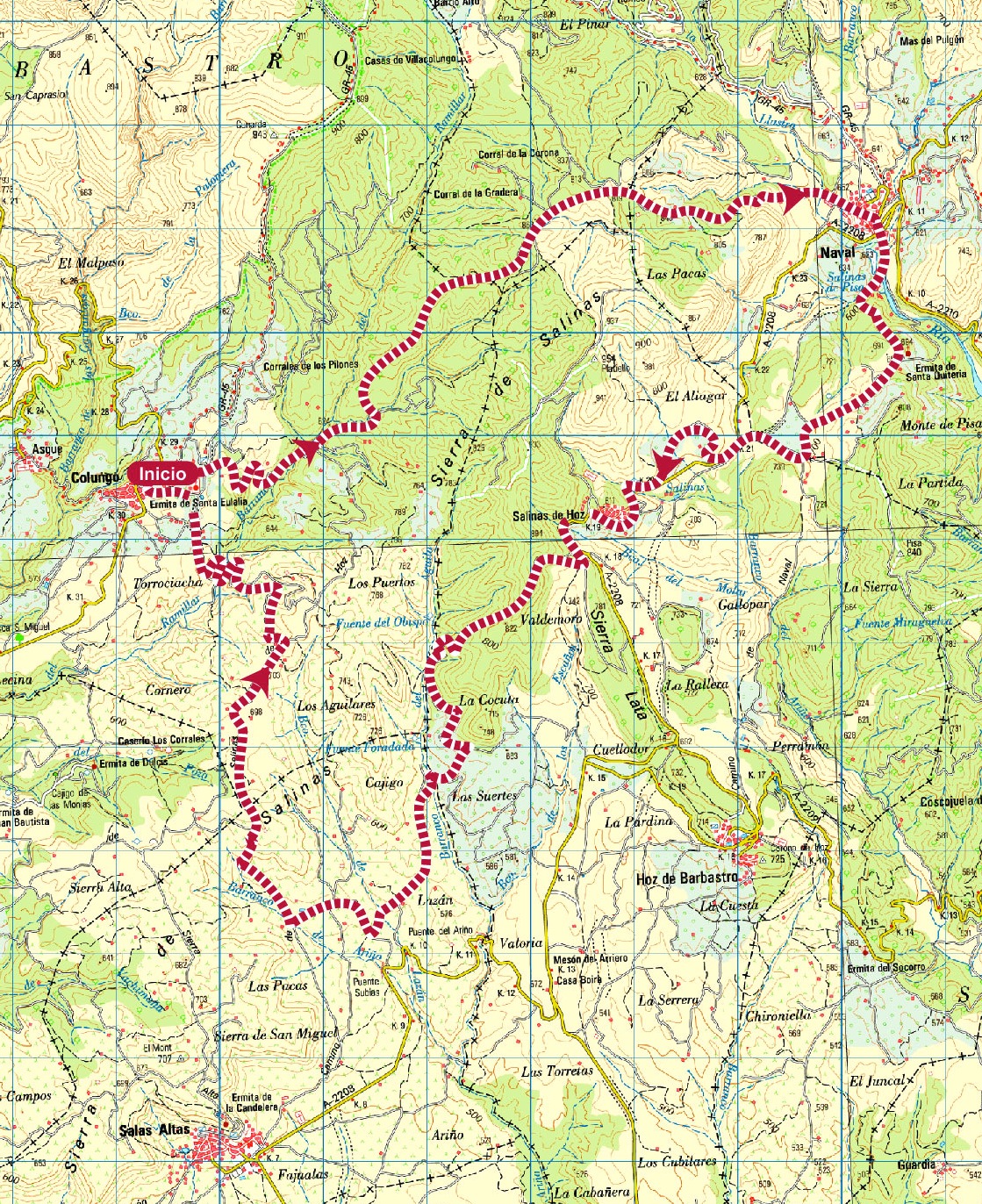
Sierra de Salinas route
Technical information
Type of route: circular/Rally
Itinerary: Colungo-Naval-Salinas de Hoz-Colungo
KM: 33,1
Duration: 4 h
Gradient: 1185 m
Level:
Points of interest
The shrine of Santa Eulalia, the Cave Art Visitor CentreArt Visitor Centre in Colungo, the salt beds of La Rolda, the Pottery Visitor Centre in Naval, vineyards and panoramic views.
Route decription
The range of hills owes its name to the many saltwater springs found there, springs that have been tapped by man for centuries. The inhabitants of Naval and Salinas de Hoz built a system of wooden channels to direct the water to shallow beds where the heat of the summer sun burned off the water to leave behind salt deposits.
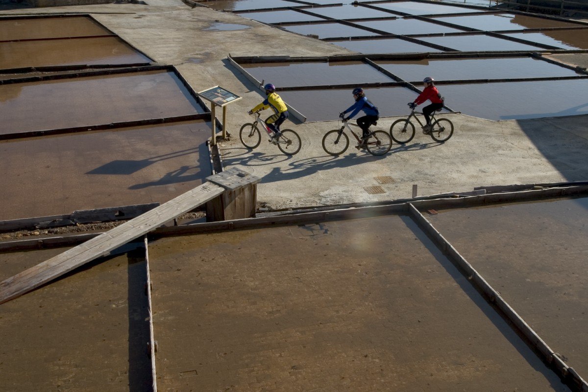
The tradition has been kept alive over the centuries at La Rolda salt beds in Naval.
The foothills of the sierra are lined with small terraces where olives and almonds have been grown for years.
In recent times, large vineyards have been planted on the flat plain.
Photo gallery


Location map
Circular Abiego Route
Technical information
Type of route: circular/ Rally/ Gravel
Itinerary: Abiego - Abiego
KM: 23,6
Duration: 2 h
Gradient: 325 m
Level:
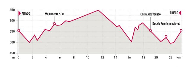
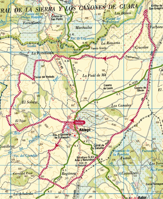
Points of interest
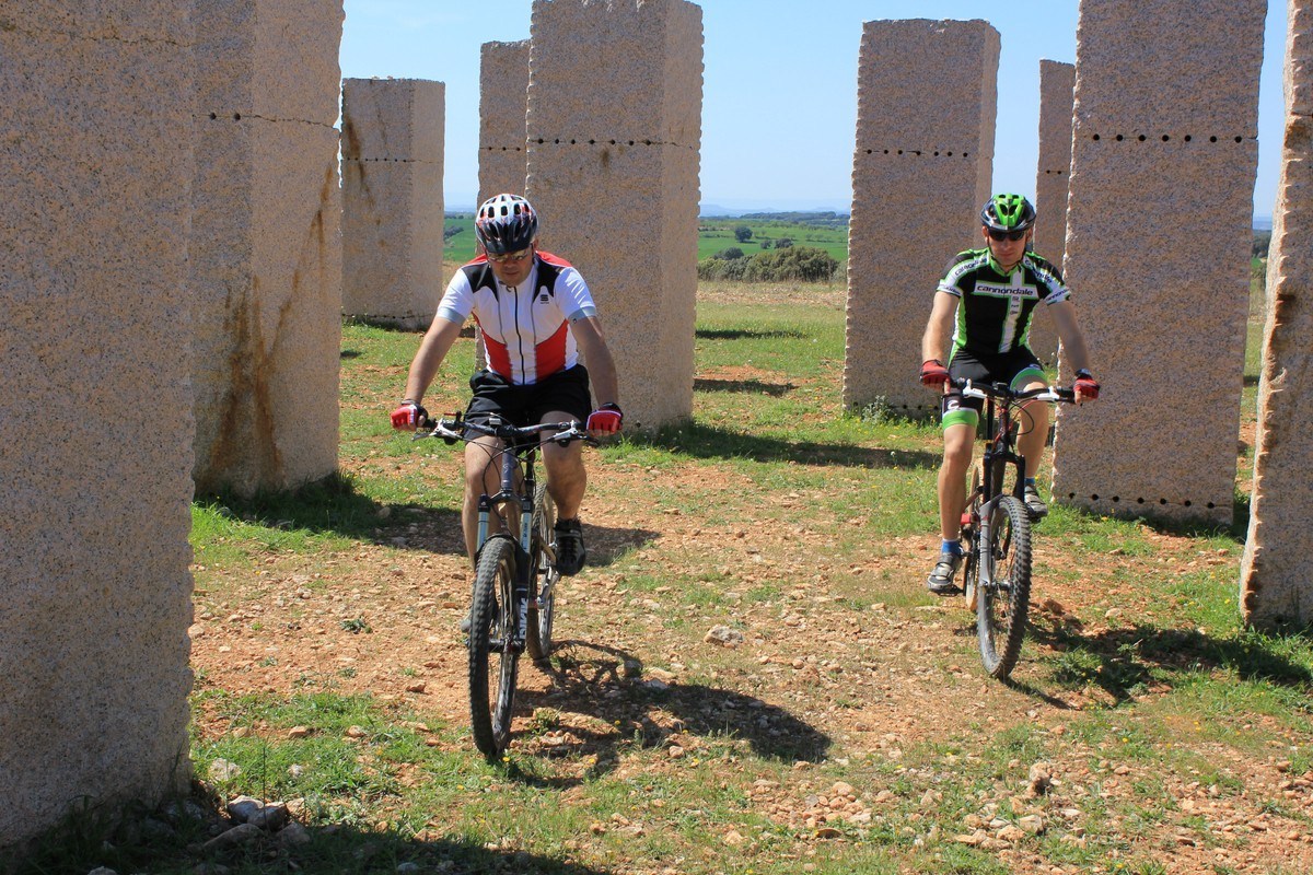
Collegiate Church of Sta . Maria , fountain, medieval bridge, site of footprints and XX century Monument .
Route description
During this circular route, one walksbetween oak trees, olive and almond fields enjoying excellentpanoramic views of the Guara and the valleys of the rivers Isuala Alcanadre.
The itinerary is marked in counter clockwise direction, starting from outside the municipal swimming pool then heading south on a paved road. After some kilometres you will reach the old herdsman path, which you have to follow toward the north. Later on it runsparallel, first to the Isuala Riverand then to the Alcanadre River. From the medieval bridge it then goes back to Abiego.
At some points, the route coincides with the Piedras de Leyenda Bike Route, making it possible to combine both paths to lengthen or shorten our walk.
Photo gallery


Location map
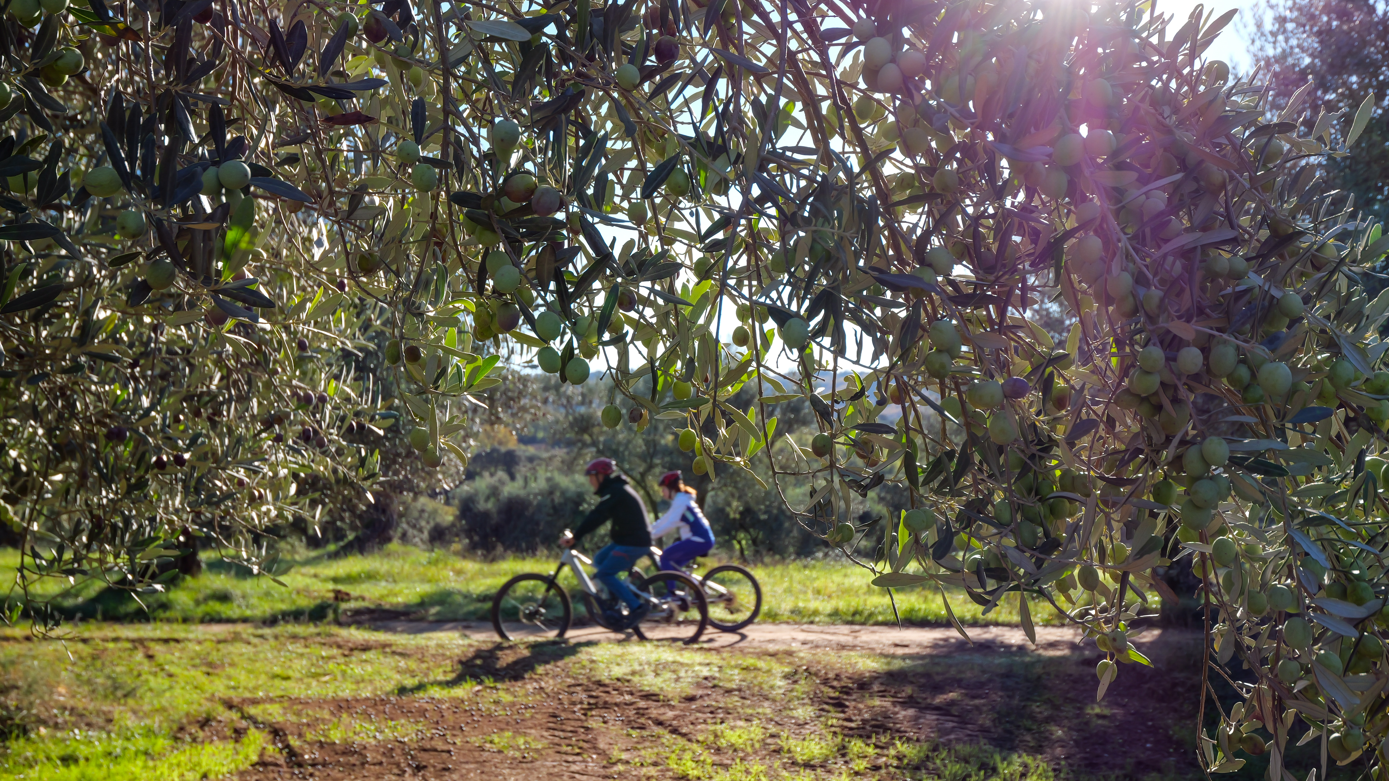
MTB Routes
One of the funniest and sportiest ways to go all over Guara Somontano and to enjoy with contact of nature is the mountain bike.
If you like to pedal discovering the landscape and the cultures, enjoying the wildest surroundings as Sierra de Guara and other softer as the Southern Somantano and you like to discover new hideouts full of charm, in Guara Somontano you will find multiple options to practise mountain bike.
Several signalled routes for mountain bike come across a great part of Guara Somontano. Several routes with different difficulty exist depending on the cumulative elevation gain and the kilometres of the itinerary. All of them are double-way routes and are circular. Most of them are connected thus allowing going over long distances.
Ruta Viñedos del Cinca
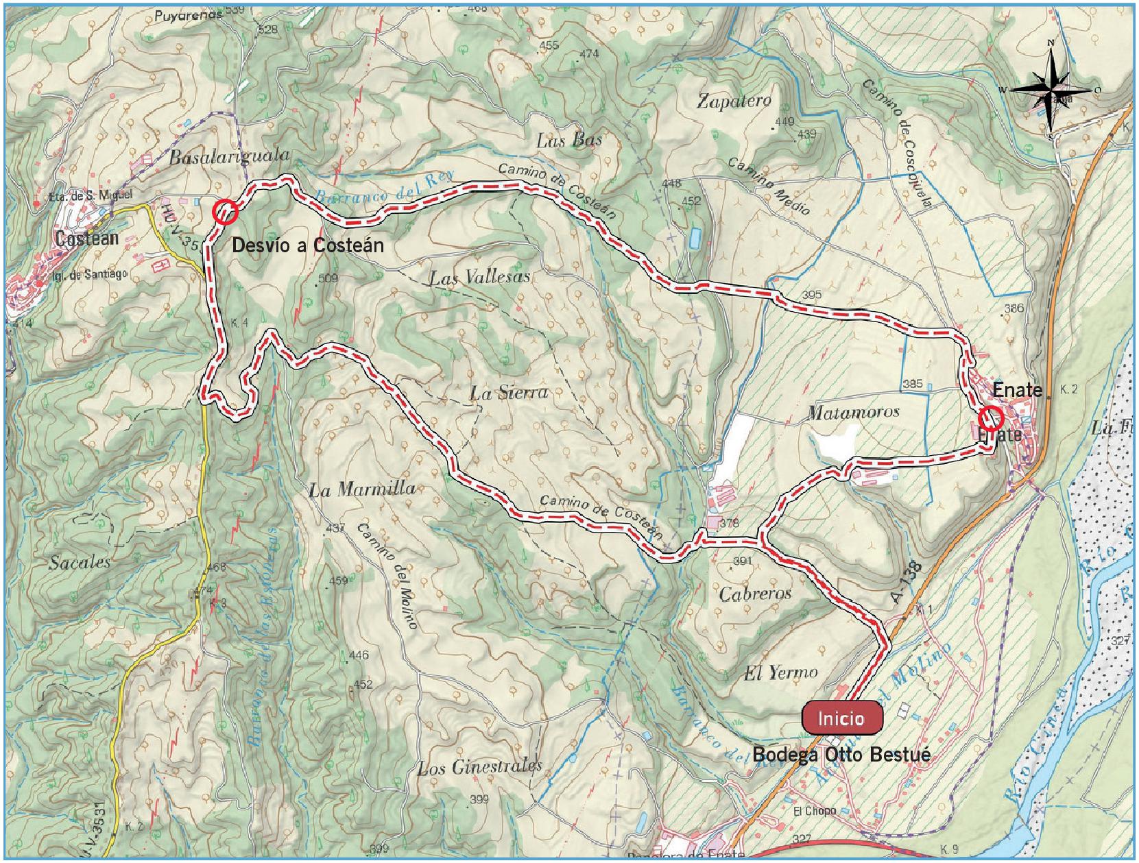
Ficha técnica
Tipo de ruta: circular/ Rally
Recorrido: Bodega Otto Bestue-Enate-Bodega-Otto Bestue
KM: 9,5
Duración: 2 h
Desnivel: 220 m
Dificultad:
Puntos de interés
Enate, Costean, el río Cinca y la bodega Otto Bestué
Descripción de la ruta
Apacible ruta circular que parte de la bodega Otto Bestué y que visita algunos de los viñedos del Somontano que colorean la margen izquierda del río Cinca. El recorrido discurre en su mayor parte por pistas agrícolas y utiliza el trazado del Camino de Costean, entre las localidades de Enate y Costean.
Se inicia en la bodega Otto Bestué y recorre 200 metros de carretera antes de girar a la izquierda y dirigirse hacia la población de Enate. En este tramo se puede disfrutar de unas bonitas vistas del río Cinca. Tras cruzar la población, el recorrido sigue en ascenso en dirección oeste hacia Costean, adentrándose por zona de viñedos y de otras leñosas mediterráneas como olivos y almendros.
Al llegar a las proximidades de Costean, se tiene que realizar un corto tramo de carretera local. En este punto se puede visitar el pueblo de Costean o continuar la ruta, girando hacia el este en dirección hacia la bodega Otto Bestué por el Camino de Costean, recorriendo de nuevo campos de cereal, de olivar, almendros y viñedos.
En las faldas de esta sierra, los bancales arrancan al monte pequeños retajos de tierra, donde tradicionalmente se han plantado olivos y almendros. Recientemente, la llanura ha sido ocupada por grandes extensiones de viñedo.
Galería de imágenes

Mapa