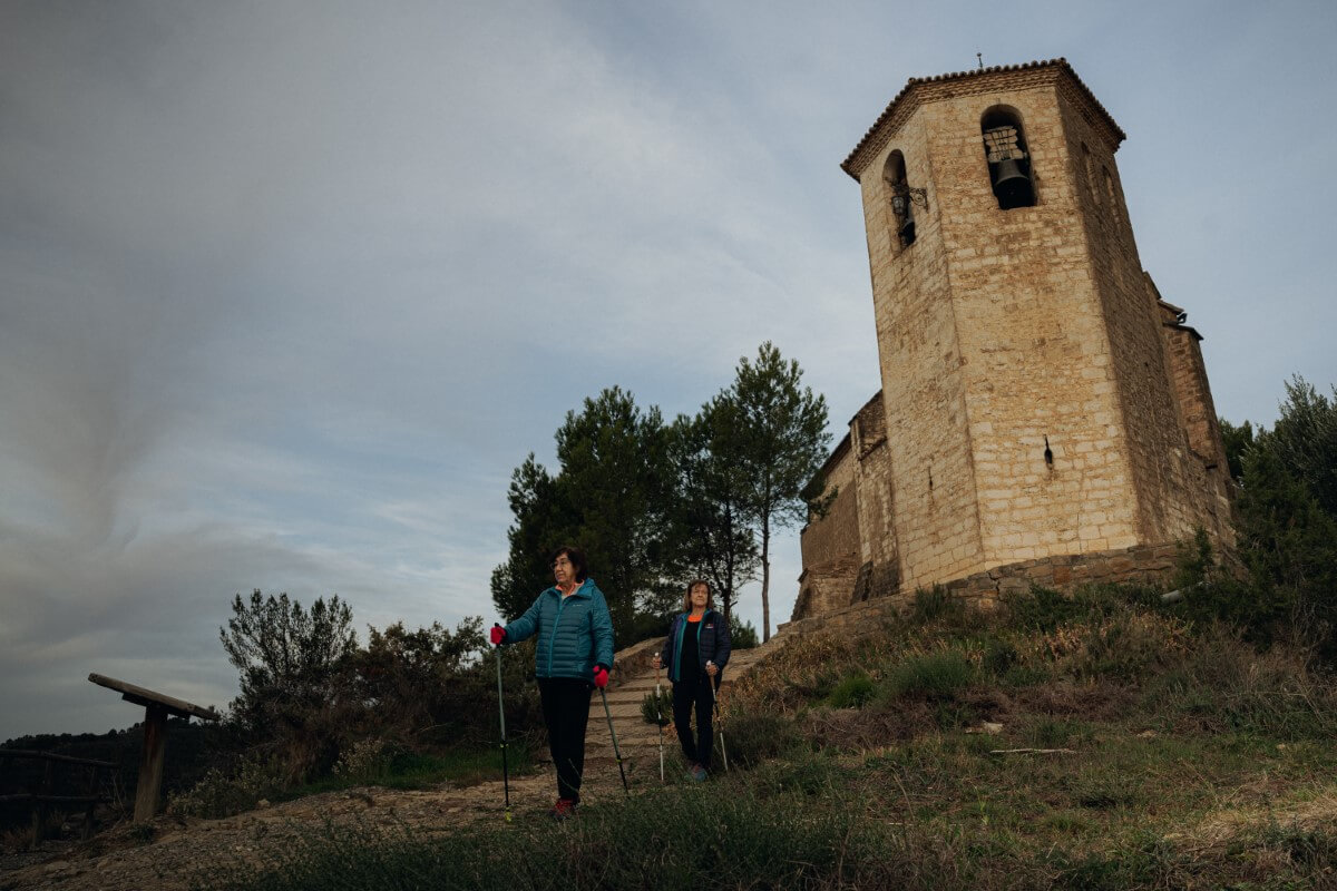
Marcha nórdica
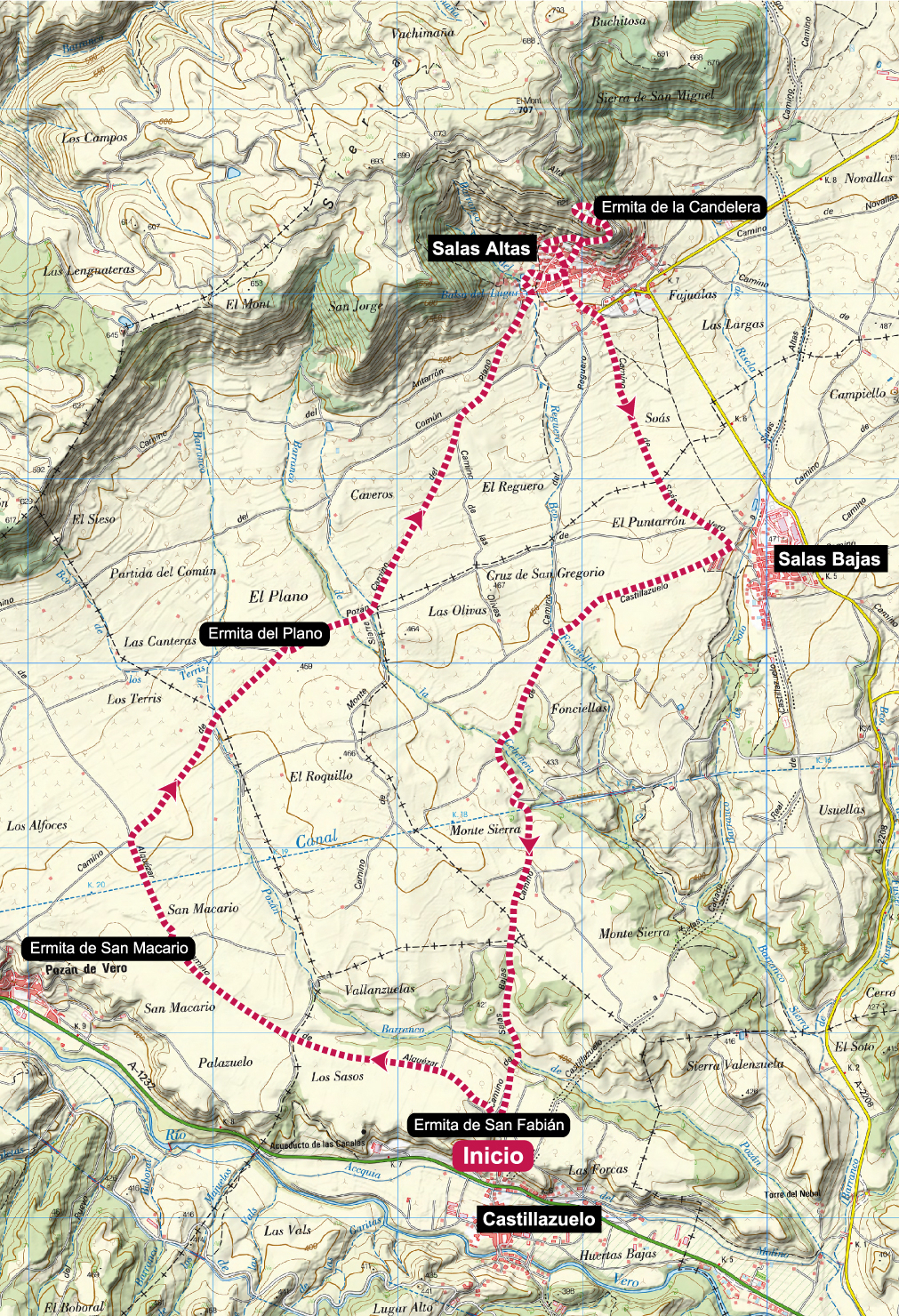
Hermitages of the Flatlands
Technical Information
Type of route: circular
Departure point: Ermita de San Fabián. Castillazuelo
KM: 14,6
Duration: 3 h 25 min
Gradient: 230 m
Difficulty:
Points of interest
Hermitages of San Fabián, San Marcario, del Plano and de la Candelera.
Route description
Between the Sierra de Salinas and the course of the river Vero there is a large plain completely covered by fields of vineyards and cereal crops. There are many hermitages in this area and thanks to this route we will be able to visit a good number of them.
Starting from the cemetery of Castillazuelo, where the hermitage of San Fabián is located, the route follows a comfortable track, sometimes even asphalted, across the plain between Pozán de Vero and Salas Altas, passing by the hermitages of San Macario and El Plano. In Salas Altas we climb up to the hermitage of Candelera, the highest point of theroute, and then descend, first to Salas Bajas and then to Castillazuelo.
Photo gallery


Map
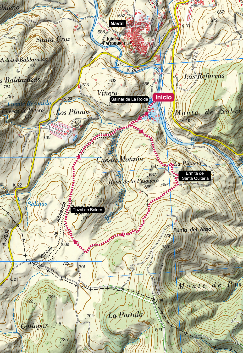
Naval salt marshes
Technical Information
Type of route circular
Departure point: Salinar de La Rolda. Naval
KM: 4,5
Duration: 1 h 15 min
Gradient: 150 m
Difficulty:
Points of interest
Naval, Salinar de La Rolda, hermitage of Santa Quiteria, panoramic views.
Route description
Naval is famous for its salt mines which, for almost 1000 years, have been exploited to produce this precious commodity, which during the Middle Ages was as valuable as petrol is today.
From the car park of the salt flats, we set off around the complex of recreational pools and salt production to head up a steep climb to the hermitage of Santa Quiteria. From there the route descends along a short stretch of path to the track from which we had turned off shortly before, and continues on the circular route around the Tozal de Bolero. On reaching the Vereda de Abizanda the route descends rapidly until it returns to the salt flats from where we started.
It is a short route with a certain slope that will require adapting the pace of the ascent and descent.
Photo Gallery
Map
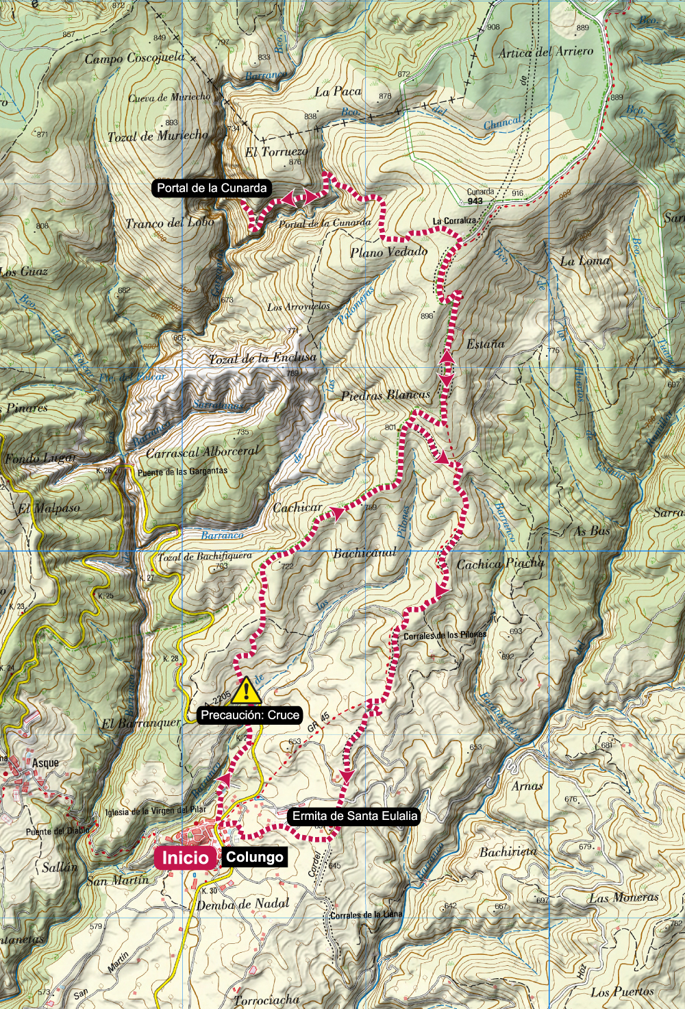
Portal de la Cunarda. Colungo

Technical Information
Type of route: circular
Departure point: Colungo
KM: 13,2
Duration: 3 h 45 min
Gradient: 530 m
Difficulty:
Points of interest
Portal de la Cunarda geological formation.
Route description
A classic route that allows you to discover one of the most unique geological formations in the surroundings of the Guara Natural Park, the Portal de la Cunarda, a large geological arch formed by the erosion of an enormous limestone rock.
The route starts from Colungo by the swimming pools to take a stretch of path that goes up to the road from Colungo to Asque. After crossing it, continue along the track, constantly going uphill, until you take a detour to the left that descends first along a track and then a little later along a path to the Portal. This section is more uneven and there are some small steps to negotiate.
The return is along the same path as on the way out until you reach a crossroads, where you can turn left to reach Colungo along an old livestock track that still preserves some cobbled sections. The entrance to the village is through the hermitage of Santa Eulalia.
Photo Gallery
Map
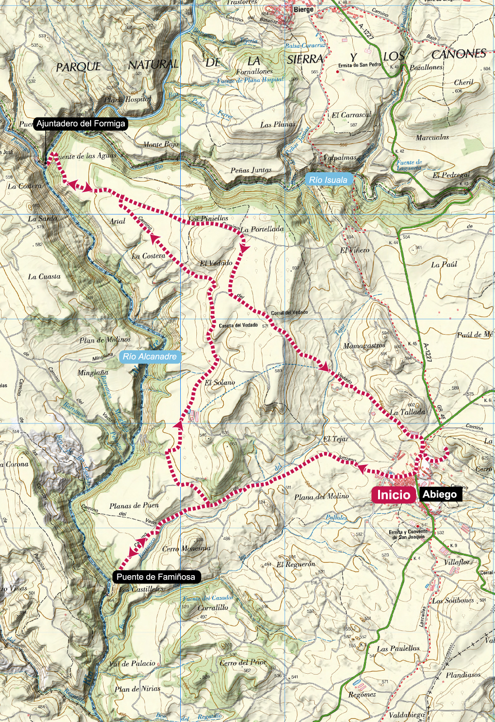
Abiego - Famiñosa bridge
Technical information
Type of route: circular
Departure point: Abiego
KM: 15,8
Duration: 4 h
Gradient: 300 m
Difficulty:
Points of interest
Mediaeval bridge of Famiñosa and the junction of the rivers Formiga and Alcanadre.
Route description
Abiego, located to the south of the Sierra de Guara, is very close to the Isuala and Alcanadre riverbeds. The communication routes with the surrounding villages made it necessary to build important bridges or to find the most comfortable fording points possible. This route allows us to get to know two of these enclaves such as the Famiñosa Bridge and the fording of the Alcanadre between
Casbas and Abiego.
The route starts in Abiego along the track of the swimming pools and goes to the viewpoint of the Famiñosa Bridge. From there, we retrace our steps for a stretch and then turn off in a northerly direction. Between fields we reach a steep and eroded slope that descends to the Ajuntadero del río Formiga and the Alcanadre. All that remains is to climb the steep slope again and return to Abiego surrounded by holm oaks, olive trees and fields.
Photo Gallery
Map