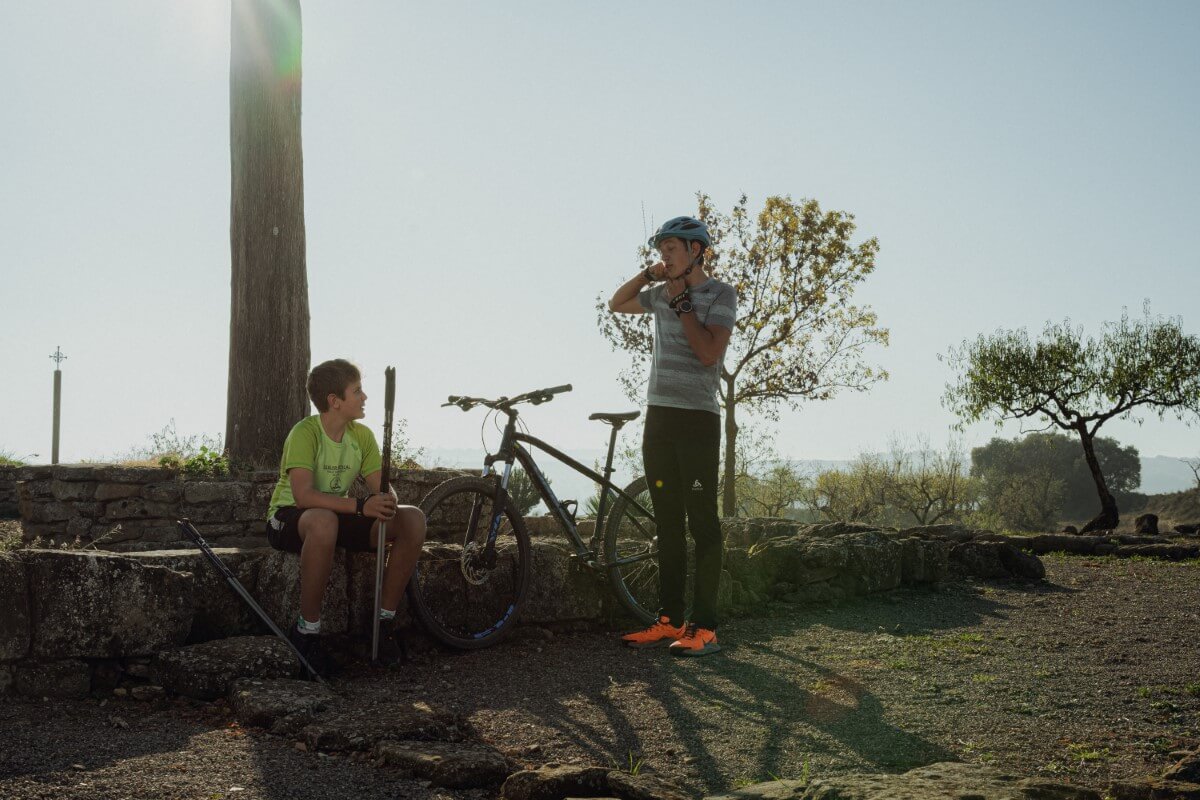
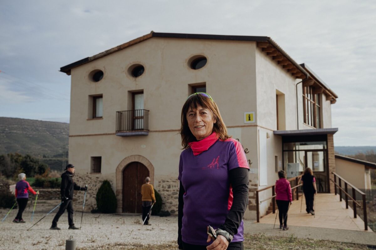
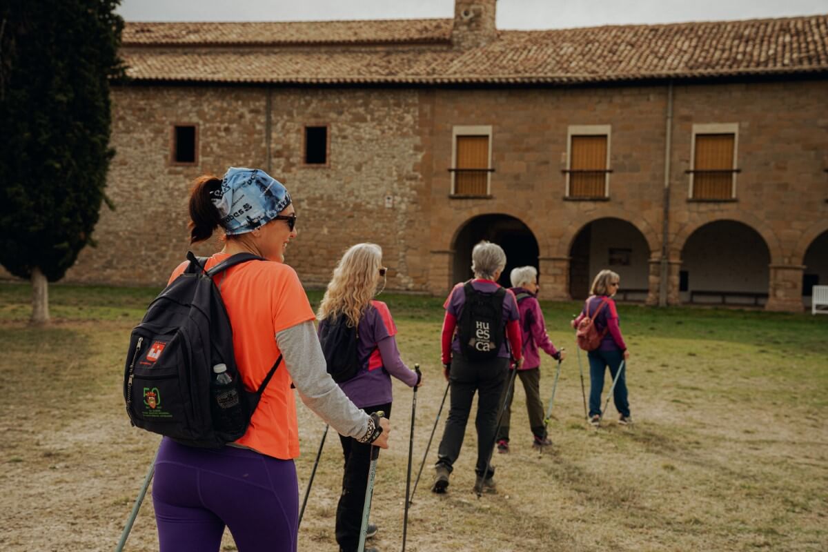
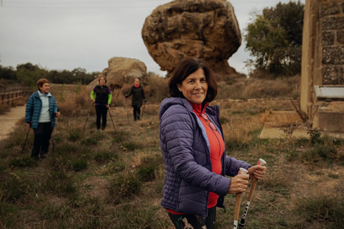
Marcha nórdica
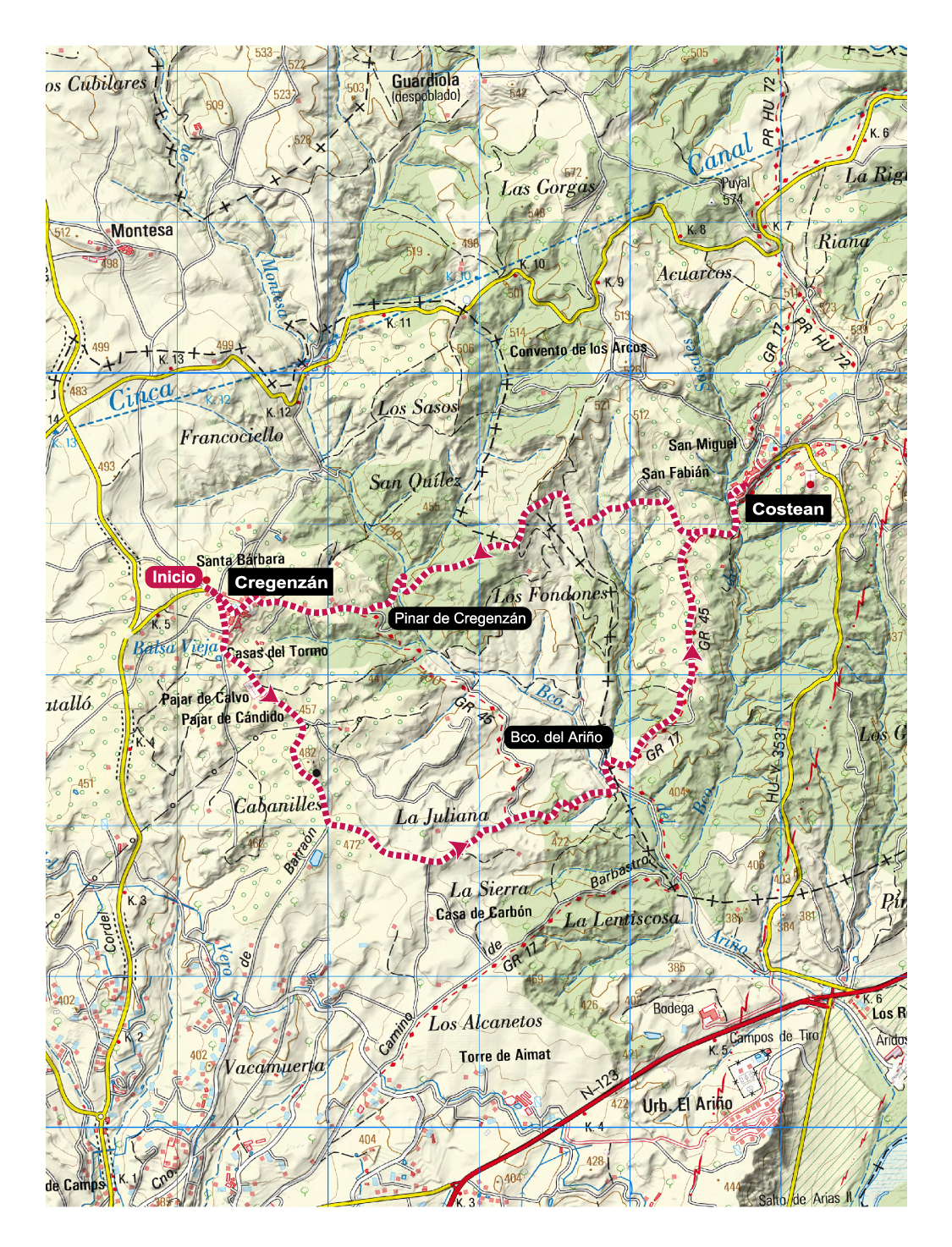
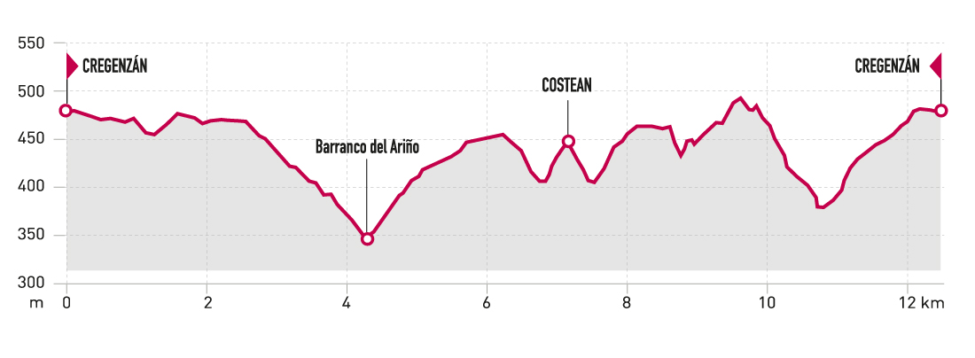
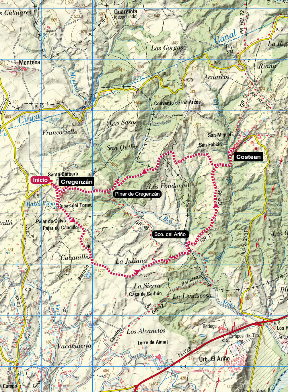
Cregenzán and Costean route
Technical Information
Type of route: circular
Departure point: Cregenzán
KM: 12,5
Duration: 3 h
Gradient: 365 m
Difficulty:
Points of interest
Panoramic views of Somontano, the Cinca valley and part of the Pyrenees.
Route description
Cregenzán and Costean are two typical Somontano villages, surrounded by vineyards, olive groves, and forests of pine and holm oak.
This pleasant route allows you to get to know the surrounding area and enjoy excellent panoramic views of the Somontano, the Cinca valley and a large part of the Pyrenees.
It consists of two distinct parts: the outward journey from Cregenzán to Costean is along agricultural tracks in perfect condition. The ascent from the Ariño ravine to Costean is along the GR 17 (Via Aran-Pyrenees of the Camino de Santiago), and is signposted. The return from Costean is mostly along the narrow and beautiful San Fabián path, which runs through the Cregenzán pine forest.
Photo gallery


Map
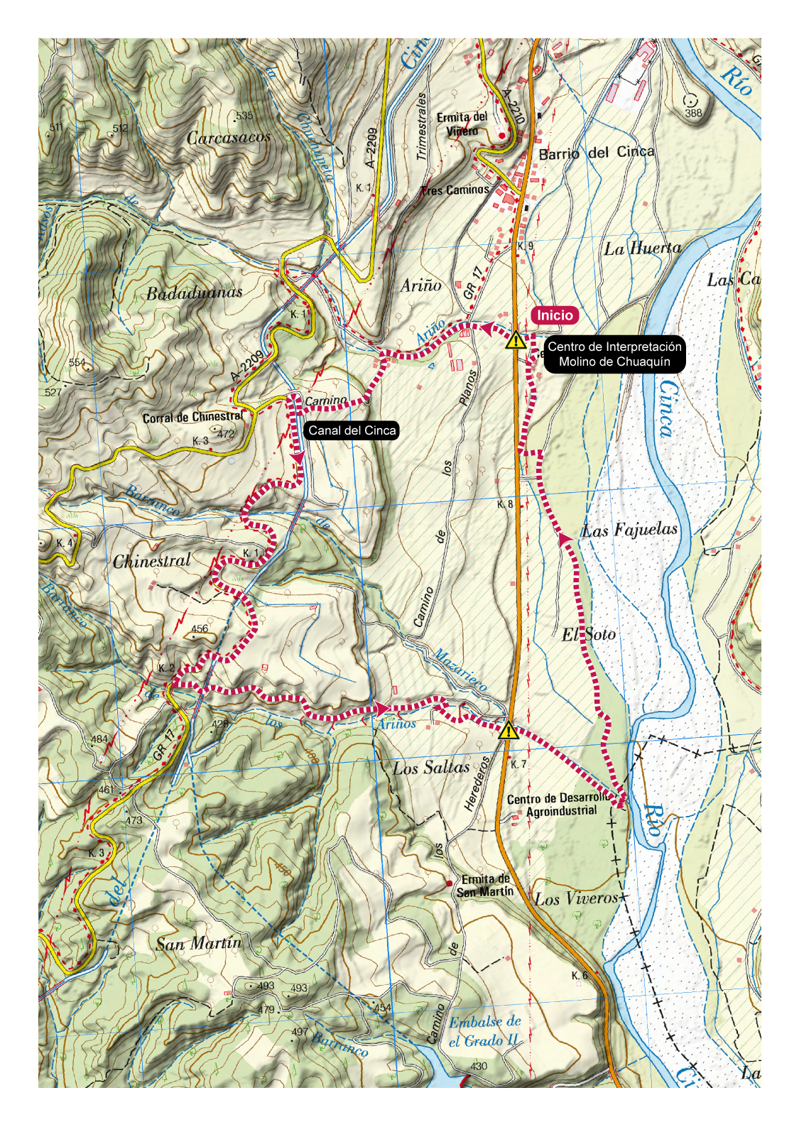
Route of the Cinca River and El Grado Aqueducts
Technical Information
Type of route: circular
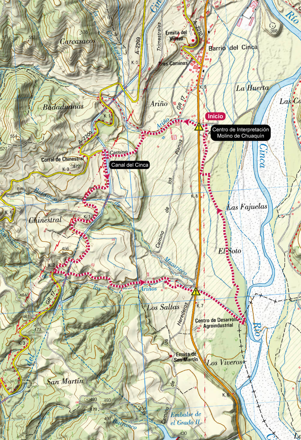
Departure point: El Grado - Molino de Chuaquín
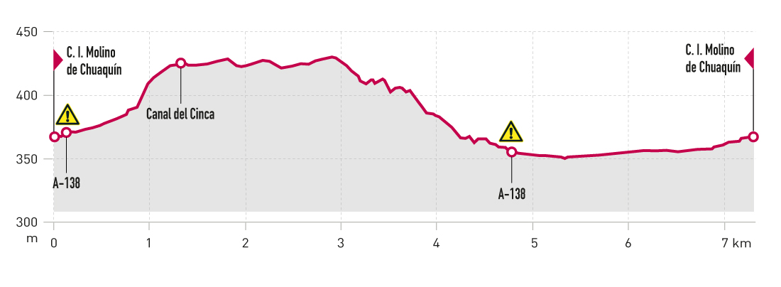
KM: 7,3
Duration: 1 h 45 min
Gradient: 80 m
Difficulty:
Points of interest
Chuaquín mill, Cinca Canal, riverside fauna and flora.
Route description
Shortly before arriving at El Grado on the A-138 road, you’ll fi nd the Molino de Chuaquín, an old flour mill that has now been restored, housing an information centre and proving a good example of the region’s ethnographic cultural heritage. Here you will also find the tourist offi ce and a space dedicated to exhibitions on parcheesi, puppets and nature.
The mill is the starting point of the route, which coincides with the regional path Árboles y Acueductos (Trees and aqueducts). Along the route, you can walk along the impressive Cinca Canal and get to know different unique trees. The route alternates sections of dirt tracks and asphalt, ending up along the banks of the Cinca river and its riverside woodland.
Photo gallery
Map
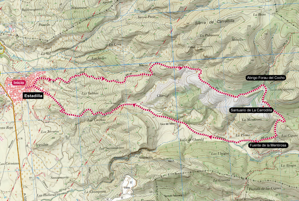
Sanctuary of the Virgin of la Carrodilla. Estadilla
Technical Information
Type of route: circular
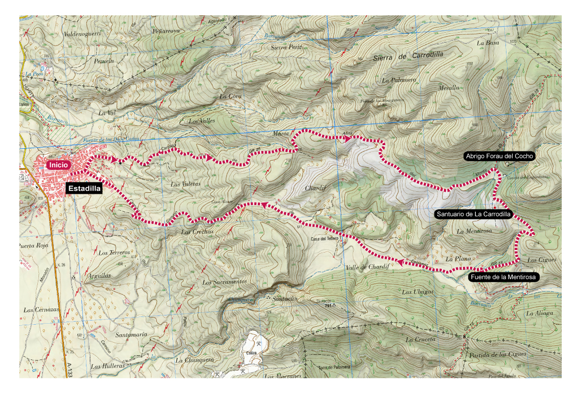
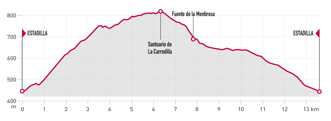
Departure point: Estadilla
KM: 13,5
Duration: 3 h 30 min
Gradient: 400 m
Difficulty:
Points of interest
Sanctuary of la Carrodilla, shelter of Forau del cocho, fountain of La Mentirosa and panoramic views.
Route description
The ascent to the Sanctuary of la Carrodilla is a very popular excursion that can be done on foot, running or on mountain bike.
The suggested route for nordic walking ascends to the sanctuary along the Alins (or La Carrodilla) path, which is the steepest but has the best road surface. It then descends along the Calasanz path, which passes by the well-known Fuente Mentirosa (Lying Fountain).
The route runs entirely along forest tracks in good condition with several asphalted sections, so all you have to worry about is enjoying the surroundings and the rich heritage that surrounds the route. In addition to the impressive sanctuary, there is a monumental ice well, and the cave paintings of Abrigo Forau del Cocho nearby.
Photo Gallery
Map
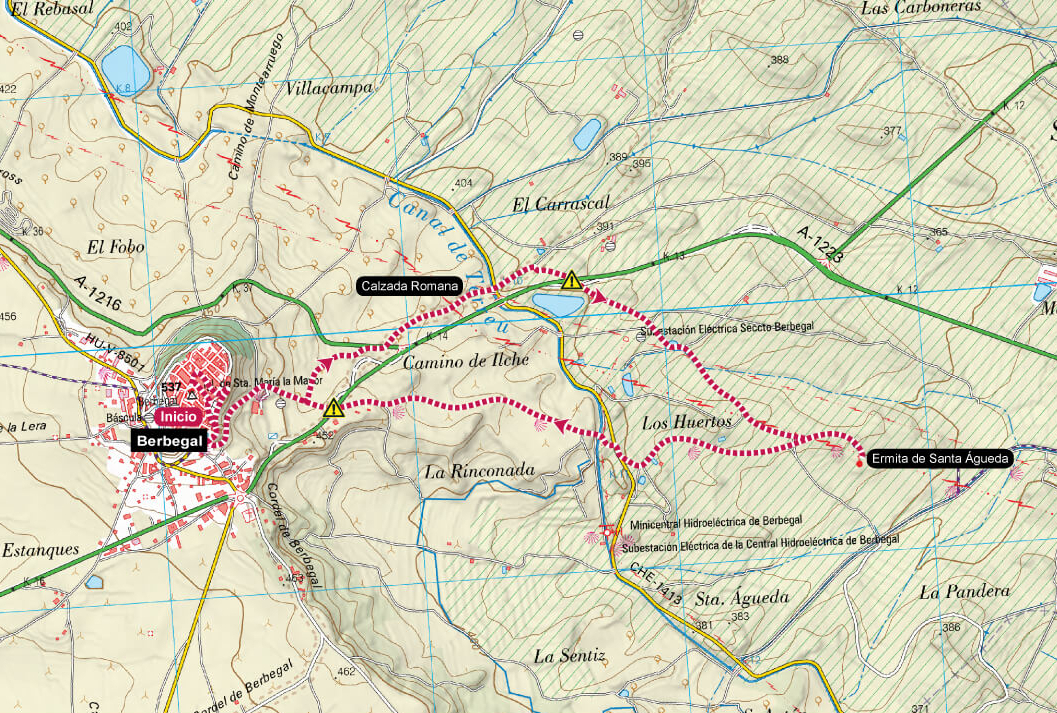
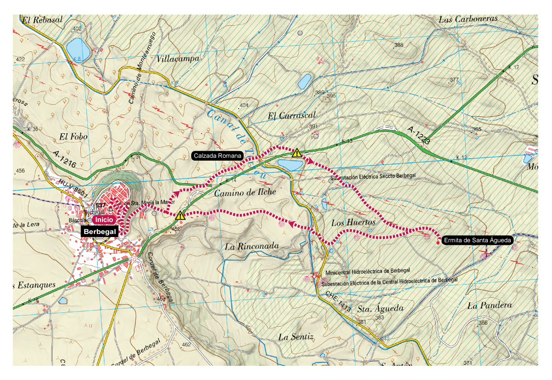
Hermitage of Santa Águeda. Berbegal
Technical Information
Type of route: circular
Departure point: Berbegal
KM: 7,1
Duration: 1 h 50 min
Gradient: 150 m
Difficulty:

Points of interest
Old Ilerda-Osca Roman road, hermitage of Santa Águeda, panoramic views.
Route description
The village of Berbegal is strategically located on a hill, with splendid panoramic views that can be enjoyed from various viewpoints.
The suggested route starts in the upper part of the village, so that, in addition to the landscape, you can admire its beautiful ancestral
homes including the current Town Hall and its imposing church. After descending from the town centre, the route heads towards the Romanesque chapel of Santa Águeda, along the old Ilerda-Osca Roman road, of which only a few sections remain. It then follows farm tracks in perfect condition to the hermitage, on an intriguing route surrounded by large sandstone rocks. The return to Berbegal is more direct, using paths in good condition.
Photo gallery
Map