PUEBLOS
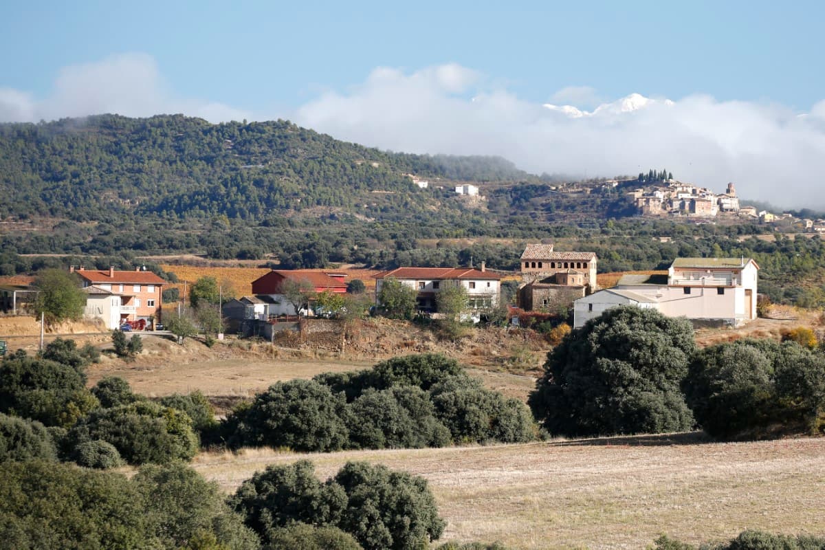
Montesa
The municipality of Hoz-Costean is made up of the villages of Montesa, Hoz de Barbastro, Salinas de Hoz, Costean and Guardia (now abandoned), all are which are located close to the Sierra de Salinas mountain range. On the surrounding slopes terraces have taken slices from the mountains to create platforms for growing the traditional staples of almonds and olives.
Vineyards have gradually taken over more land on the rolling hills around Montesa. The village occupies an exceptional spot at over 500 metres above sea level, yet is relatively close to the capital city of Barbastro.
The village church dedicated to San Millan stands at the end of the only street facing an 18th century ancestral home adorned with the Pano coat of arms. The regular joint of the church’s north wall and the deep-rooted Gothic nature of the entrance decoration (delicate edging, pretty cantilevers and elegant mouldings) point towards medieval origins. The style and design of the renovation work suggest it was carried out in the early 16th century as can be seen in the simplicity of the vaults with their slightly pointed finish, the delicate sculpture of the sandstone ribs and the decoration of the supporting cantilevers.
The result is a simple space with harmonious proportions in which the stellar vaults attract all the attention.


Buera
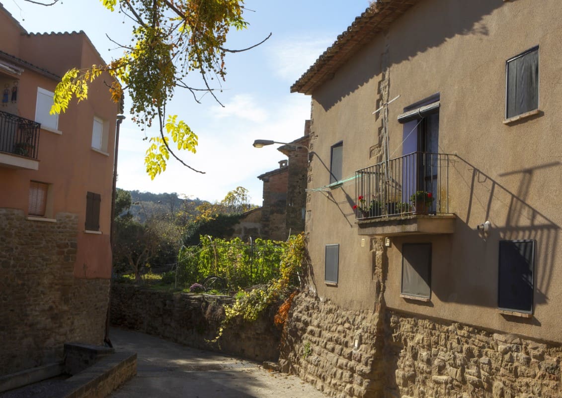
The town sits on a stretch of flat land at 522 metres above sea level. Two long streets contain the majority of the houses of the town, many of which offer beautiful paved courtyards. Surrounding the town, a patchwork of carefully tended vegetable gardens can be admired, as can a few surviving stone walls which enclose the old roads.
The parish church, dedicated to San Juan, is a simple yet beautiful building with a medieval air. Its interior walls are made of natural stone and emphasize the purity and geometrical simplicity of the lowered vault of the nave.
A just 4 km from Buera, the shrine of Santa María de Dulcis can be visited. It was erected in the 17th century in honour of Our Lady who, according to tradition, appeared above a honeycomb. At the side of the access road to the shrine lies San Juan's chapel. Close by, the “Pozo de Nieve de Os Moros” can be found, which is an old well built to conserve ice brought down from the mountains.
Visitors can enjoy the friendly welcome of Buera’s inhabitants during the annual fiestas at the end of August. In January bonfires are lit in honour of San Fabián and San Sebastián.


Bierge

It is said that a castle once stood on the hill known as Mount Casallo, where the origins of the settlement of Bierge lie. The parish church dedicated to Santiago (St. James) is a 16th century renovation of an older church, with the Renaissance decoration of the doorway and the gallery of brick arches providing unmistakable chronological references.
Over time, the village extended down the lower slopes of the hills and onto the plain. Many of the houses display coats of arms, hinting at the noble fever that swept the area in the 18th century. They are often situated above beautiful open doorways, integrated in the form of large keystone and perfectly slotted into the arc of the semicircular door arch.
The chapel of San Lorenzo goes almost unnoticed among the houses of Bierge. On the 10th August children prepare a bonfire in the square to burn an effigy filled with straw. The villagers roast potatoes and eat them with anchovies and also enjoy peach with wine.
San Lorenzo, San Lorenzo,
en qué tiempo has venido,
en el tiempo de las uvas,
el melocotón y el vino


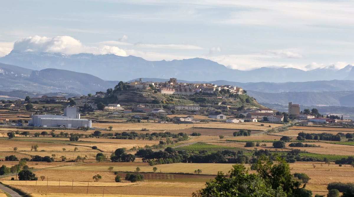
Berbegal
There are a number of curiously shaped stones near the village of Berbegal, such as Peñón de Muyed or Peña de Santa Águeda. (peña meaning crag.) According to legend they were menhirs, monumental megaliths sunk vertically into the ground, which were thought to have been used for rituals involving human sacrifice.
However the true origins of Berbegal are Roman. The presence of the road that joined the cities of IIerda (Lerida) and Osca (Huesca) favoured the creation of new settlements to service people using the route. These settlements included places such as the Roman Caum, which was located in the municipal district of Berbegal. Caum stood at a crossroads from where a subsidiary road left the main highway to reach the villages of Somontano.
The region of Berbegal was later part of Muslim Spain until 1088 when Sancho Ramirez claimed military occupation and partial repopulation of the area began. Free peasants settled in the area under the protection of castles such as Gramapán, which were being built alongside a number of beautiful Romanesque churches such as Santa Maria la Blanca. The old roman road was used throughout the medieval era and the troops of the infamous El Cid travelled its route at the end of the 11th century. Part of its course coincides with the pilgrimage Way of St. James (Camino de Santiago), which passes close to the Romanesque chapel of Santa Águeda.
The King of Aragon, Count of Barcelona and conqueror of Valencia and Mallorca, Jaime I counted on the support of the village during the first difficult years of his reign at the beginning of the 13th century. He needed the collaboration of the local people in order to stand up to Aragonese and Catalan factions who made and broke alliances to meet their own particular interests.
His appreciation of the support received was shown in privileges, special exemptions and the granting of a license for a fortnightly market. As a free village that did not belong to the nobility, the church or the crown, the authority of these royal privileges was confirmed in the centuries that followed by King Fernando “El Católico”, Carlos I and Felipe II.
In the 17th century, the growing tension between Catalunya and La Corona finally broke down into open war. The Aragonese people gave as much manpower and material resources as they could to help, despite their scant resources. Those hectic years were propitious as they brought about something that was rather uncommon; visits by King Felipe IV to Aragon and in particular to Berbegal. The village became an arsenal and barracks for imperial troops in their advance towards Catalunya.
The old village is variegated in appearance and was once walled with two entrances; one to the north and the other to the south. Many of the houses display heraldic crests revealing their important past. The village is built on sandstone rock a number of tanks and wells pit their surface, although the water from them tends to be rather brackish.
The Hospital Arch is all that remains of an old hospital that was once used by pilgrims. The old Town Hall is a noble building made of brick and skirted by a base of strong ashlars. It has 3 floors and is finished with the characteristic galley of pointed arches.
The Greenwich meridian is an imaginary line that serves to help man locate his position on earth and requires, among other things, the use of different time zones. This meridian, which passes through the English village of Greenwich, also passes through Berbegal and, because of this, the boundary path that circles the village, is known as the Meridian Path. The route boasts magnificent 360º views of Somontano and looks out over at least 70 villages.
Berbegal is also home to a stretch of the St James Way, which coincides in part with the old Roman road. This ancient route leads to the Santa Agueda chapel; a small Romanesque building (12th century) with a single nave and semicircular apse.
The chapel stands at a crossroads, around 3.5 km from Berbegal, where the road between Berbegal and Peralta de Alcofea crosses the Lagunarrota to Pertusa road. The 16th century San Gregorio fountain with its trough and washing area stands on the same site.


