PUEBLOS
Estadilla
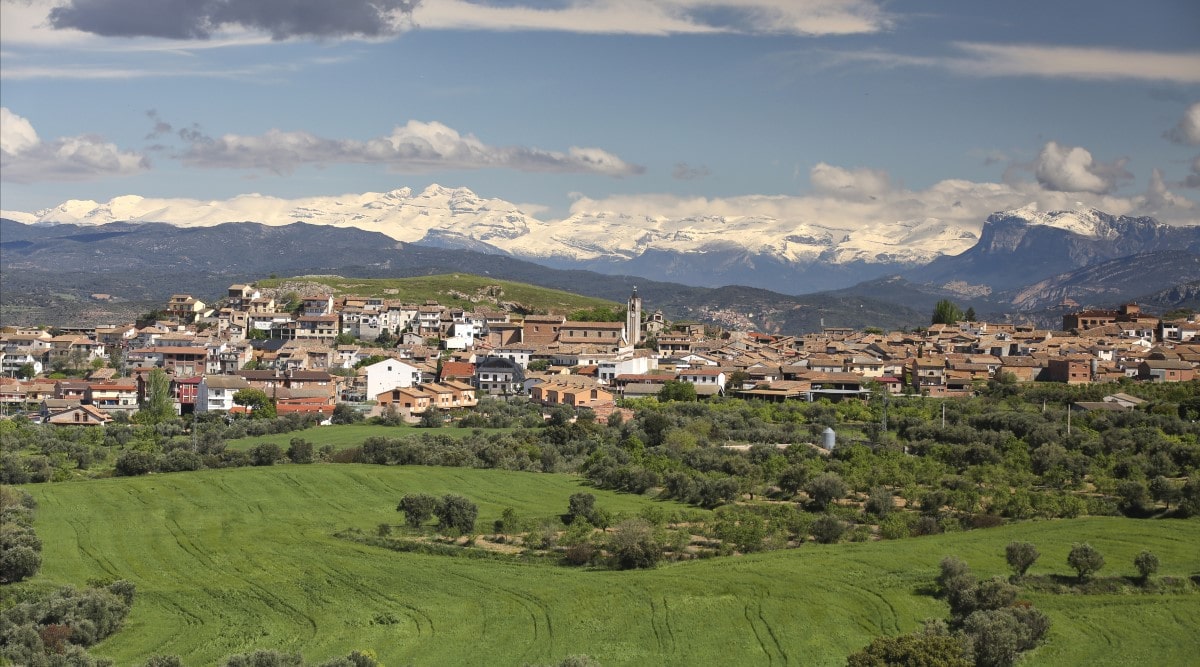
Located between the mountains and the riverbank of the eastern reaches of Somontano, Estadilla boasts a variety of attractions.
The name of the village is derived from the Latin word stata (stop) making reference to its remote Roman origins. It sprang up during the first centuries of our era next to one of the many secondary roads that were used to link the Ebro valley with the Pyrenees.
Today it is the departure point for a multitude of destinations but is also the ideal spot for enjoying wild yet welcoming nature. It has retained an interesting ancestral culture that is tangible; Baixo Ribagorzano is the name given to the local dialect that is still used by many villagers.
The landscape that surrounds the village hides many contrasts awaiting discovery. To the west lie the banks of the River Cinca and flat and fertile lands peppered with fruit trees, olive trees, almond trees, vines and cultivated crops. To the north there are lush vegetable gardens, irrigated from the spring waters of the village fountain. The east reveals the dramatic mountain formations of the Carrodilla range where caves and gorges are a result of the karstic phenomena.
The limestone rock in the Sierra de la Carrodilla is susceptible to the erosive effect of the water as it filters through the rock, sculpting a number of distinctive features on the surface as well as underground. These include the canyons of Chardiz, la Chunquera, Santacum and Las Covas, the underground abyss known as Las Gralleras, caves such as Aigua, la Bruja, Alonsé, La Val, and La Sierra de Periz and springs such as Mentirosa where the water re-emerges from this underground network.
The peak of Buñero, with slopes coved in holm oak and Portuguese oak, reaches a height of 1108 metres. It is a magnificent viewpoint over the surrounding valleys of Cinca and Ésera, the Pyrenean peaks of Ribagorza and Sobrarbe and the mountain ranges of Guara and Somontano.
Holm oak, oak, juniper and a great variety of aromatic and rupicolous plants dress the slopes of these mountain ranges and provide the perfect environment for the much sought after truffle.
Soaring in the skies close to the village are the Crag Martin, Egyptian Vulture, Griffin Vulture and even the rare Lammergeyer and an exceptional display of butterflies can be found in the Chardiz Canyon.
Estadilla’s proud history reveals that it was once the location of a medieval defensive fortress (statella), which had a strategic role in the control of the left bank of the River Cinca. At the end of the 9th century the village was conquered by Aragonese troops after years of Muslim domination and between then and the 13th century was free of direct rule. However in 1260 this changed and its future fate was controlled by the powerful Baron of Castro, a man of a strong lineage that was linked to the Catalan and Aragonese nobility.The old town that we see today grew beneath the shadow of the old castle, of which hardly anything remains. The arcaded main square is home to a number of noble ancestral homes such as Casa Marro, Casa Sangenis and Casa del Barón as well as the Town Hall, a Renaissance building built in the style of a 16th century Aragonese palace.


El Tormillo
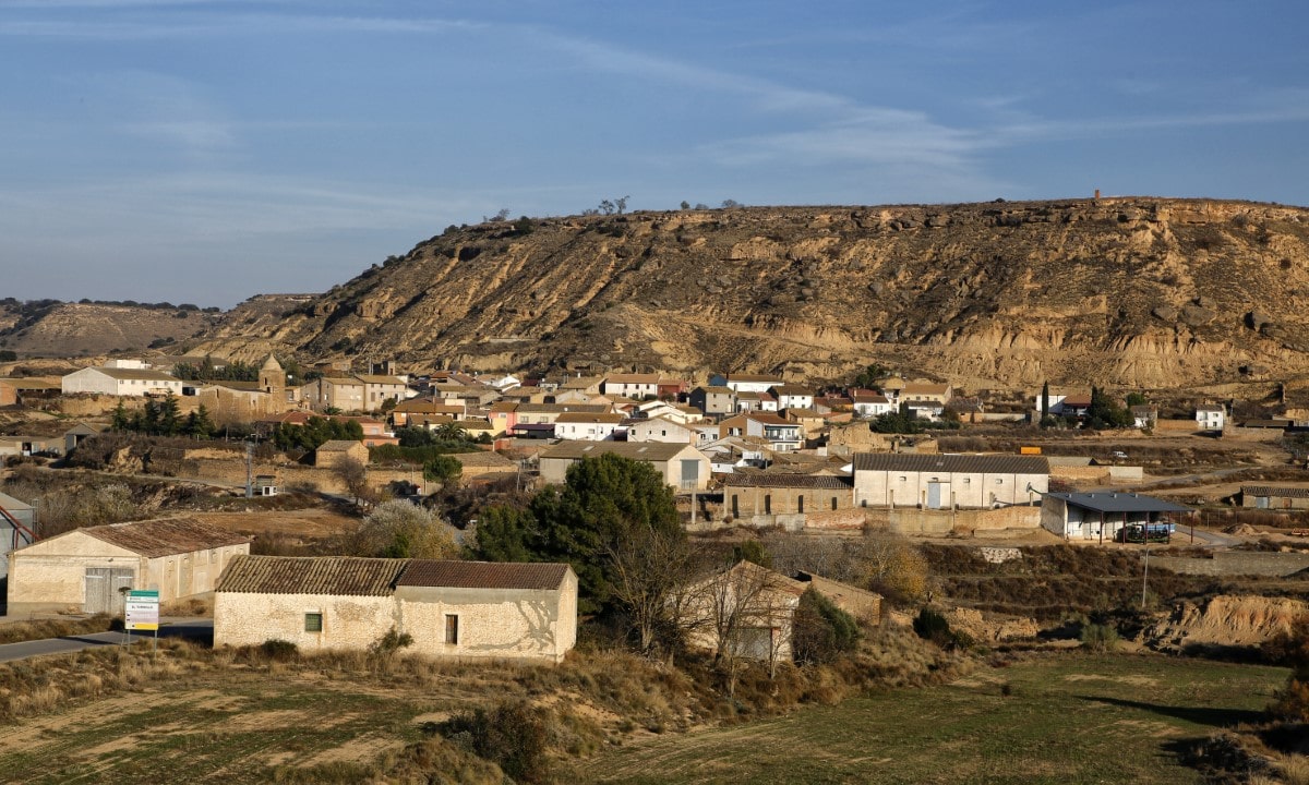
Bordered by the flat plains of Monegros to the south, the village of El Tormillo belongs to the municipality of Peralta de Alcofea. It shows another side of Somontano; a semi-arid landscape with gentle rolling slopes covered with juniper and aromatic plants.
Traditionally, the local people worked the land, cultivating crops without the use of irrigation. However, in recent years the countryside has been transformed into vast expanses of irrigated land where crops such as maize and alfalfa are grown for forage.
In addition to the surprising beauty of the landscape, the area also boasts scattered remnants of its medieval past.


Estada
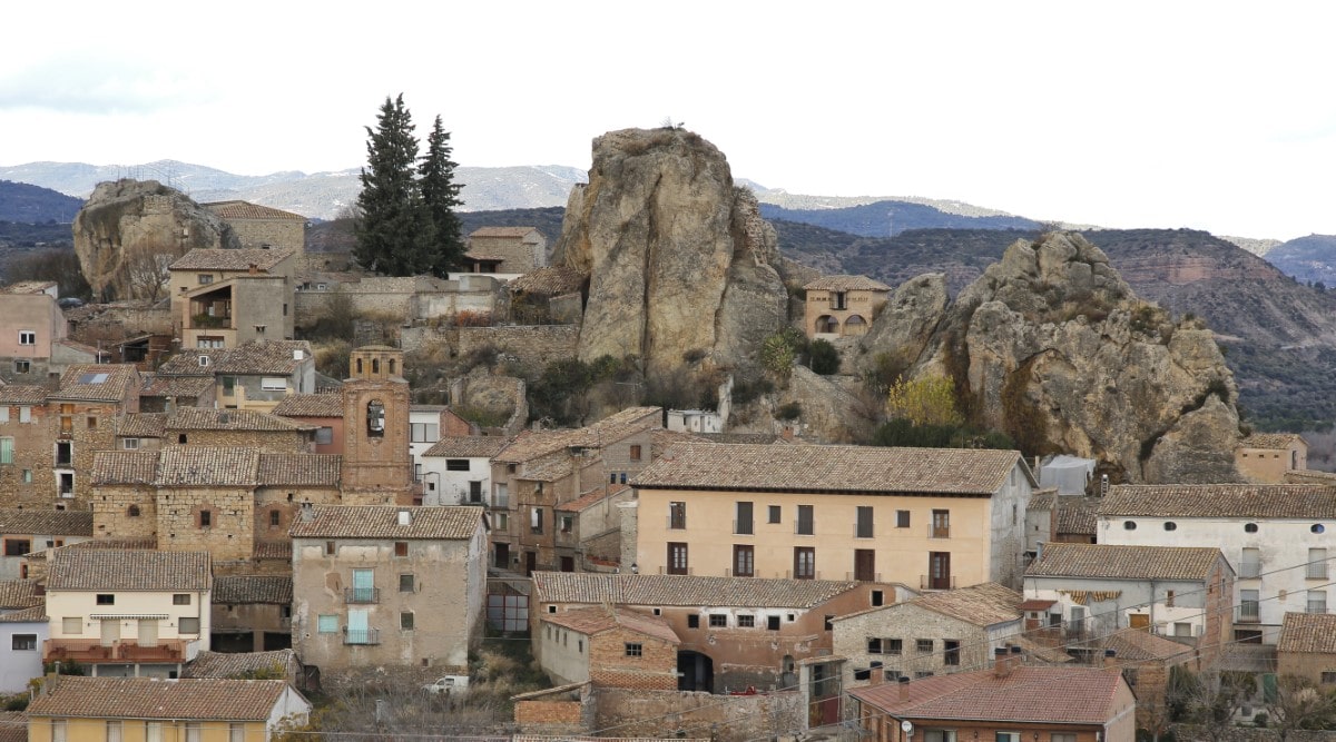
The village of Estada is located in the Cinca Valley, next to the Aragon to Catalunya canal.
The name of the village comes from the Latin word "Stata" which refers to a stop along a Roman municipal road. The town's origins lie in Villa Stata, an important fortified agricultural settlement of late Roman times (6th century). The intricate mosaics belonging to the villa’s noble rooms are now kept in the Provincial Museum of Zaragoza.
It was retaken from the Moors in 1087 by Pedro I and was fortified.
The parish church is dedicated to San Pedro and was built in the 18th century, constructed using the original foundations of the Roman church, which it replaced. The doorway and the stone facade with their curves and flowing lines, express the language of the new baroque style. The tower, decorated with ceramic adornments and geometric shapes using layered bricks, highlights the unique neo-Mudéjar flair.
"El Ciego" Reservoir where the river comes to a halt, provides an important wetland that is inhabited by mallards, herons, cormorants and hibernating gulls.


Enate
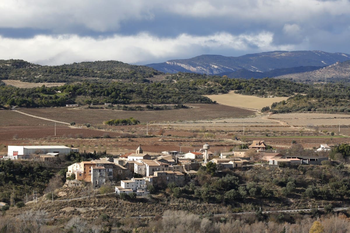
This small village is within the municipal boundaries of El Grado and sits on a fluvial terrace on the right bank of the River Cinca. It has a clear defensive character as, in addition to being able to watch over the valley from its lofty location, the village was once walled. The remains of one of the arches that gave access to the medieval enclosure can still be seen.
The old village is clustered around the main square of San Valero, the hub of the centre. Here, two houses, known as "Casa Agustín" and "Casa Guardia," stand out for their beautiful arched doorways.
Tradition says that Saint Valero lived in exile in the village as an old man. He is now the patron saint of Enate and a street and parish church are named in his honour.
The church has a single nave and was built in the 18th century from modest materials (brick and rammed earth) giving it a friendly and welcoming air. There is a covered passageway attached to the west end of the church that features a semi circular arch with a coat of arms on the keystone. This leads to the tower, which has three sections topped by a spire.


