Conjuntos históricos
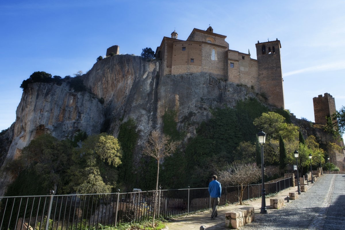
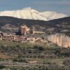
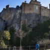
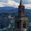
The proud Collegiate Castle of Santa Maria la Mayor rises from the deep ravines of the Sierra of Guara, which have been patiently sculpted over time by the waters of the River Vero. At the foot of the castle lie the labyrinthine medieval streets of the historic village of Alquézar, which has deservedly been declared a Site of Historic-Artistic Significance.
Rock, water, history, art and legend: these individual characteristics have merged together in Alquézar, a village that surprises the visitor with its unique atmosphere. To walk the historic streets; to cross beneath the archways of the old walls; to listen to ancient tales of Moors and Christians: is to step back in time and relive history.
The village of Alquézar is situated in the final stretch of the River Vero canyon, in a particularly picturesque setting. It offers a multitude of options for nature lovers and adventure-sport enthusiasts - pot holing, rock-climbing, horse-riding and bicycle routes to name a but a few.
The sport of canyoning in particular is associated with Alquézar. It involves a combination of climbing, abseiling and wading down water-filled canyons – not for the faint hearted! The gentler pastime of hiking is also hugely popular, and there is one notable trail that merits a special mention. It leaves from the Monchirigüel fountain in the centre of the village and descends down through the canyon of La Fuente, allowing walkers to experience the final section of this majestic gorge first-hand. Following this same path, it is possible to discover springs, waterwheels, dams and bridges. These man-made structures all illustrate the importance of the water from the River Vero: a resource that has been used in Alquézar since medieval times.
From Alquézar one can also visit the prehistoric cave paintings of Quizáns and Chimiachas.
Viewpoint “Smile to the Wind”:
This viewpoint provides the first wondrous sight of the historic village of Alquézar, set against the final section of the canyon. The turquoise waters of the River Vero are ever present as they continue their journey from the mountains of Guara to the fertile and sweet lands of the plains below.
On the highest point of a solitary rock, a place surrounded by deep ravines, an unassailable stronghold was built by the Christian kings. The original Moorish castle that once stood on this site was constructed at the beginning of the 9th century on the orders of Jalaf ibn Rasid. His aim was to prevent the Christian forces from the neighbouring county of Sobrarbe entering into Barbitanya. However, Alquézar was finally conquered by the Christians in the 11th century. Over the centuries, the mountains of the pre-Pyrenees have represented a true barrier between these two cultures and religions. The name “Alquézar” actually originates from the Moorish name of “al-Qasr” meaning fortress.
Once King Sancho Ramírez had gained power of Alquézar in 1067, the slopes of the castle began to welcome new inhabitants. However, the repopulation did not begin in earnest until the year 1100, the year that the city of Barbastro also passed into the hands of the Christian kings. The layout of the new village of Alquézar was designed to adapt to the varying levels and curves of the land, and to protect it from the most extreme climate changes. The original medieval layout has been kept until the present day.
Gothic doorway:
The village originally had three gateways providing access to the interior of the urban enclosure, but only one remains: a beautiful Gothic entrance. The doorway is unusual as at one end it was built with a smooth semi-circular arch, whilst at the other end a pointed arch was created, crowned by the coat-of-arms of the village. This shows three towers of a single castle, a design that commemorates the military origins of the town.
Beneath the covered passageway is the entrance to the house of El Médico, where one of the oldest coats-of-arms in Alquézar is displayed. Its age can be ascertained due to the moulding of Gothic appearance and the lack of ornamental details popular in later years. It shows the bars of Aragon, a ‘rampant’ lion with claws spread in attack, and surprisingly, a shell next a pilgrim's staff.
Pedro Arnal Cavero Street:
Once known as Calle Mayo (Main Street), this is the very heart of medieval Alquézar and a walk along this particular street takes the visitor into the historic depths of the village. It is one of three main streets that run lengthways through the village, between which many smaller streets and passageways branch off and connect, allowing easy access to all parts of town.
Several “callizos,” or covered passageways above the streets are still in existence. These are evidence of the necessity to make use of every bit of available space in a village that was once densely populated. It is said that it used to be possible to cross from one end of Alquézar to the other without once stepping on the street.
The architecture of the houses brings together stone, brick and a clay-like material used to build walls (tapial.) This highlights the clever use of local materials, which were easily taken from the plains and the mountains nearby.
A multitude of details await discovery in these narrow paved streets.
Chapel of Our Lady of Nieves:
The small chapel of Our Lady of Nieves is found in Pedro Arnal Cavero Street, just before reaching the main square. This chapel has a single nave with three tracts, covered with a star-shaped ribbed vault, and housing a small altar. The altar is a mixture of Renaissance and Gothic designs, due to the fact that it was put together using various pieces of previous altars. The facade was built by stonemasons in the 17th century following a model of popular religious architecture of the time.
Next to the chapel there is an ancient doorframe, no longer in use, with the silhouettes of two shoes. It has been suggested that could have once been a shoemaker’s workshop, although this is unconfirmed.
The Main Square:
Set in the very heart of the village of Alquézar, the old Main Square is today known as the square of Mosén Rafael Ayerbe. This important historical figure was a priest in the village at the beginning of the 20th century. He achieved fame for creating a new strain of almond tree better adapted to the climatic conditions of the area, from which a variety of almond called "largueta" or "desmayo" is harvested.
It is a beautiful and secluded square surrounded by an arcade, with a harmonious blend of semi-circular arches and straight passageways. Local merchants once came here to sell a variety of produce from the plains and mountains: these days, a weekly market is still held. Permission for an annual fair was first granted by Carlos V in the year 1528, and has been held in the square every year since. That year marked the start of a prosperous new era for Alquézar.
Monchirigüel Fountain:
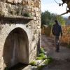
After crossing the Main Square and continuing along Calle de las Iglesias (Church Street), a small street to the left leads to a flight of stone stairs. These steps lead down to the Monchirigüel Fountain.
It was built in the 16th century and proudly displays the Alquézar coat-of-arms and elements of Renaissance decoration.
From this point, there is a wonderful view of the Collegiate Castle of Santa Maria rising from the hard rock, in apparent defiance of the deep void beneath.
Cruz de Buil Square:
Calle de las Iglesias (Church Street) eventually converges with two other streets, creating the square known as the Plaza Cruz de Buil. Access to the walled enclosure of the collegiate castle can be gained from this square, by passing through an emblazoned entrance built between the 15th and 16th centuries. This entrance has always been the only means of penetrating the enclosure as the castle is surrounded by vertical walls of hard rock.
Viewpoint “O’Bicón”:
Alquézar is surrounded by breathtaking scenery, as the view from the “O’Bicón” viewpoint highlights. To reach this magnificent spot, take Calle Baja from the Cruz de Buil Square.
The view takes in the last stretch of canyon and the mighty River Vero on its journey down from the Pyrenees. It is possible to clearly distinguish the differences in the limestone and conglomerate rocks of the canyon, each having their own distinct characteristics.
The power of the surging waters flowing through the bottom of the ravine was once used to move the turbines of an old hydroelectric plant, and also to move the heavy stones of the Fuentebaños mill downstream.
The sound of the Vero as it passes over rocks is ever present in this beautiful corner of Somontano.
Parish Church of San Miguel Arcángel:
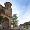
The parish church of San Miguel the Archangel is situated at the far end of town. Construction commenced in 1681 on top of the ruins of a previous church, and the building was eventually completed in 1708.
It is a building of popular design, which stands out for its simplicity and strength. It is made up of a number of different sections and features several small tiled roofs. The baroque nature of the church is hard to discern from the outside, however, the style become more noticeable inside the building. The nave is covered with a barrel vault and the semi-circular decorations are distinctly baroque in nature. Practically the whole of the altar and many other religious artefacts were destroyed in the Spanish Civil War, which helps to explain the scarcity of the interior decoration. Only the top part of the baroque main altar has remained.
Collegiate church of Santa María la Mayor:
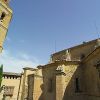
The atrium that provided access to the Romanesque temple still remains and is now integrated into the cloister. The capitals date back to the 12th century and reproduce scenes from Genesis. The walls are decorated with murals that date back to the 14th – 18th centuries.
The chapel of Santa Ana, which opens up to the cloister, is a faithful reflection of the melting pot of cultures found in Somontano in the 16th century. Its facade, richly decorated with stucco, boasts a variety of
Gothic, Mudejar and Renaissance elements.
In the 16th century the cloister was extended with the construction of a second floor. One of the rooms was once used as accommodation for residing canons and is now home to some excellent pieces, which make up the Collegiate Church Museum.
A beautiful Gothic facade gives way to the interior of the impressive 16th century church. The star shaped groin vaults that cover the nave highlight the rich decorative style of the internal architecture.
The main altarpiece reflects 16th century Renaissance style and was designed as a holy monument, as the Blessed Sacrament was permanently displayed behind the central oculus. In addition, the 17th century Baroque Chapel of the Lecina houses an almost lifesize Romanesque figure of Christ.
In the 17th and 18th centuries music played an important role in celebrations and religious ceremonies and the rich sounds of the Baroque organ brought depth and magnificence to any occasion.
Ethnological Museum Casa Fabián:
Strolling through the rooms of a 17th century house with its courtyard, kitchen, bedchambers and cellars, immerses visitors in the way of life of the inhabitants of Somontano in the mid 20th century.
Around Alquézar, there are diferent walking routes as:
- Route of Chimiachas
- Route of Pasarelas
- Somontano Nature Route
In Alquézar, you can play other activities like climbing and canyoning, too.
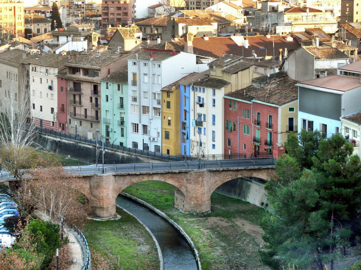
Since its foundation in the 10th century, Barbastro - or Barbatanya as it was known in Moorish times - has held the important role of capital of Somontano.
Its geographical location resulted in it becoming the administrative capital of the area, with a great emphasis on commercial development. This important role has been maintained until the present day.
This journey takes us back in time to uncover the secrets of the local history; to learn about the characters that helped shaped it and to discover the traces they left behind in the city.
The climb to the impressive Monastery of El Pueyo should not be missed during a visit to Barbastro. The view from the hilltop location is unsurpassed across the whole of Somontano, .
From the capital city, it is also possible to reach the towns of Burceat and Cregenzán, on foot or by bicycle, by following a path belonging to the GR45 network of paths.
The Historical Complex of San Julián and Santa Lucía:
This historic collection of buildings can be described as the gateway to Somontano.
Within the walls of the old city hospital, the Tourist Information Office provides visitors with details of the area. In the same building there is superb shop selling local wine and gourmet products, and the Wine Zone belonging to the Regulatory Board of the Somontano Denomination of Origin (known as the D.O.) The D.O. is the body that supports, promotes and controls the wine-producing activities within the Somontano boundaries.
The gothic church of San Julián was built in the 16th century, and has recently been completely restored and refurbished as the Somontano Visitor Centre.
The Cathedral Complex:
The Catedral de la Asunción is the most emblematic monument of the city. The ambitious construction from the early 16th century, was a city project financed by the local council. The church was built in the style of a huge hall and has a total of three naves, which are all of the same height. This feature gives the open-plan interior a sense of space, balance and majesty. The remarkable altarpiece with its spectacular alabaster base is a work of Damián Forment, with help from his pupil Juan de Liceire, and is a particular highlight of the cathedral’s interior. In the late 17th century the cathedral was enriched with new chapels, two of which show clear 18th century Baroque elements.
The bell tower stands apart from the main building, just to the north of the apse, and history provides an feasible explanation for this. The mosque that once stood on the same site was consecrated as a cathedral soon after the Christian conquest, and the minaret was converted into a belfry. Around the beginning of the 14th century, this minaret was knocked down and replaced by a medieval tower with thick walls, long before the current cathedral had been built. Early in the 17th century another section was added and the reconstruction of the spire took place in the 18th century.
The final appearance and location of the tower are a result of all of these factors. The sound of its bells have always enriched city life, but in addition to civil and religious functions, the tower has also been used as a watchtower and as a refuge over the years.
The Diocesan Museum is located within the Cathedral complex. In addition to displaying an interesting collection of gold and silver work and a variety of fabrics, it has brought together precious sculptures and medieval paintings.
The excavations carried out in the grounds of the cathedral – known as the Archaeological Garden - have brought to light the remains of a 10th century mosque, a church, a Gothic cloister, an abbey and a late 18th century cemetery.
The Episcopal Palace stands a few metres from the cathedral. In 1571, after many years of dispute, Barbastro recovered its position as the Episcopal Headquarters. The city promised to provide the bishops with a residence appropriate to their position, and so it bought a block of buildings to be adapted for this purpose. From the outside, the residence genuinely took on the appearance of an Aragonese palace. The tower to the side of the building is reminiscent of those found in fortified rural residences, and was a sign of power the occupants of this particular city dwelling could not do without. Alterations carried out in the 19th century have resulted in the current aspect of the palace.
Constitution Square:
The Town Hall is located at the end of the square in the city centre. The original council building was built at the end of the 15th century under the direction of the Moor, Farag de Gali, who was the master builder to King Ferdinand The Catholic. The present building was drastically renovated in 1950, and features narrow eaves, large windows on the upper floor and a forged iron balcony. The meeting room still contains some of the original decoration.
The place that is now occupied by the Hermanita’s Home for the Elderly in Need, was originally the site of the ancestral home of the Pueyo family. Later it became the headquarters of the "Casino of Friendship", one of the two in existence in Barbastro in the 19th century. The original building was demolished in order to make way for the first home of the “Hermanitas.” This order of nuns was founded in Barbastro in 1873 by Saint Teresa de Jornet and the canon and historian of the city, Saturnino López Novoa.
The final building of the square is the College of the Escolapios. It was the first college to belong to the Escolapios Fathers of Spain (1677) and is still active to this day. The church, of Jesuit typology, has a Latin cross foundation with a cupola and a high longitudinal nave, which opens out to chapels where the galleries are located. Capitals, half-relief pilasters, mouldings and cornices; all speak volumes of a classic baroque decor. Inside the building important paintings by the Barbastro artist, Francisco Zueras, are on display.
On the walls that face out onto Argensola Street it is possible to see a coarse coat of arms. This is a reminder that the City of Barbastro originally donated this land - previously a street - for the building of a church.
Noble Renaissance Houses:
The Renaissance period is very much in evidence upon entering Main Street, which leads away from the church of the Escolapios. The building known as Latorre House or "Zapatillas House" is the location of the National University of Distance Learning (Open University) in Barbastro. Its brick facade, arched galleries and wooden eaves are typical of the buildings common amongst the middle class in 16th century Aragonese cities.
The carved wooden eaves of the Argensola Palace are one of the finest examples of this kind of classic Renaissance decoration. The walls of the palace have witnessed the birth of famous Barbastrians such as General Ricardos, one of the great European military men of the 18th century, as well as the poets Lupercio and Bartolomé Leonardo de Argensola. They were considered to be the best writers of classical poetry of their era, which fell halfway between the 16th and 17th centuries.
The Market Square:
Barbastro’s market square is different to many other squares across Spain, in that it does not have any official buildings. The town hall and cathedral of the city both have their own specific squares, a sign of their respective civil and religious power. This particular square is a place for the region’s traders and market gardeners; a place to buy and sell, to trade and negotiate.
At one end of the square is the Santa Ana Chapel (16th to 19th century). To the side of this stands the 'Almudi' which is a public warehouse or corn exchange, used for the buying and selling of wheat and other grains. The bustling activities in this building often caused the church, and those in it, to be covered in dust.
The square’s oldest houses, of popular design with low porches, make up a compact, uniform front. The different styles and tastes that have appeared with the changing eras have provided a constantly changing scene, against which the Barbastro people continue to live out their daily lives.
In 1926, the green light was given to a project to construct buildings of an historic nature, such as the San Pedro Warehouses and Calonge House (neo-mudejar). In 1975, the Entrearcos Cultural Centre was built on the land of the ancestral home of San José María Escribá de Balaguer. Inspired by the traditional Aragonese style, it was built using stone, open brick, reinforced concrete lintels and old Arabic tiles.
The river, bridges and fountains:
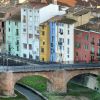
Continuing along Argensola Street, the waters of the River Vero suddenly appear. Strong walls once protected the right-hand bank of the Vero, and these were later used as the base of several houses. These exceptionally high walls formed a compact, solid front, and meant that access to Barbastro from the left-hand bank was only possible via the bridges, which connected with the gateways to the city.
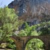
Portillo Bridge was rebuilt in the 20th century along the same lines as the original. The first bridge, built around the year 1600, had three parts made of brick and was subject to heavy bombing during the Spanish Civil War.
San Francisco Bridge, and the gateway that leads to it, both took their name from the Franciscan monastery, which had been established around the 13th century.
On the left banks of the River Vero there were once three public fountains. These gave name to the area, Arrabal, which translates as ‘the poor area.’ The Azud and Vivero fountains disappeared with the canalisation of the river. However the San Francisco fountain, one of the finest in Aragon, still stands. Its construction was commissioned by the City Council in 1553, and it stands on the site of a previous spring known as the "Fuente de los Frayles”. The master sculptor Jaques de Guertch was responsible for the Renaissance layout, and the consummate stonemason Juan de Araçil, worked with him to create the final product. It was completed in only 5 months with clean white stone from the nearby Fonz quarries.
San Francisco Complexe:
El Arrabal, an area of the city that used to be outside the first walled enclosure of the medina, has its roots in the Islamic era of the 9th century. Just by the church of San Francisco, the San Antonio square holds the remains of public baths dating back to the 10th century, which had various vaulted rooms and lion-head fountains. The remains are not open for viewing at present.
The San Francisco Monastery is in this same area of the city, and was founded between the 13th and 14th centuries. Its arrival coincided with a period of growth amongst the mendicant orders. In the San Antonio square it is still possible to see the foundations of the old cloister and the layout of its original walls featuring the small windows of the cells. These have since been transformed into private houses.
Between the 16th and 17th centuries the medieval church was reformed and the large nave was covered with star-shaped ribbed vaults. During the 17th century new chapels were added, such as the Claramunt chapel with its mural paintings and a beautiful glazed tile plinth from Muel (Zaragoza). The church has a stairway that descends into an arched crypt, where a long bench crafted from stone is divided up into fifteen seats of honour. The bodies of the deceased were placed on these seats, and were supported by with the walls of the crypt. Some time after the construction of the crypt the merit of this system was questioned, which resulted in the lowering of some of the seat’s arms, to allow wooden coffins to be placed on the bench.
There is also a small chapel covered with beautifully designed star-shaped vault, which is dedicated to Ceferino Giménez Malla, or"el Pelé" as he was also known. He was an honest gypsy mule trader, who was beatified in 1997 by Pope John Paul.
La Barbacana Ice Well:
From this part of the city it is easy to get to the San Juan neighbourhood where the La Barbacana Ice Well is located. On the banks of the River Vero and nestling at the foot of an ancient city wall, this old construction has been carefully preserved because of its importance to the local history. It is one of the best examples of a unique industry that flourished in Somontano between the 16th and 19th centuries. The ice well has been tastefully converted into a small visitor centre, and inside its past is explained in detail through exhibits and audiovisual displays. Learn how the snow was collected and stored, how the ice was produced and distributed and the various uses it was put to.
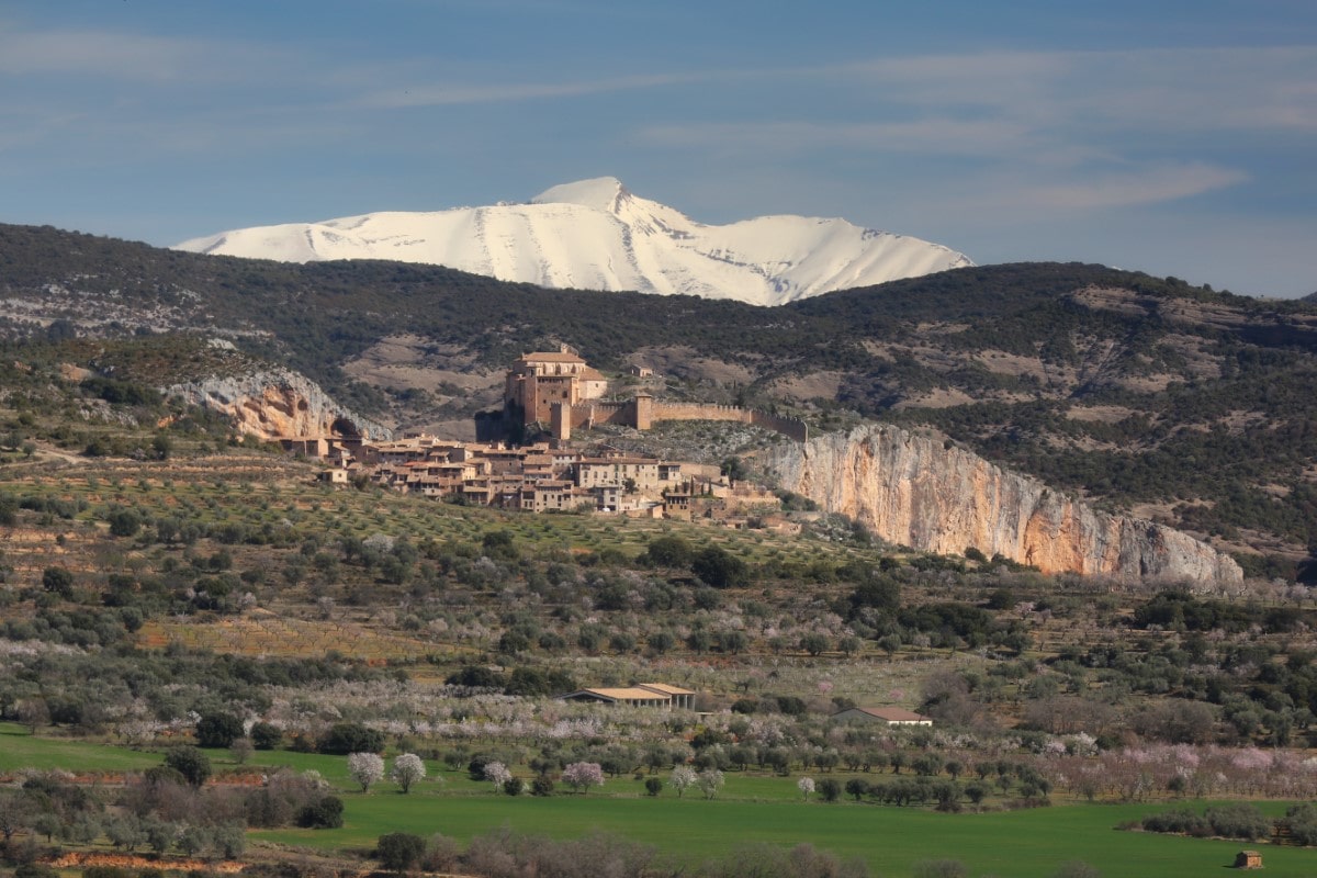
The passing of the centuries has left an important mark on many villages in Somontano. In the city of Barbastro and in the medieval villa of Alquézar, this legacy is so valuable that both have been recognised and declared as UNESCO World Heritage Sites.
With their history and proud heritage they provide an excellent setting that should be seen first hand as the legends, stories and secrets they hide reveal their souls and their hearts. Either place would be a perfect starting point from which to get to know Somontano.


