Trail Running
Trail Running
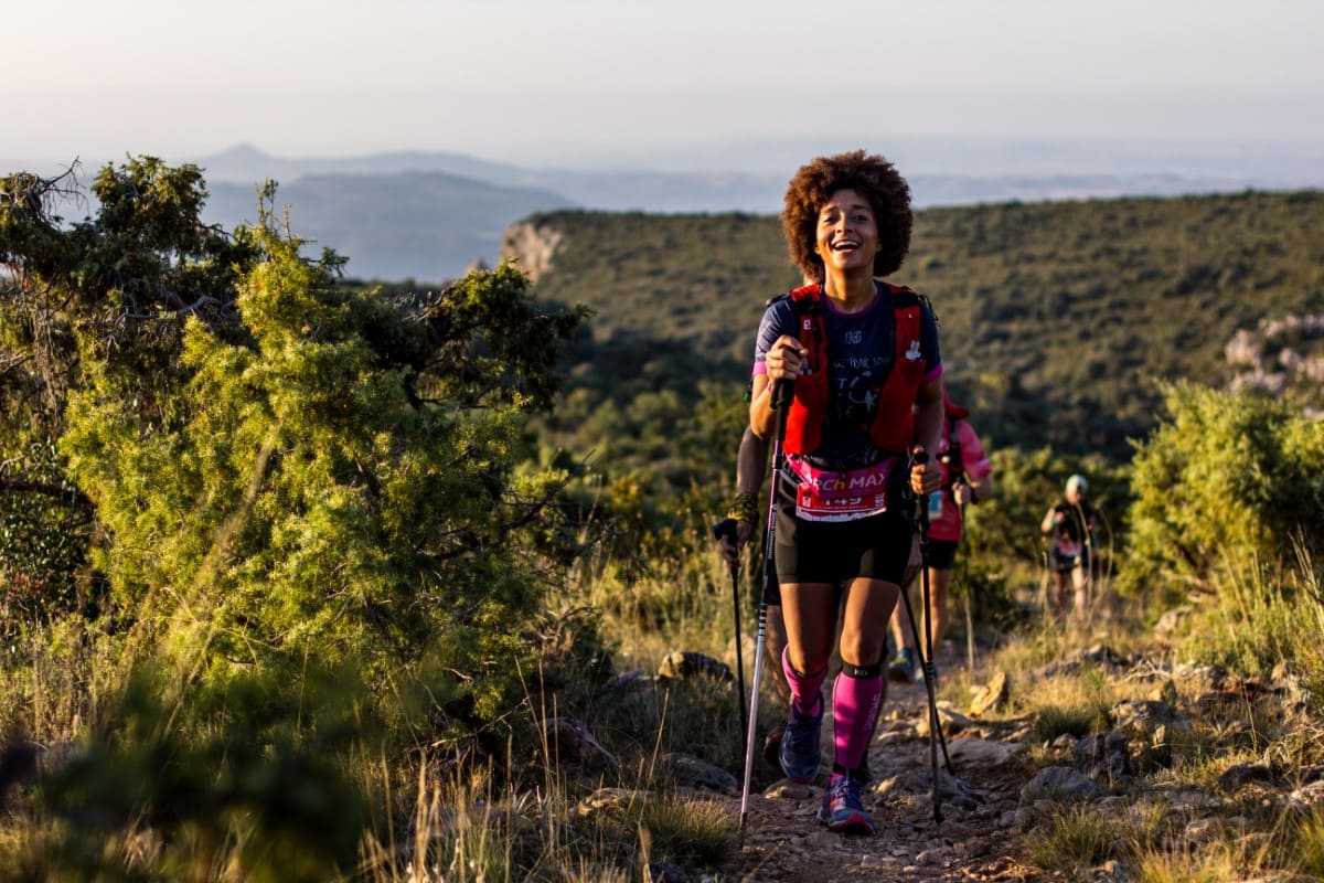
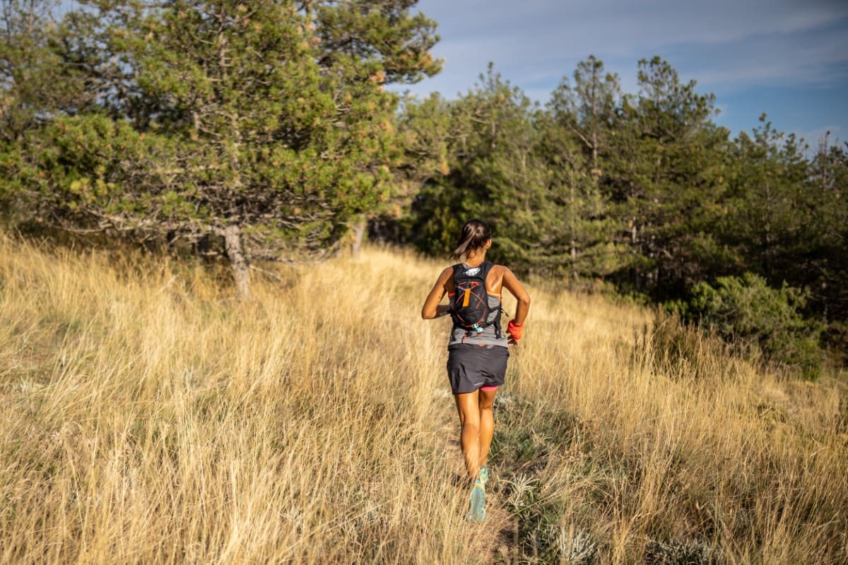
In the last few years, trail running has undergone impressive growth and more and more people are fond of running on mountain trails, looking for new races or routes and new challenges. In short: new adventures.
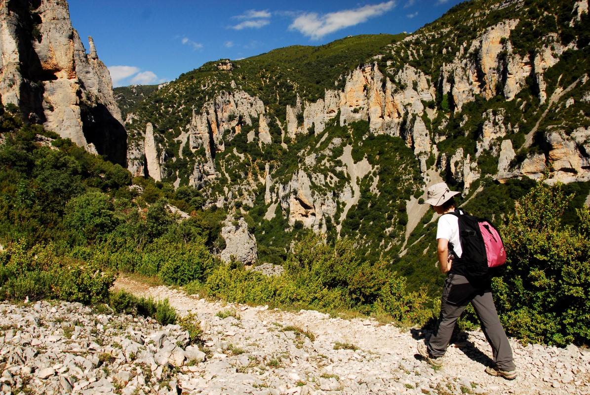
Located in the outskirts of the Pyrenees, Guara Somontano has an awesome orography with long climbs and steep descents, to practice this sport year-round.
The range of possibilities offered by this territory for trail running is so wide that each year, two sporting events are organized: the Trail Sierra de la Carrodilla in June in Estadilla and the Ultra Trail Guara Somontano in Alquézar in October.
Enjoy Guara Somontano with our new trail running routes.
Prepirenaica Trail
Guara Somontano together with the Hoya de Huesca and Cinco Villas in the province of Zaragoza is Prepyr365 area. This consists of territories in the heart of the Pre Pyrenees that allow us to enjoy natural and patrimonial resources and explore natural surroundings such as the Sierra de Guara, the Reino de los Mallos or the Sierra de Santo Domingo.
Prepirenaica Trail is a 12 stages tour going through the great trails of Santo Domingo, Reino de los Mallos and Sierra de Guara ranges located on the Aragonese Southern Pyrenees.
Prepirenaica is a challenge that every hiker and trail runner must experience. We have designed the tour including the best spots of this wonderful and remote land including ancient trails, pre-historic hermitages, medieval and uninhabited villages, deep canyons and overwhelming natural areas. A series of trails that will for sure delight you.
Of the 12 stages, 3 stages cover the most beautiful corners of the Sierra de Guara:
Enjoy the PrePyrenees 365 days a year!


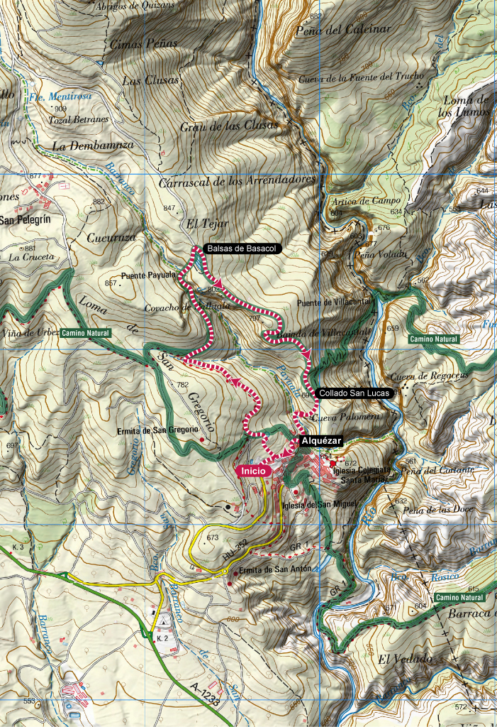
Family Trail. Alquézar
Technical information
Type of route: circular
Starting Point: Alquézar
KM: 4,2
Duration: 1 hora
Gradient: 190 m
Difficulty:
Downloads
Route description
This short but intense route will allow the younger ones to introduce themselves in the exciting world of trail running while visiting some of the most picturesque spots around Alquézar.
The track begins climbing up, fi rst to the Baseta and then to Basacol and Chimiachas. The fi rst section of the climb is easier and follows a nice paved street. The second part is more rocky and it’s shared with a small water pipe that we must sidestep to protect our ankles. Once at the Payuala bridge, the trail continues climbing some steps until Basacol pools, higher point of the route. After passing by the pools, the trail descends by a rocky pedrestian path until San Lucas col. From there, another rocky but short trail leads to Alquézar village, where we will stroll a bit along the streets before reaching the starting point.
Photo gallery


Map
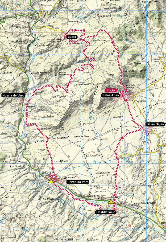
Somontano Vineyards Trail. Salas Altas
Technical information
Type of route: circular
Starting point: Salas Altas
KM: 31,6
Duration: 4 - 6 horas
Gradient: 560 m
Difficulty:
Route description
This is a pure Somontano style route, with crop fi elds, vineyards and the Vero riverside woods. It’s a nice combination for a trail that will allow the runners to squeeze themselves to reach race paces more tipical of urban routes, even with its almost 600 m of elevation gain. Special attention must be paid to the GPS device as there are plenty of road diversions in the route.
From Salas Altas the track goes down to Salas Bajas and Castillazuelo in south direction. Then continues by the Vero riverbank until Pozán de Vero, where a paved road will take us up to a big plateau of agricultural fi elds reaching Huerta de Vero and Buera. A small loop of the trail enables to visit Buera before returning to Salas Altas, where the route ends just after passing by the Candelera chapel.
Photo gallery
Map