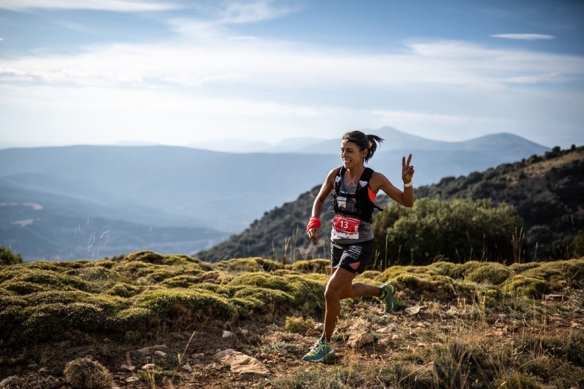
Trail Running
Rock Cathedrals Trail. Rodellar
Technical information
Type of route: circular
Starting Point: Rodellar
KM: 25,9
Duration: 4 - 6 horas
Gradient: 990 m
Difficulty:

Route description
This route includes some of the best trails of Sierra y Cañones de Guara Natural Park. It goes along Mascún and Alcanadre river valleys passing by a series of beautiful uninhabited villages. All the track is shared with an homonymous all-mountain bike tour included in BGuara bike route catalogue.
From Rodellar, the route goes down to Mascún River Canyon going up to Nasarre by Andrebot ravine and passing by Losa Mora Dolmen. It follows GR 1 trail from Nasarre to Bara, the only place where it is possible to get some water. From Bara, it follows Alcanadre river course. It goes up to Miz and later climbs to Collada del Aire. From Otín, it goes back to Rodellar by the so-called «La Costera», a spectacular last section running along Mascún River Canyon.
Photo gallery


Map
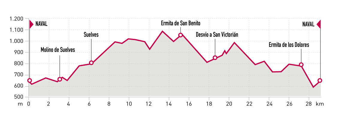
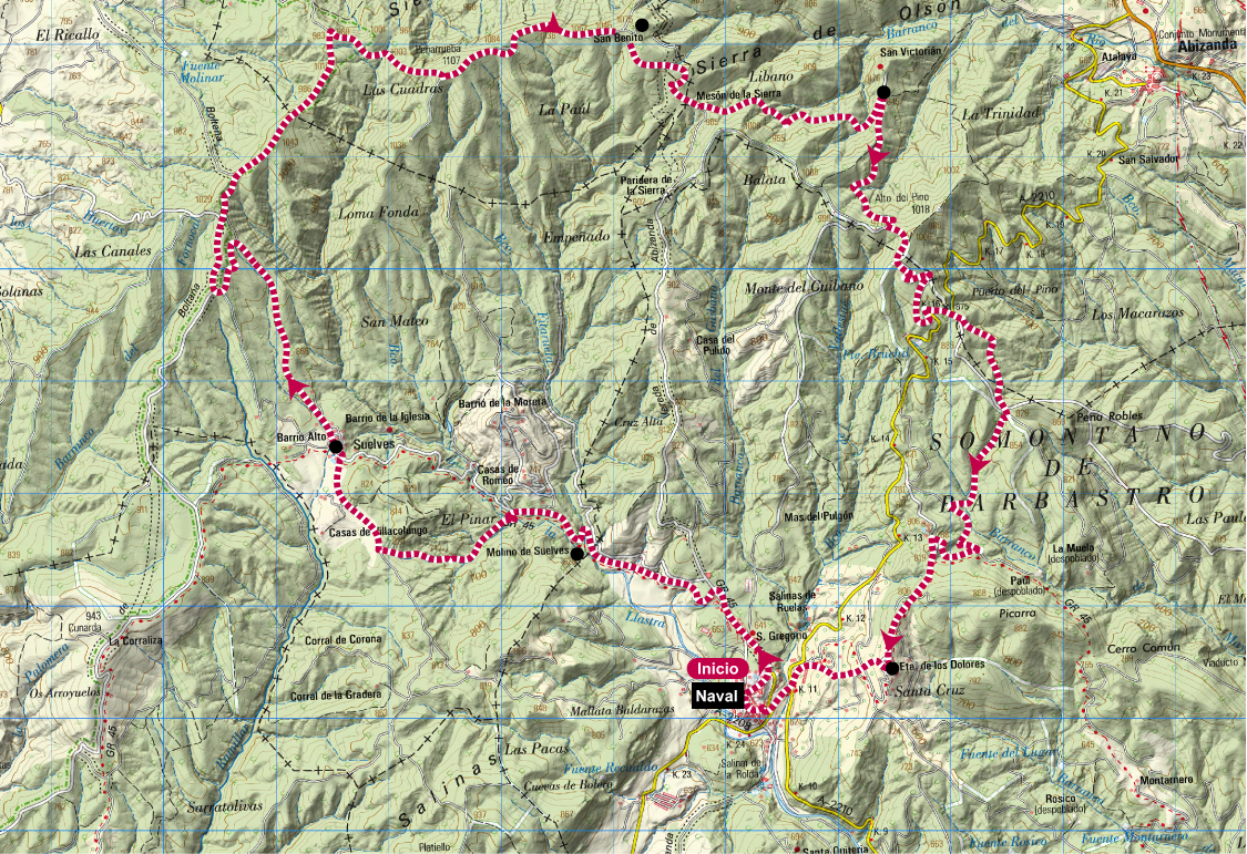
Naval Trail
Technical information
Type of route: circular
Starting point: Naval
KM: 28,9
Duration: 4 - 6 horas
Gradient: 1360 m
Difficulty:
Route description
Naval is located at the foothills of Arbe and Olsón mountain ranges that constitute the natural border between Somontano de Barbastro and Sobrarbe regions. This route will let you discover both of them at the time you head towards Suelves through a combination of unpaved roads and beautiful singletracks.
From Naval, it goes to Suelves and later climbs to the top of Arbe mountain range. The descend towards Naval starts at San Benito hermitage and includes a series of ascends and descends featuring some steep sections. The route ends in Naval after crossing Abizanda road in the surroundings of «del Pino» pass and «de los Dolores» hermitage.
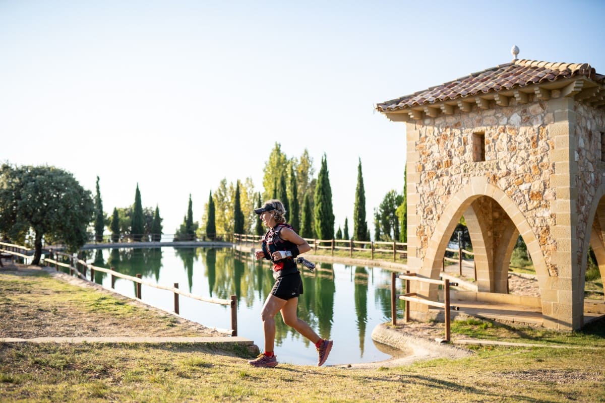
Photo gallery
Map
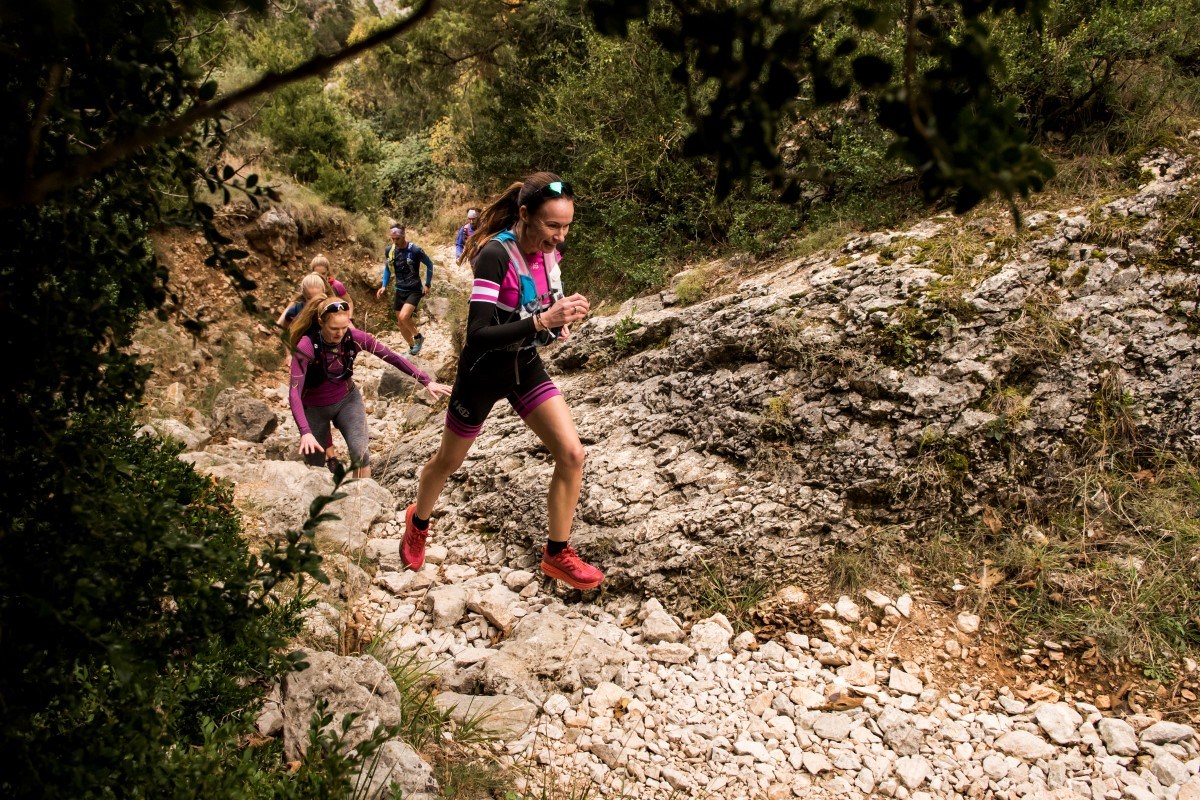
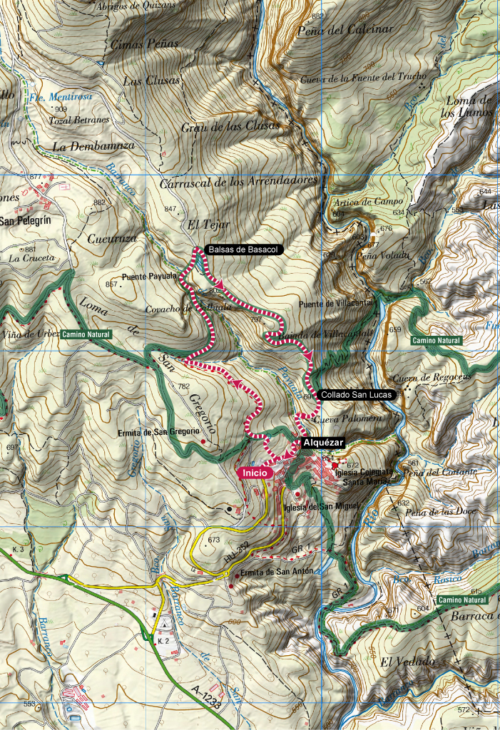
Family Trail. Alquézar
Technical information
Type of route: circular
Starting Point: Alquézar
KM: 4,2
Duration: 1 hora
Gradient: 190 m
Difficulty:
Downloads
Route description
This short but intense route will allow the younger ones to introduce themselves in the exciting world of trail running while visiting some of the most picturesque spots around Alquézar.
The track begins climbing up, fi rst to the Baseta and then to Basacol and Chimiachas. The fi rst section of the climb is easier and follows a nice paved street. The second part is more rocky and it’s shared with a small water pipe that we must sidestep to protect our ankles. Once at the Payuala bridge, the trail continues climbing some steps until Basacol pools, higher point of the route. After passing by the pools, the trail descends by a rocky pedrestian path until San Lucas col. From there, another rocky but short trail leads to Alquézar village, where we will stroll a bit along the streets before reaching the starting point.
Photo gallery


Map
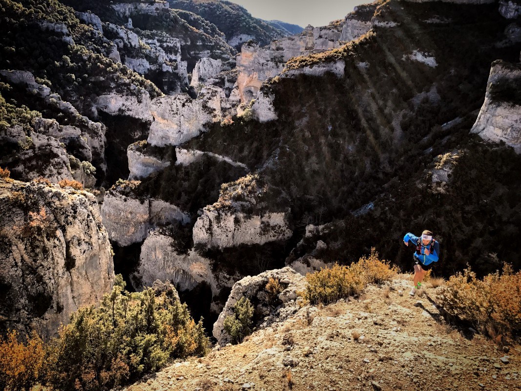
Alcanadre Trail. Bierge
Technical information
Type of route: circular
Starting point: Bierge
KM: 20,6
Duration: 2 - 3 horas
Gradient: 595 m
Difficulty:
Route description
This circular route with amazing panoramic views visits some interesting natural spots like Fuente de La Tamara (water spring) and the impressive Peña Falconera, better known as Huevo de Morrano. But be careful: near La Tamara the trail crosses the river by some stepping stones and it’s mandatory to wet your feet. You must also pay special attention to the water level before crossing. For this reason it’s recommended to follow the route in anti-clockwise direction.
The fi rst half of the trail follows the Camino Natural del Somontano in north direction, in parallel to Alcanadre river. After passing under Huevo de Morrano, the route diverts from the Camino Natural and heads to Morrano and San Román by forest and dirt roads. Near San Román there’s another path that quickly descends to Salto de Bierge, from where the route fi nally returns to Bierge by the Camino Natural.
Photo gallery
Map