Bici de carretera
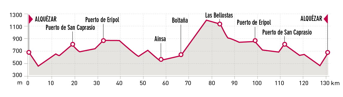
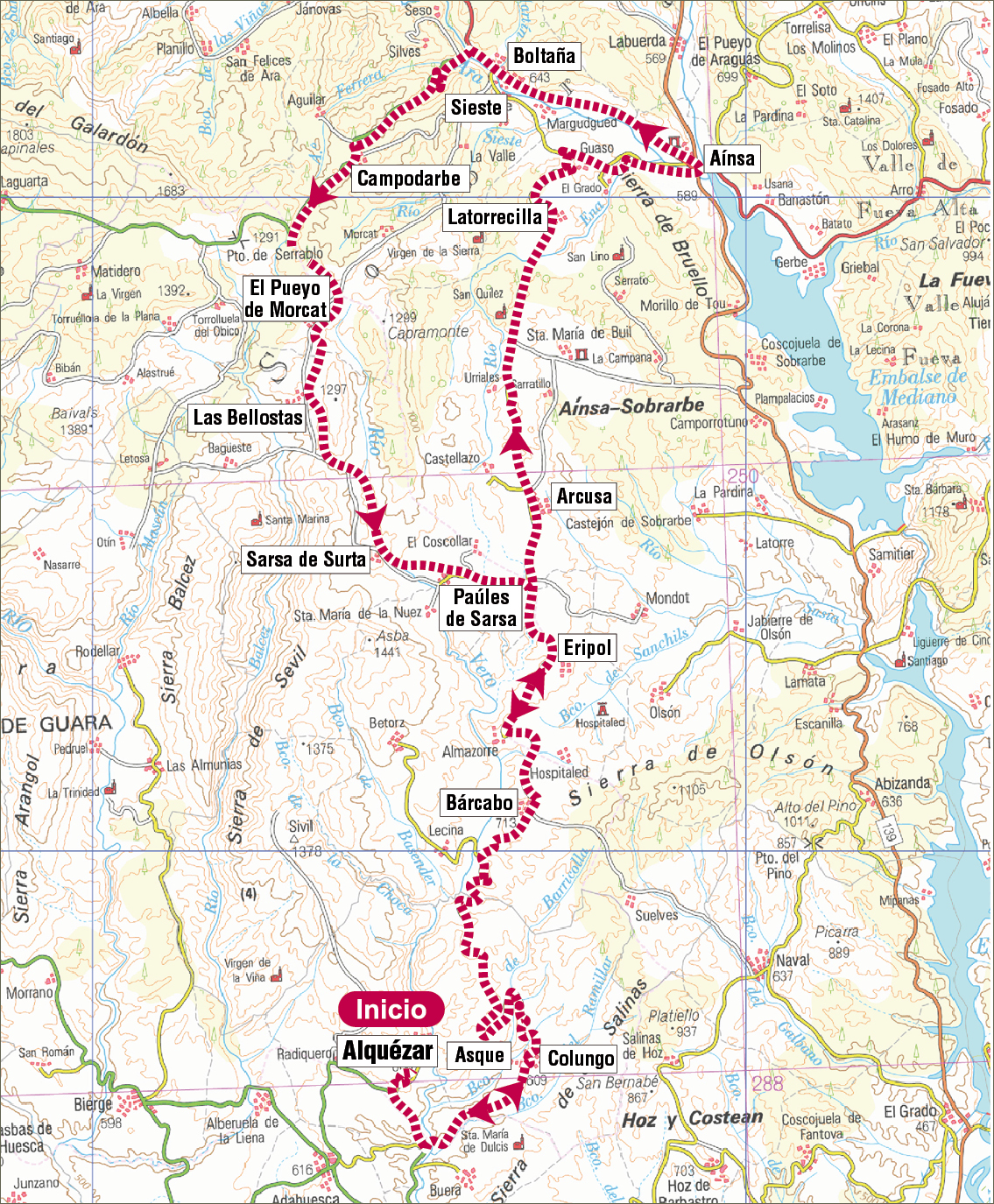
Route 05: Alquézar-Aínsa-Boltaña-Las Bellostas-Bárcabo-Alquézar

Technical information
Type of route: circular
Departure point: Alquézar
KM: 130
Duration: 5 h
Gradient: 1.500 m
Dififculty: +
Itinerary
Alquézar - Aínsa - Boltaña - Las Bellostas - Bárcabo - Alquézar
Route description
Starting off from the medieval village of Alquézar and taking a trip back to prehistoric times, with the surrounding UNESCO world heritage listed cave art, the path winds through the wide-open spaces of the Biello Sobrarbe whose paths enter the Sierra de Guara Natural Park. Along the path, cyclists will come across small pretty villages, where it seems time has literally stopped.
It is worthwhile stopping along the way to discover the medieval villages of Boltaña and Aínsa whose historic centres at the foot of the imposing Pyrenees Mountains will surprise the visitor.
It really is a demanding route that passes through incredible countryside, medieval villages and abandoned villages, always with views onto Peña Montañesa, Monte Perdido and the Pyrenees.
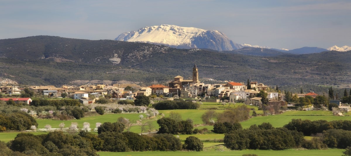
Photo gallery
Map
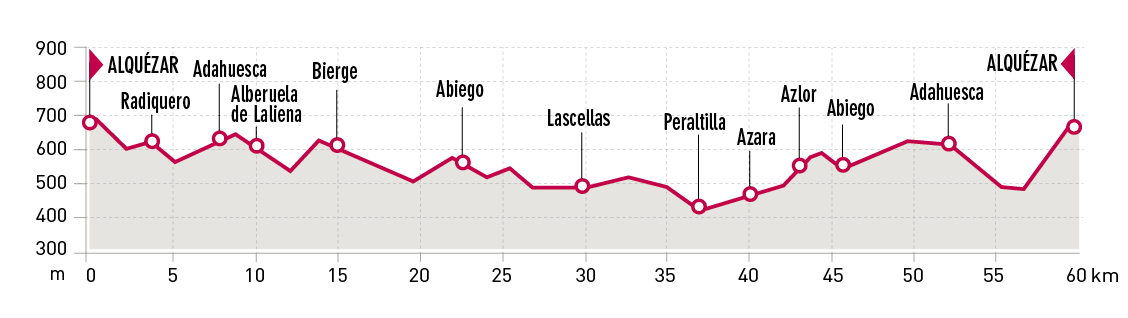
Route 06: Alquézar-Adahuesca-Bierge-Lascellas-Peraltilla-Abiego-Alquézar
Technical information
Type of route: circular
Departure point: Alquézar
KM: 59,1
Duration: 3 h
Gradient: 900 m
Difficulty:
Itinerary
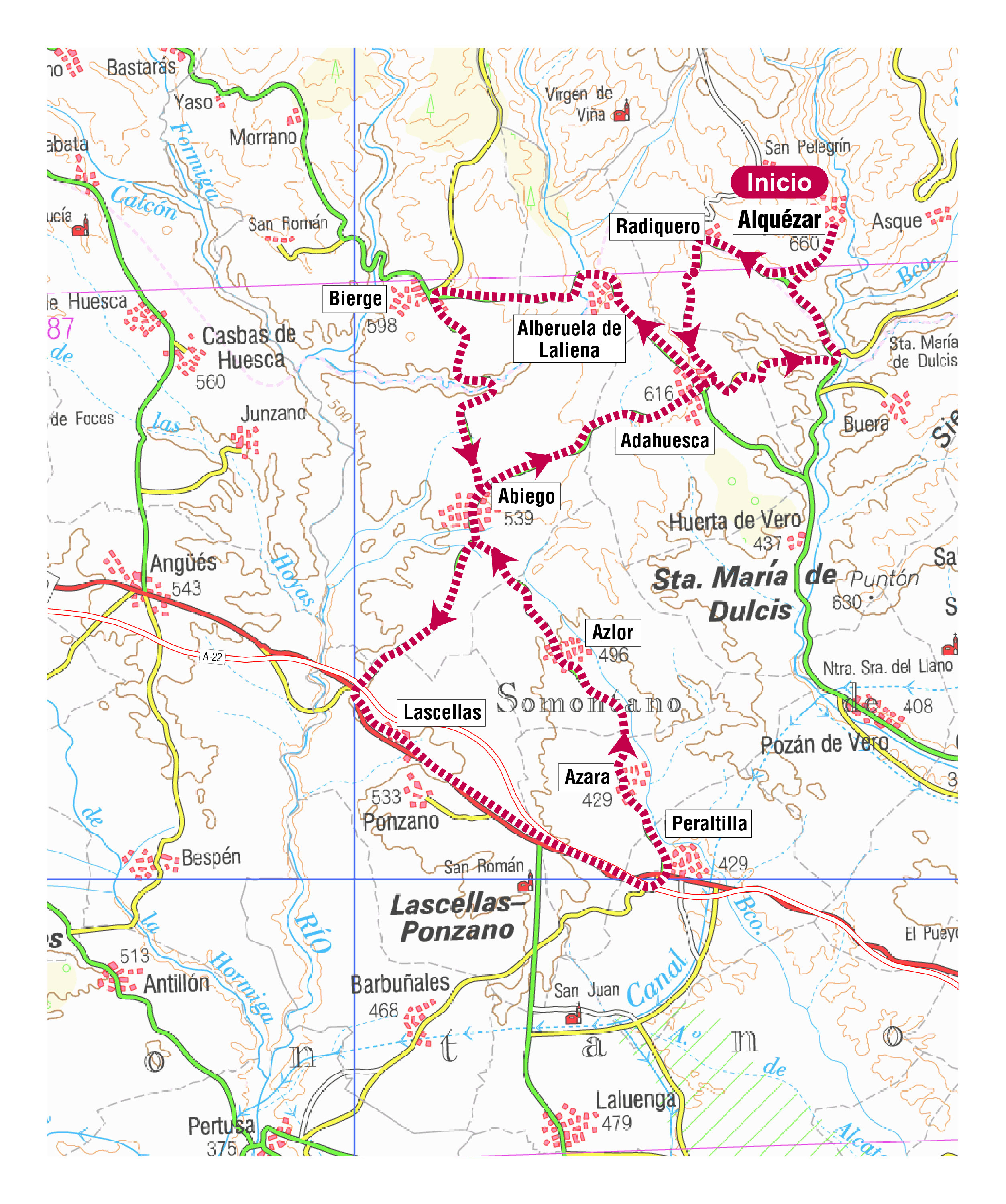
Alquézar - Adahuesca - Bierge - Lascellas - Peraltilla - Abiego - Alquézar
Route description
This path starts and ends in one of the Most Beautiful Villages of Spain, Alquézar, an old medieval village and paradise for lovers of world heritage, nature and adventure. From here and crossing olive and almond fi elds, and vineyards, the itinerary runs through part of Somontano de Barbastro: Radiquero, Adahuesca, Alberuela de Laliena, Bierge, Abiego, Lascellas, Peraltilla, Azara, Azlor, Abiego again and fi nally Adahuesca, before returning to Alquézar.
All the villages have a rich historical and artistic past and some make up part of the River Vero Cultural Park and/or the spectacular Sierra de Guara Natural Park. The Sierra de Guara and the Pyrenees will be faithful companions along the way.
Photo gallery
Map
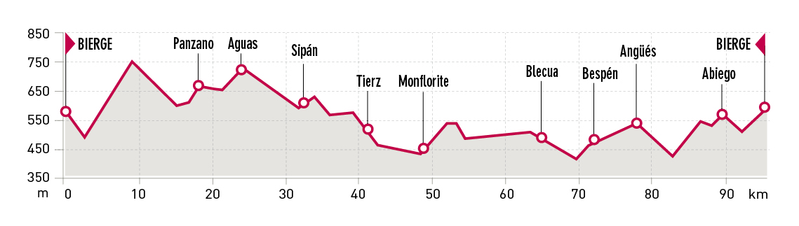
Route 07: Bierge-Aguas-Huesca-Blecua-Angüés-Bierge
Technical information
Type of route: circular
Departure point: Bierge
KM: 95,6
Duration: 4,5 h
Gradient: 1.350 m
Itinerary
Bierge - Aguas - Huesca - Blecua - Angüés - Bierge
Route description
This route runs through the villages in the southern area of the Sierra de Guara Natural Park and part of Somontano and La Hoya de Huesca.
Departing from Bierge, the path climbs, descends and winds, making for an enjoyable road that links several villages in the south of the Sierra de Guara such as Morrano, Yaso, Bastarás, Panzano, Aguas, Sipán and Bandaliés until arriving in the vicinity of Huesca, the capital of the province. From Tierz, the path sets out on its return between cultivated fi elds through various villages of the Hoya de Huesca such as Monfl orite, Alcalá del Obispo, Pueyo de Fañanás, Blecua, Bespén and Angüés. The path then makes its way towards Abiego before ending in Bierge. El Tozal and El Cabezo mountains will be constant reference points throughout the trip.
Photo gallery
Map
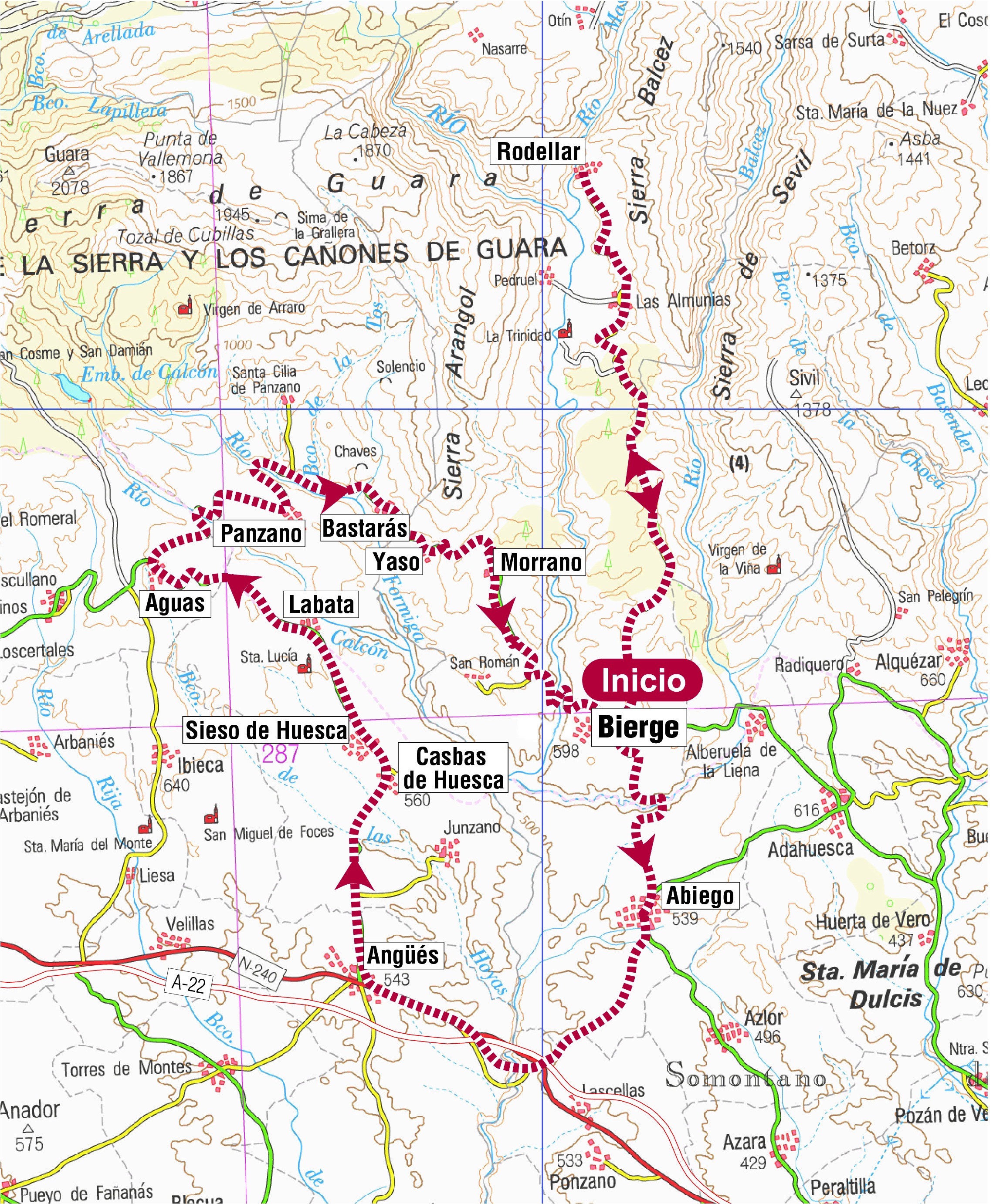
Route 08: Bierge-Abiego-Angüés-Panzano-Morrano-Rodellar-Bierge
Technical information
Type of route:: circular
Departure point: Bierge
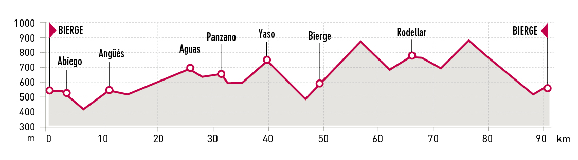
KM: 91,5
Duration: 4 h
Gradient: 1.300 m
Difficulty:
Itinerary
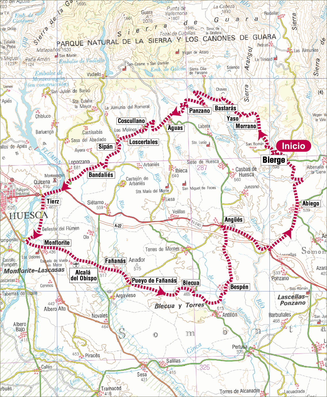
Bierge - Abiego - Angüés - Panzano - Morrano - Rodellar - Bierge
Route description
Departing from the village of Bierge, this path runs through the southern part of the Sierra de Guara Natural Park. From there, the track makes its way toward Abiego, which has a collection of fossils and “el Monumento al Siglo XX” (20th Century Monument), an interesting piece of land art. It then moves on to Angüés, Casbas de Huesca, Sieso de Huesca, which is known for its cheeses, Labata and Panzano, where on can´t miss the opportunity to visit the Vultures House (Casa de los Buitres) to learn more about these birds.
Returning to Somontano, the track passes Bastarás, Yaso and Morrano, the last village is well known because of an interesting geological formation called “El Huevo” (The Egg).
Once in Bierge, the track enters the heart of Guara, climbing up along a winding road until Rodellar, a world famous village renowned for canyoning, hiking and one of the best places for rock climbing in the world.
Photo gallery
Map