Rutas en la Sierra de Guara
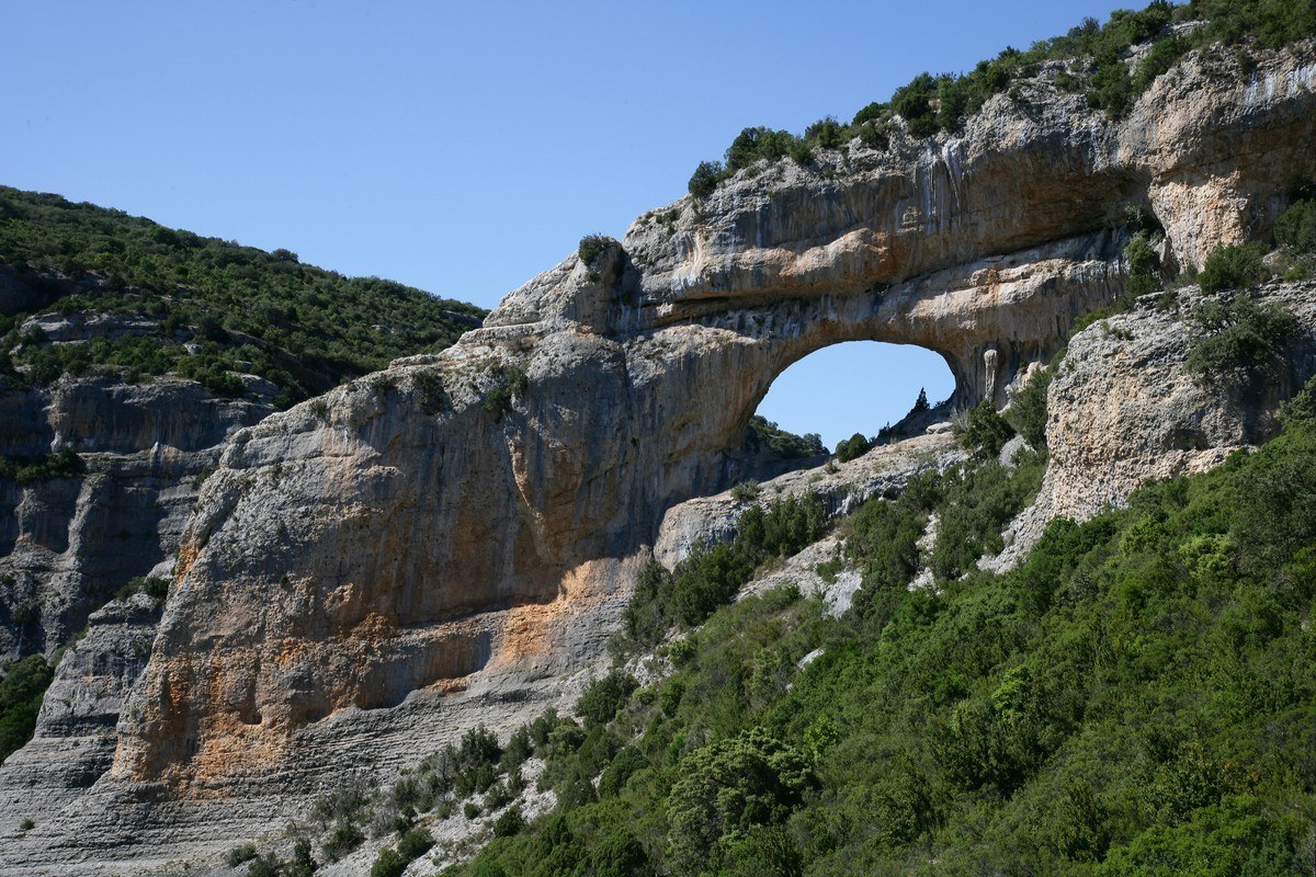
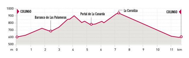
Portal de la Cunarda Route. Colungo
Technical information
Type of route: circular hiking route
Departure point: A-2205. Colungo
KM: 11,7
Duration: 4 h
Gradient: 540 m
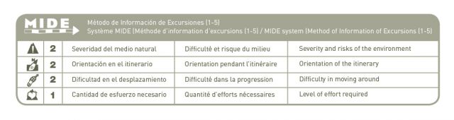
MIDE: 2-2-2-3
Difficulty:
Points of interest
Limestone formations, landscapes, characteristic of the Sierra de Guara and areas of mycological interest and Portal de la Cunarda
Route description
This is an easy, circular route of approximately 3 hours in duration, which starts and finishes in the village of Colungo. After passing by the water fountain and the old washing area the route crosses the road and follows the ancient “Os Carros” footpath (also known as the Suelves track.) Opposite a small, old stone shelter the path descends into the Arruellos canyon. Further on it enters the Cunarda pine forest, which is a great spot for lovers of wild mushrooms, and drops down into the Tacho canyon. From the point where the Tacho and Portal canyons merge it is possible to see the distinctive and impressive arch formed by erosion of the limestone.
Photo gallery


Map

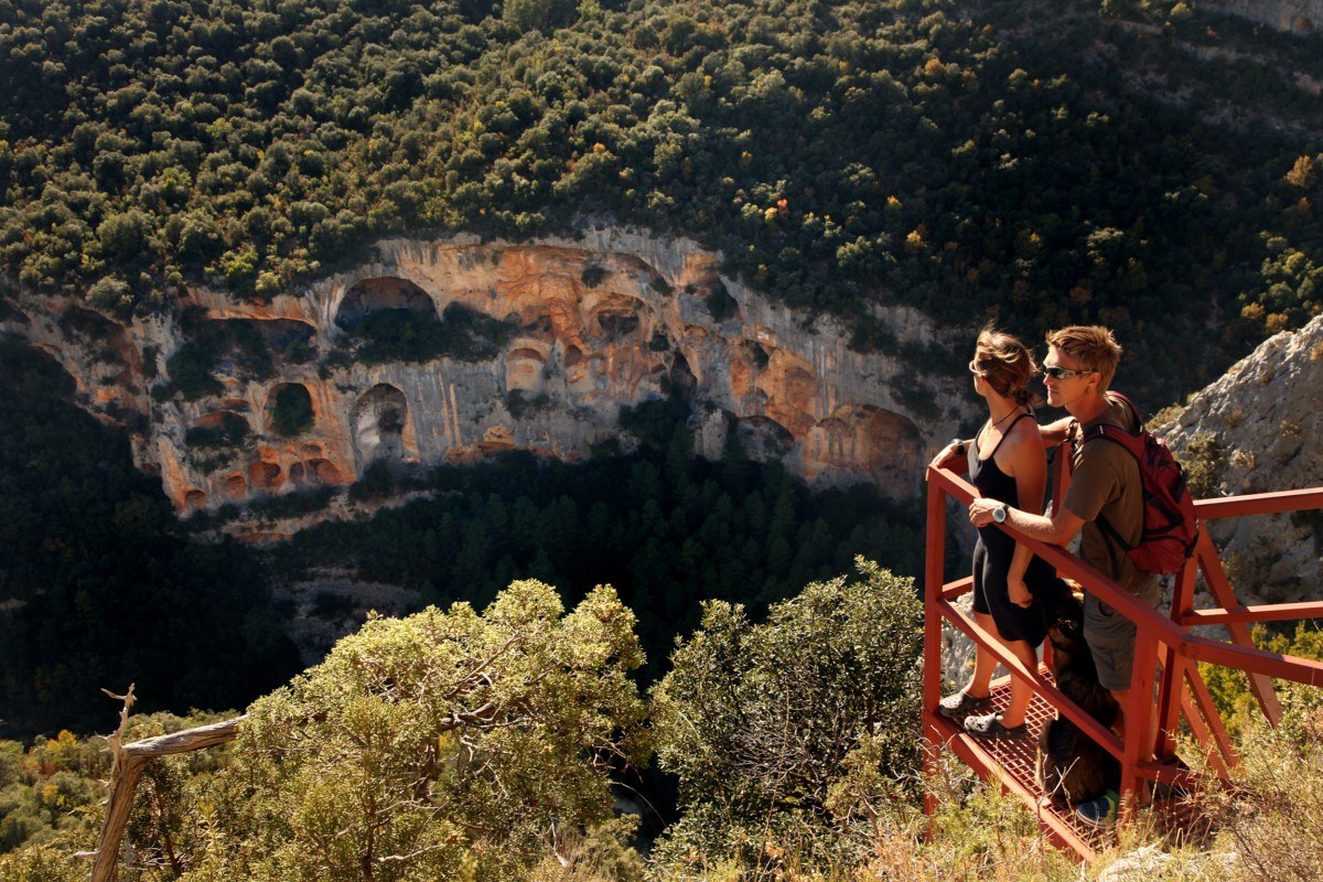
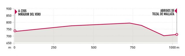
Route to the Tozal de Mallata. Colungo
Technical information
Type of route: return hiking route
Departure point: A-2205. Mirador del Vero
KM: 2.2
Duration: 50 min
Gradient: 140 m
MIDE: 2-1-2-1
Difficulty:

Points of interest
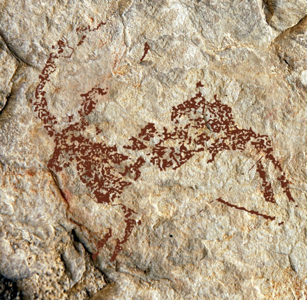
- Limestone formations, magnificent views of the Pyrenees and, above all, the Vero canyon, cave paintings
Route description
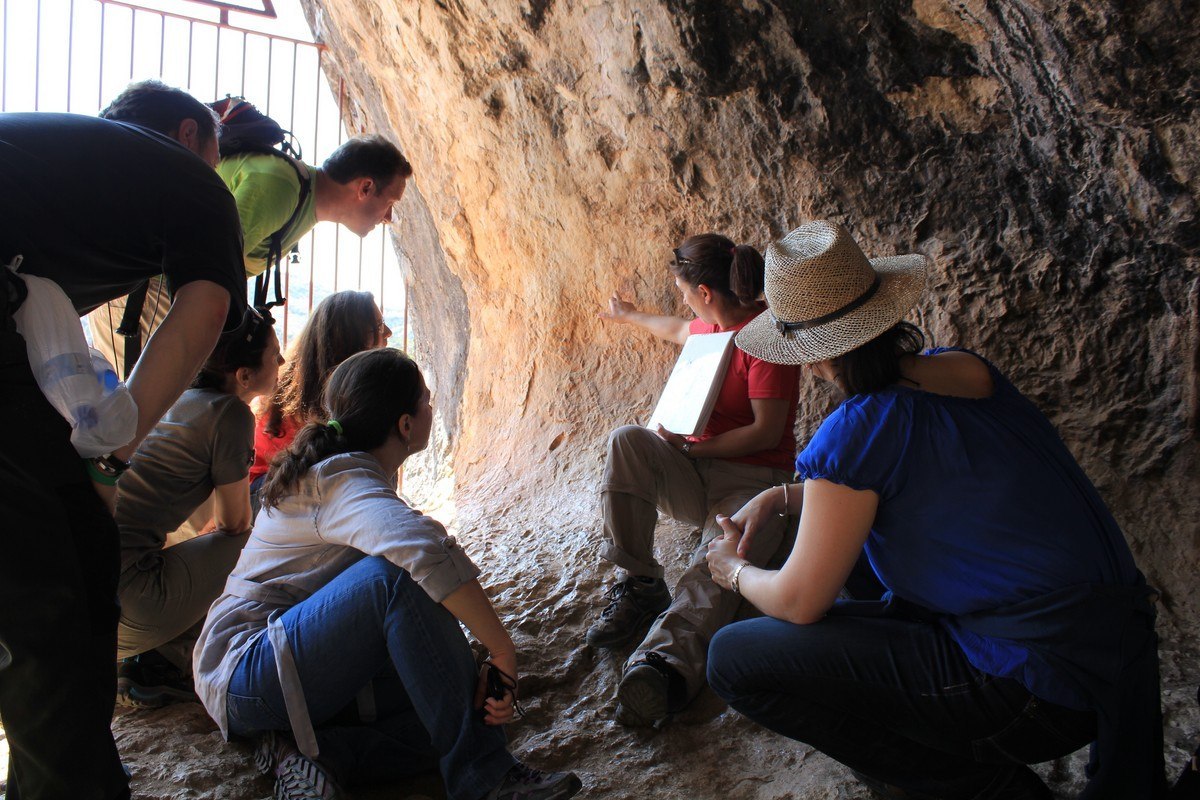
The Tozal de Mallata can be reached from the viewpoint over the River Vero by taking the sign-posted route that crosses the Portiacha ravine. It takes approximately 20 minutes to get there, and a further hour and a half is needed to visit the cave with the help of a specialist guide. The paintings in these caves (part of a World Heritage Site) are the work of arable and livestock farmers in the Neolithic period and the Bronze Age.
The higher caves that are more difficult to reach reveal human and animal figures, symbols and enigmatic geometrical shapes. Along the route, there are magnificent views over the Pyrenees and into the depths of the Vero Canyon.
Photo gallery


Map

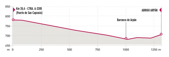
Route to the Arpán Shelter. Colungo
Technical information
Type of route: return hiking route
Departure point: A-2205. Aparcamiento Arpán
KM: 2.6
Duration: 1 h
Gradient: 120 m
MIDE: 2-2-2-1
Difficulty:
Points of interest
Route description
On the A-2205 road, in the direction of Arcusa and past the turnoff to Asque, there is a car park from which this well-marked path departs. This small cave of Arpán shows paintings of archers, deer and four-legged animals in the Levantine and Schematic styles.
The area around the cave reveals a landscape similar to that contemplated by the pre-historic painters.
Photo gallery


Map

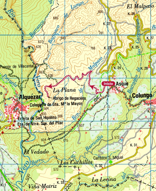
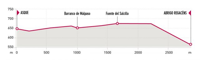
Route Asque- Regacéns Shelter. Asque
Technical information
Type of route: return hiking route
Departure point: Asque
KM: 5,8
Duration: 2 h
Gradient: 180 m
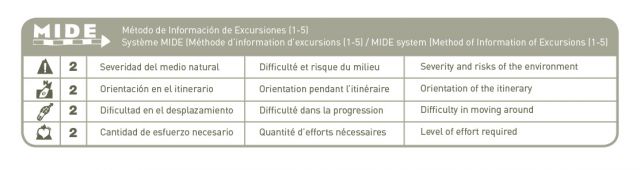
MIDE: 2-2-2-2
Difficulty:
Points of interest
Route description
After leaving Asque, the path zigzags through olive groves and almond tree orchards before arriving at a valley that marks the entrance to the protected area of the Sierra and Canyons of Guara Natural Park.
From here the path continues through the countryside, passing thickets of holm-oak, low brush and scrub typical of the area. Watch out for the place where the path branches off to descend steeply into the canyon to reach the Regacens shelter. The opening to the shelter faces the Fuente canyon.
This enormous fissure in the rock appears to have fractured the mountain range into two halves, and allows a secretive glimpse of the village of Alquézar.Here, it is often possible to see falcons and the occasional golden eagle flying over the limestone cliffs; however, the lammergeyer is considered to be the true king of the skies above Guara.
Photo gallery


Map