Descenso de barrancos
Peonera
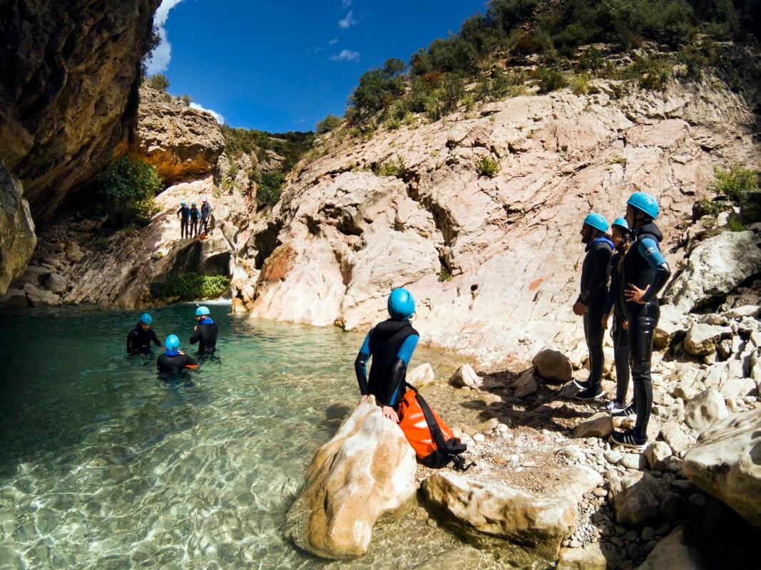
This is one of the best aquatic descents of the Sierra de Guara and certainly one of the most entertaining thanks to the high number of jumps and thrilling drops. Experience wild nature to the full in La Peonera Inferior; a canyon with one of the highest volumes of water in the park. Its crystal clear waters run along a riverbed that has been patiently excavated from the rock before flowing into wide, welcoming pools of intense turquoise that are bathed in sunlight.
This descent reveals glimpses into days gone by, when hunters and fishermen moved in the depths of the canyon looking for pigeons, trout and honey.
There are a number of tricky areas known as “caos,” where the water tunnels under a maze of boulders, and difficult passes to negotiate (some, such as the Anais pass, have been fatal) so a good working knowledge of the environment is essential. It is also crucial to take along all the necessary equipment in order to be able to overcome possible difficulties.
Along this particular route there are a number of natural springs such as Tamara and El Puntillo. The area around El Puntillo is an area of transition between conglomerate rock and calcareous substrate; here it is easy to spot majestic birds of prey flying over the canyon and fat trout swimming in the water, especially in the area known as the Estrechos de Tamara.
Downloads
Technical information
Access: there are three possible ways to enter La Peonera Inferior:
- Descend the previous canyon, known as La Peonera Superior, which can be reached from near the village of San Saturnino.
- Access it from Morrano.
- Depart from the car park between Bierge and Las Almunias de Rodellar (between the 5 and 6km mark on the HU-341 road)
Approach: If choosing option 3 there is a walk of around 45 minutes from the car park to the start. Take the well marked forest path and upon reaching a “Y” shaped junction, follow the track to the right, which descends sharply down to the river bed.
Nearest village: Morrano
Descent:
- If the full section is completed it takes around 4 hours to reach the Bierge dam (3km)
- 2 hours if the descent stops at the Tamara spring.
- 1 hour if started from the TamaraSpring and the descent of the canyon is started from La Puntillo spring; suitable for families with children.
Return: Immediate if a second car has been left at the Bierge dam. From the Tamara spring there is a path that leads to Morrano (45 minutes walk) if a car is not available in the car park near the Bierge dam.
Escape routes: Various along the route:
- There is a way out at the top of “Loma Güega” although it is poorly signposted.
- At the spot known as “Faja e los Caracoles” just before entering the Tamara narrows.
- Various ways out along the Tamara narrows.
- From the Tamara spring there is a forest track that leads all the way back to the car park (option 3.)
Car combination: It is advisable to leave one car parked in the car park near the Bierge dam (Salto de Bierge.)
Difficulty level:
- Medium in summer
- Professional level when the river water level rises. Due to the large number of accidents that occur each year in La Peonera, the use of a professional guide is highly recommended.
Minimum equipment requirements:
- Full wetsuit and neoprene socks or canyoning shoes.
- Helmet
- 15m rescue rope
- Waterproof canyoning backpack
- Watertight barrel
- Due to the length the route, it is advisable to take along drinking water and a picnic.
Points of interest
- Walking track until the rock formation known as the “Huevo de Morrano,” which is signposted from both Morrano and the Tamara spring.
- A walking path runs parallel to La Peonera canyon on the left bank; it is signposted from the Bierge dam to the Tamara spring.
Photo gallery


Gorgas Negras
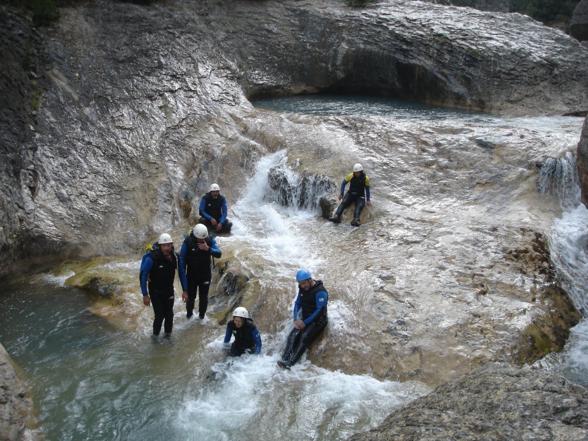
Descending the Gorgas Negras canyon is a true adventure. This is one of the classic routes of canyoning and follows one of the main rivers in the Sierra de Guara; the Alcanadre. It is a demanding route, both in terms of physical endurance and technical requirements, and should only be attempted by experienced canyoners and professionals. It is a long and time-consuming descent, the majority of which requires contact with very cold water.
Adequate equipment and provisions are essential for this infamous descent to avoid the risk of hypothermia. Physical exertion is required for a period of around 12 hours, meaning participants should think hard about their personal capabilities, strength and stamina before attempting this canyon.
The route offers a number of pleasant surprises; the abandoned village of Nasarre with its beautiful Romanesque church and the Losa Mora dolmen are just a couple.
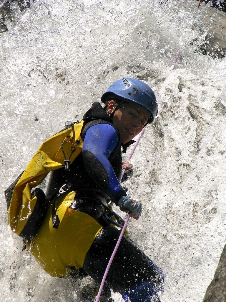
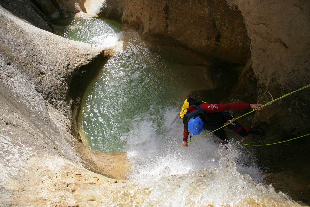
During this fascinating and spectacular descent, it is necessary to carry out various rappels and a number of jumps as well as to overcome potholes, endless pools, numerous rock piles (caos) and narrow passages. In addition, it is essential to take into consideration the constant danger from siphons.
The use of a professional guide is strongly recommended due of the risks associated with this descent. An experienced guide is able to evaluate the water flow and has the benefit of knowing the canyon well with all its difficulties and flaws as well as its escape routes.
Descargas
Technical information
Approach: 3 hours. From Rodellar, descend to the river bed along the well signed path and once there, walk upriver for around 15 minutes to reach the Mascún spring. Cross the river and take the steep path marked to the left, which is signposted as “Barranco de Andrebot (por la cueva) y Dolmen de Losa Mora.” Continue on past the dolmen along the path towards Nasarre. Skirt the village to the left and take the unused path that heads downwards. Before reaching the water, a path leads off to the left, which goes to the canyon entrance. Nearest village: Rodellar
Descent: 5-6 hours KM: 4,8km
Return: 2-3 hours. There are two options:
- Option 1: The most common, which is to descend the Barrasil canyon and use the return path from there to arrive in Rodellar.
- Option 2: Use the path that enters the Barrasil canyon as the exit from Gorgas Negras (see BarrasilCanyon)
Escape routes: Few, difficult and long.
- Bozos de Lañas
- Canal alta
- Canal del Ordio.
Car combination n/a
Difficulty level: very high in any season of the year
Minimum equipment requirements:
- Full wetsuit
- Neoprene socks or canyoning shoes and neoprene gloves
- Helmet
- Harness
- Double anchor lanyard
- Ropes
- Equipment for abseiling (figure-of-eight descender)
- 2 ropes of at least 25m in length.
- Waterproof canyoning backpack
- Watertight barrel
- Essential to take along drinking water despite the springs on route.
- Plenty of high energy snacks and a plentiful picnic given the length of the route.
Points of interest
- Spectacular views (Mascún, Nasarre, Losa Mora etc.)
- Observation of birds of prey
- The full range of karstic phenomena
Photo gallery


Barrasil
This is a simple and pleasurable descent and is ideal for keen walkers who want to learn the techniques of canyoning with supervision. A great calcareous canyon, perfect for lovers of walking and hiking who fancy getting wet and are tackling canyoning for the first time.
The presence of such clear and, at times, fast flowing water affords this route many charms although the difficult approach means that it is seldom visited.
Traditionally, this canyon was used frequently by local people as a place to hunt and to fish.
Technical information
Approach: 1h:30 min. Leave the car in Rodellar and from here it’s a good 2 hour walk to reach the start of the canyon. Go down to the river bed along a well marked path and once there walk upstream for about 15 minutes until reaching the Mascún spring. Cross the river and take the path to the left, signposted towards “Andrebot y Dolmen de la Losa Mora” (although you won’t actually get as far as the dolmen.) Upon arriving in fields (known as “Llanos del Seral”) at the end of the climb, take the path to the left. Nearest village: Rodellar
Descent: 2h - 2h:30min KM: 2.400 m
Return:
Option 1: 30 minutes to the Pedruel bridge
Option 2: go upstream along the Mascún canyon as far as the Coda bridge. This way is much prettier and more satisfying than following a path back to Rodellar
Escape routes: Several on the slope on the left bank of the river.
Fajeta o Sirrio
Camino d’a Caxigareta
Cueva Rubiacha)
Car combination n/a
Difficulty level: low to medium except in periods of fast flowing water.
Minimum equipment requirements:
- Full wetsuit and neoprene socks or canyoning shoes.
- Helmet
- 15m rescue rope
- Waterproof canyoning backpack
- Watertight barrel
- Picnic
Points of interest
- Rodellar
- Puente de Pedruel
- Mascún
Photo Gallery


Mascún
The Mascún canyon is widely considered to be one of the most beautiful in Europe and is emblematic of the Sierra de Guara national park. It is strongly recommended that persons wishing to descend this canyon contract a professional and experienced guide due to the great physical exertion required and danger involved during periods of high water levels. A total of 9 hours are needed, meaning that only those in peak physical condition and with plenty of canyoning experience should attempt it.
Since canyoning became popular in the Guara region, the Mascún canyon has succeeded in stirring up great interest with those who visit. It is, without doubt, one of the most spectacular descents due to its sheer cliffs, which almost touch in places such as “El Puntarrón,” and its astonishing stone architecture. Although the flow of water dries up at certain times of the year to offer a different aspect, the descent with water offers a fantastic spectacle of light and colour. The canyon is also one of the most diverse in terms of its attractions; 9 rappels, numerous jumps, underground stretches etc. As if all this wasn’t enough, the descent boasts one of the most unusual and mythical landscapes of the area with famous landmarks such as la Ciudadela, the oak groves and uninhabited village of Otín and the Saltador de las Lañas.
Mascún offers a magnificent descent along a river bed chiselled from rock with deep pools of turquoise water, exciting rappels and technical jumps, all of which add up to an unforgettable experience.
Downloads
Technical information
Aproximación: 2h:45 min. Leave the car in Rodellar; from here it is a 3 hour walk to the start of the canyon. From Rodellar go down to the river bed along the well marked path, and once there, follow the river upstream for around 45 minutes. Here, a fork in the path branches off to the left and is signposted as Otín and Mascún. Then follows an arduous climb to reach the abandoned village of Otín; follow the path as it skirts the village and take the path towards the north. Arriving at a poplar grove indicates the entrance to the Raisen canyon; continue on until you reach a fork to the right (not very well signed) that goes to the entrance to the Mascún canyon. Nearest village: Rodellar
Descent: 3 - 4 hours KM: 8,3km
Retour: 2 - 3 horas
Escape routes:
- Saltadero as Lañas waterfall in the direction of Raisen
- Waterfalls of Peña Guara
- 100m before the “Oscuros” it is possible to cross a stony pit to leave the canyon; once in the Oscuros there are no escape routes.
- El Sendero d’o Turno is the best route out of the canyon
Car combination n/a
Difficulty level: very high in any season of the year
Minimum equipment requirements:
- Full wetsuit and neoprene socks or canyoning shoes.
- Neoprene gloves
- Helmet
- Harness
- Double anchor lanyard
- Ropes
- Equipment for abseiling (figure-of-eight descender)
- 2 ropes of at least 35m in length.
- Waterproof canyoning backpack
- Watertight barrel
- Picnic
Points of interest
- Oak Groves of Otín, with magnificent specimens
- The uninhabited village of Otín
- Cuca Bellostas. A towering rock spire, which is one of the most recognised landmarks in the area. Its name is phallic in origin and makes reference to a big headed villager from Otín of old.
- La Ciudadela and the natural rock architecture of the canyon. The extreme shapes and forms, such as obelisks, spires, gigantic monoliths, natural bridges, hollows and ledges, give the valley an aspect of an enchanted city in ruins. This landscape once intimidated walkers and villagers and was said to produce overpowering sensations in the depths of the gorge due to its marked silence and solitude. The name Mascún derives from a Moorish name meaning “a place inhabited by spirits.”
- Surgencia de Mascún. A famous and quite spectacular spring, which provides the gorge with a permanent supply of water.
- Saltadero' as Lañas. A temporary waterfall in the rocky hollow at the entrance to the canyon; it falls 30m over smooth, terraced rocks.
- Birdwatching. See vultures around La Ciudadela and Egyptian Vultures from the start of the canyon to the “caos.”
Photo gallery


