


RUTAS EN COCHE
The Pre-Pyrenees charms everyone who visits it and on this route we will discover some of the secrets of the Aragonese Pre-Pyrenees. This mountainous strip is not only the prelude to the emblematic peaks of the Pyrenees, but an area of great scenic and cultural value in itself that should not have any envy of the Pyrenees, because the beauty of its landscapes combines a great historical, cultural and artistic heritage.
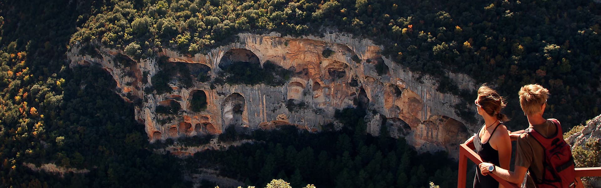
Here, history has left its mark on medieval towns, Romanesque churches, walls, towers… and nature has done the rest by leaving behind canyons, gorges, rivers, creating varied landscapes for those who seek something different. In its expanse, natural areas stand out, such as the River Vero Cultural Park or the Natural Park of the Mountains and Canyons of Guara, and a small inclusion in the UNESCO World Geopark of Sobrarbe-Pirineos, which consists of natural surroundings of great beauty and variety harbouring history and art in equal measure with examples such as the rock art of the River Vero, declared a World Heritage Site by UNESCO.
Distance: 242 km
Estimated time without stops: 5 h 46 min
Recommended stages:
- Rasal – Ligüerre de Cinca – Abizanda
- Abizanda – Alquezar
- Alquezar – Huesca
Itinerary:
- I will start in Rasal: Rasal - Bentué de Rasal - Arguís y Túnel de Manzanera - Belsué - Embalse de Santa María de Belsué - Lúsera - Nocito - Lasaosa - Laguarta - Las Bellostas - Sarsa de Surta - Paules de Sarsa - Olsón - Ligüerre de Cinca - Abizanda - Naval - Salas Altas y Salas Bajas - Pozán de Vero - Alquézar - Radiquero - Adahuesca - Bierge - Panzano - Ibieca - Huesca.
- I will start in Huesca: Huesca - Ibieca - Panzano - Bierge - Adahuesca - Radiquero - Alquézar - Pozán de Vero - Salas Altas y Salas Bajas - Naval - Abizanda - Ligüerre de Cinca - Olsón - Paules de Sarsa - Sarsa de Surta - Las Bellostas - Laguarta - Lasaosa - Nocito - Lúsera - Embalse de Santa María de Belsué - Belsué - Arguís y Túnel de Manzanera - Bentué de Rasal - Rasal.
More information at www.slowdrivingaragon.com/ruta/secretos-prepirineo/


Map:

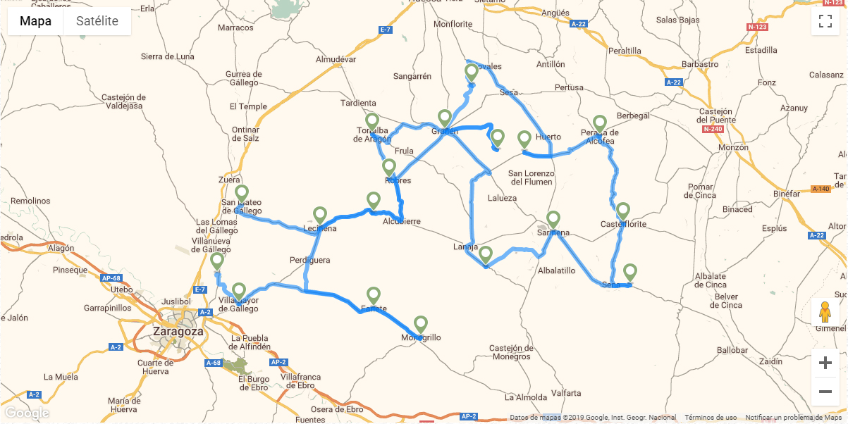
A pesar de que esta ruta discurre, en su mayor parte, por el corazón de la comarca de Monegros, tiene parada en la localidad de Peralta de Alcofea, situada en el límite sur de la comarca de Somontano de Barbastro, en un terreno suavemente ondulado sobre el río Alcanadre.
Un paisaje espectacular que se transforma ante nuestros ojos en una fantasía de formas y colores. La estepa monegrina tiene uno de sus principales símbolos en los “torrollones“, fantasías geológicas creadas por la erosión de los siglos, en unos sedimentos que hace millones de años fueron el lecho del mar. Un destino ideal para observar la fauna y la flora esteparia, pero también para los amantes de la historia, las tradiciones, la gastronomía, la tranquilidad y la aventura.
Distancia: 324 km
Tiempo estimado sin paradas: 5 h 45 min
Etapas recomendadas:
- San Mateo de Gállego-Ruta Orwell-Grañén
- Grañén-Villanueva de Sijena-Sariñena
- Sariñena-Cartuja Aula Dei
Más información en www.slowdrivingaragon.com/ruta/desierto-las-cartujas


Mapa:
The course of the river, the course of history. To follow the course of the River Vero upstream is to take a journey through history and time.
The route gradually climbs alongside the stretch of the River Vero that courses between the towns of Castillazuelo and Buera. Stops can be made at a number of interesting villages and a beautiful bridge, and the changing landscapes will encompass fields of crops, riverside groves and forests of majestic oak.
From Barbastro take the A-1232 road towards Alquézar. Approximately 5km from the city, you will come across Castillazuelo, which is the first place of interest of the excursion. Park the car at the entrance to the village, and take a gentle stroll around the quiet streets. This is an ideal way to start a journey that follows the course of the River Vero.
After wandering along the friendly main street and crossing the church square, you will arrive at a narrow stone bridge dating back to the 16th century. This bridge takes you to the River Vero Visitor Centre. A visit here is essential to understand how the characteristics of nature and of man have developed in harmony with the river during the centuries. Visitors of all ages will enjoy the centre, due to the careful attention to detail and attractiveness of the displays.
There is a pleasant walk that leaves from just outside the visitor centre and follows both sides of the river, which is highly recommended. The circular route is simple and self-explanatory and is known as the Camino ras Vals or Ras Vals Way.
After this chance to stretch your legs, the route continues by car along the A-1232. The next riverside village is called Pozán de Vero and is famous for three distinct reasons. Firstly, for its candied almonds; secondly, because of a famous witch known as Dominix the Cripple who once lived there; and finally, for being the birthplace of Joaquín Campodarbe, one of the biggest ‘Casanovas’ to have ever lived in the area!
Climbing steadily up the wide valley of the River Vero, it is possible to make out the riverside thickets that mark the course of the river, and which are home to many different species of fauna.
Soon you will come across Huerta de Vero on the right-hand bank of the river. This pleasant village has an interesting centre with some fine examples of popular architecture, such as the attractive parish church.
Following the route to the north, it is possible to take a small detour in the direction of the village of Buera. The village centre is made up of a number of traditional buildings adorned with coats of arms, arched doorways and beautiful paved patios. From here you can enjoy another simple walk by following what is known as the Route of Santa Maria of Dulcis. The new Olive Oil Visitor Centre – or El Torno de Buera as it is also called - is also well worth a visit, as it reveals the secrets of a natural product that is essential to the people of Somontano. An addition for the future will be the Camino del Agua, or the Water Trail, which will offer visitors many new and unknown places to visit with a variety of water-related themes such as wells, springs and traditional outdoor wash houses.
Bidding farewell to Buera, rejoin the main road A-1232 and continue alongside the River Vero. Just a kilometre after rejoining the main road you will come across the magnificent Bridge of La Albarda, which is considered to be one of the most beautiful and best-preserved bridges in the whole of the Huesca province.
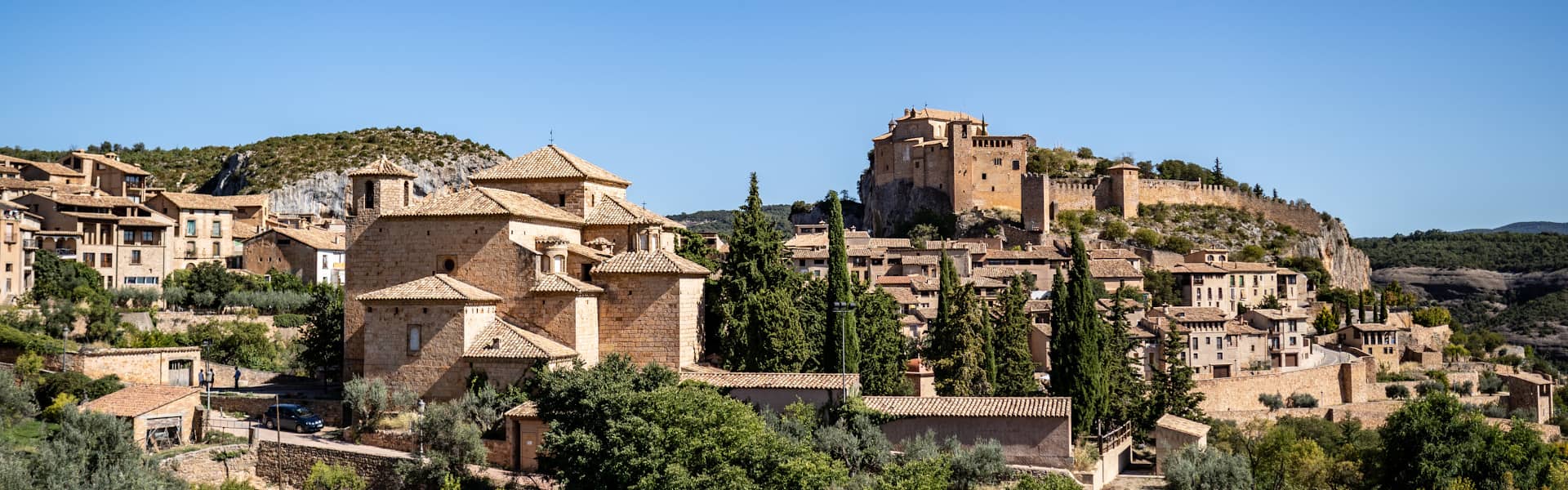
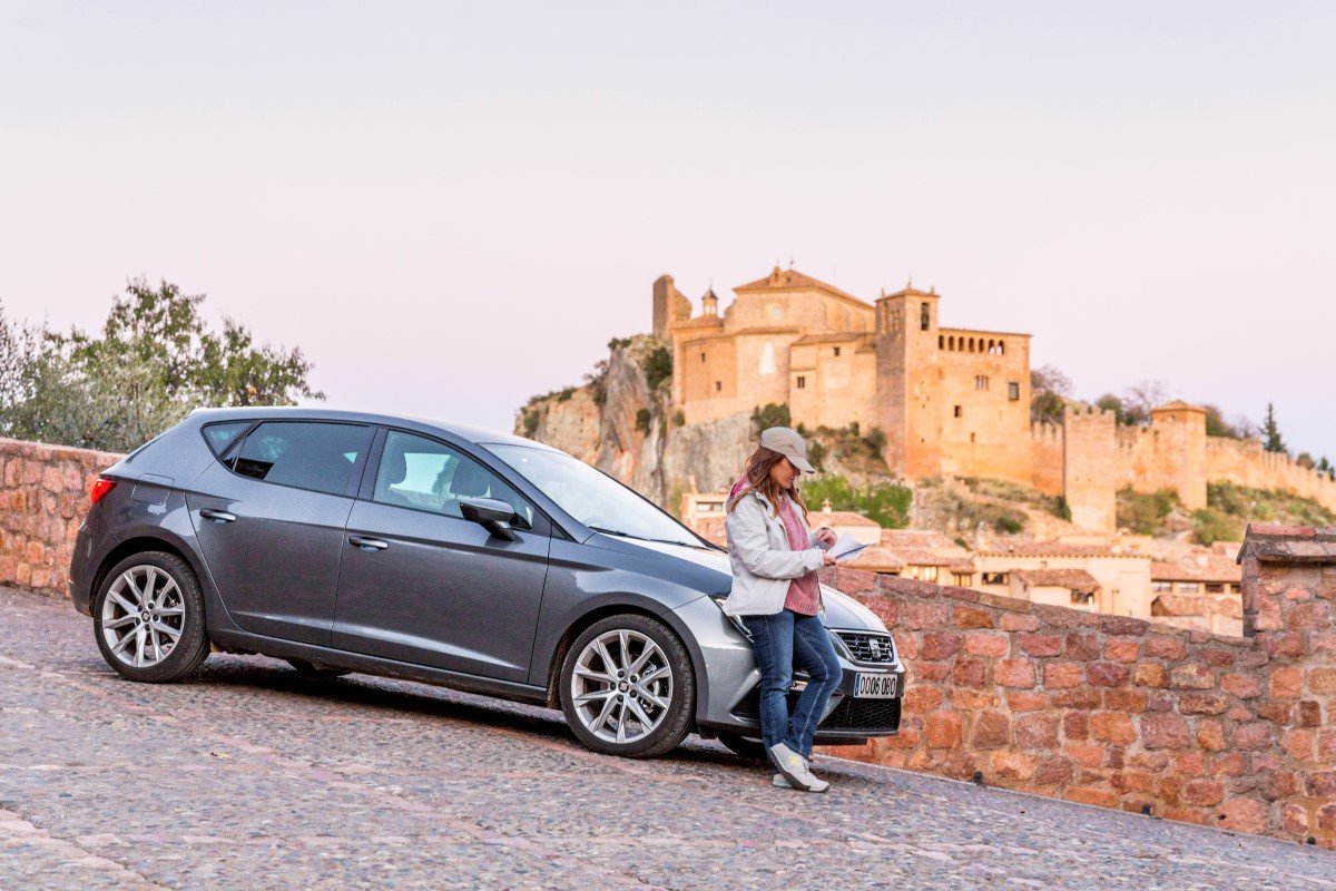
From the beauty of this old bridge, the route continues to the splendour of the medieval village of Alquézar. This is a place that must be visited at leisure in order to be able to soak up the medieval atmosphere, and to allow time to visit the numerous attractions of historic importance. Due to the detail involved, Route 7 is dedicated solely to the attractions of Alquézar.
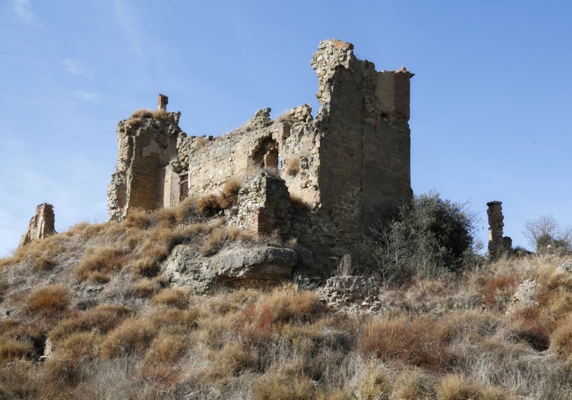
The small town of Peraltilla lies alongside the N-240 road that unites Barbastro with Huesca. This is the starting point of a unique and surprising route, which takes in the ravine of La Clamor. Around Peraltilla you will first notice the huge blocks of gritty sandstone, surrounded by oak trees and cultivated fields. The remains of a 12th century medieval castle lay dormant on the top of the large rock, which gave name to the town (“petra alta” meaning “high stone.”) During the 9th century the castle was occupied by Muslim populations.
Following the A-1231, and just 700 metres from Peraltilla, it is possible to make out the legendary Stone of Santa Lucia to the right. It has a mysterious hollow in its centre, which is accessible by a small staircase dug from the rock.
Next on the agenda is the village of Azara. Here, in addition to a pleasant stroll around the quiet streets, a climb to the top of Santa Margarita's Rock is recommended. The remains of an old fortification are still in evidence, and a beautiful panorama of the town and its environs can be admired.
The route continues to climb up through the ravine of La Clamor and passes a strange succession of large rocks; aligned and leaning slightly, as if weary and needing support. Upon reaching the town ofAzlor, another great stone will call your attention. An old church bell tower sits above it, and the markings of the old castle still linger. The streets of Azlor are home to many houses with beautiful facades and a road leaving from near the cemetery leads to the Labanera Spring with its old washing area. This small circuit of just under a kilometre can be carried out by car if preferred. The starting point is found at the crossroads to the north of the town where an image of the Virgin of the Pilar presides.
Back to the main road, continue along in the direction of Abiego. Around 1.5 km from Azlor there is a road to the right that leads to the small Reservoir of the Moors, which collects the waters flowing from the ravine of La Clamor. A five-minute walk will take you from the metal fence of the road to this hidden and atmospheric place.
In the car once more, drive a further 500 meters down the main road until you arrive at the crossroads with the old Somontano cabañera (the old track for moving livestock.) Wandering to the left along a small dirt track you will come across the enigmatic Monument to the XX Century, a contemporary work of the sculptor, Ulrich Rückiem. In addition to the attraction of this amazing modern sculpture, this tranquil spot also boasts wonderful views over the peaks and plains of the Sierra of Guara and of the village of Abiego, which will be your next destination.
Abiego possesses many diverse elements of interest in its centre that are worthy of a visit. However, it has achieved a degree of fame due to a particularly special rock, which can be found on the outskirts of the town. This rock is the only place in the Somontano of Barbastro area, where the fossilized prints of mammals that walked the earth 25 million years ago can be found. To get there takes just 5 minutes. At the entrance of the town, just next a resting area with benches, take the road to the right signposted towards Adahuesca. From Abiego it is also possible to take a comfortable stroll to visit a medieval bridge on the River Alcanadre.
At just over 3 km from Abiego you will once again meet the cabañera. Follow it to the left for about 200 meters and a collection of stones around an iron cross will appear; this place is known locally asCrucelós. In this mysterious place, ancestral pagan rites have converged with Christian ways and history has merged with legend. In order to understand these old beliefs and rituals better, a visit to the Visitor Centre of Legends and Traditions in Adahuesca is highly recommended. The town, birthplace of the Saints Nunila and Alodia, also stands out for the rich heritage displayed in the secular and religious architecture. Many of the attractive houses display geometric symbols on their facades, their powerful significance faded with time.
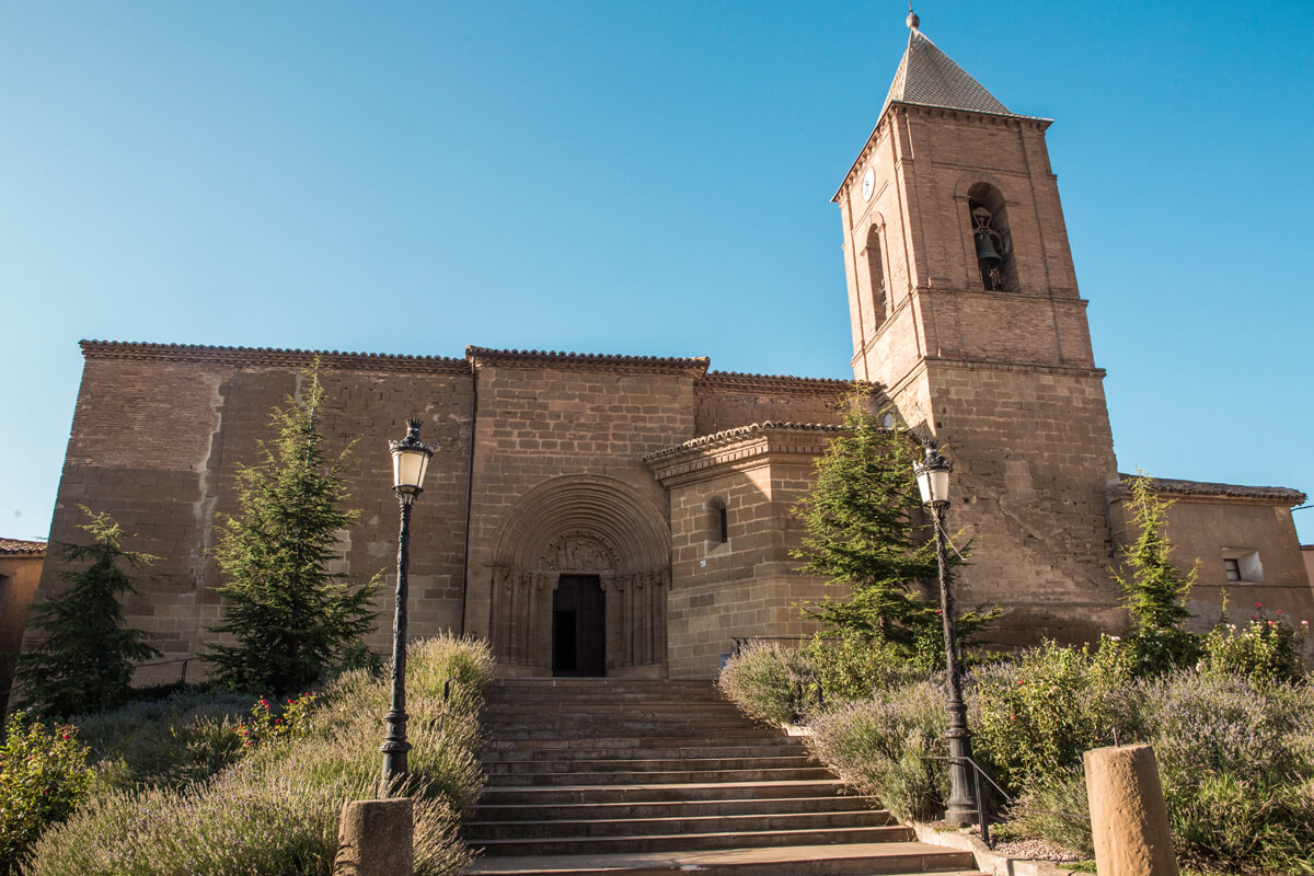
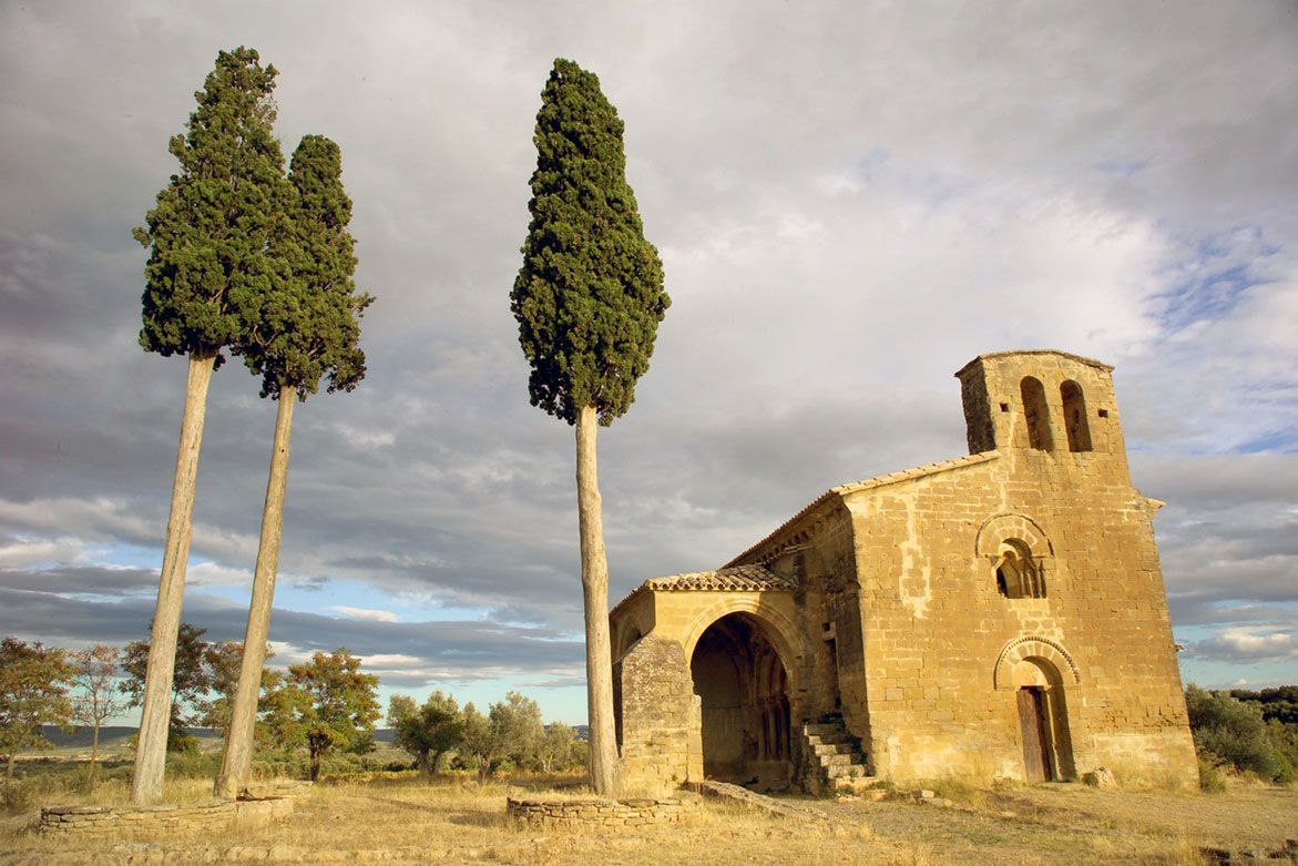
Lovers of Romanesque art should not miss a visit to the chapel of Nuestra Señora de Treviñowhilst still in Adahuesca. It can be found on the same road as the village’s spring-fed well.
The town of Alberuela de Laliena, located 3 km from Adahuesca in the direction of Bierge, also has an interesting Romanesque church, which was named after San Nicolás of Bari.

