De interés geológico
Geological interest
Somontano provides a perfect opportunity to learn how the landscape around us was formed. A visit through the region reveals signs of geological processes that explain the existence of mountains and valleys, canyons and stone pillars, rocky outcrops and cliffs.
Start your journey here to see the main points of geological interest in Somontano.
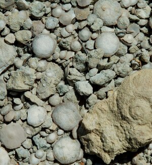
La Fondota, Paleontological Site. Abiego
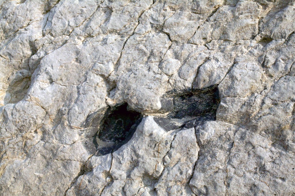
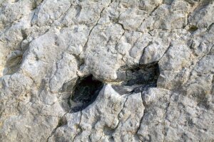
At the entrance to Abiego on the road from Bierge there is an interesting collection of over 1000 ichnites preserved in a layer of limestone. They are the fossilized footprints of herds of herbivores, now extinct, that lived on what were meadows dotted with small lakes. They are thought to correspond to the artiodactyla group of mammals, possibly the Anoplotherium or Entelodon.
Between 35 and 40 million years old, they date back to between the Eocene and Oligocene periods. Originally left in mud, the footprints filled with leaf and plant residue, which protected them from erosion.

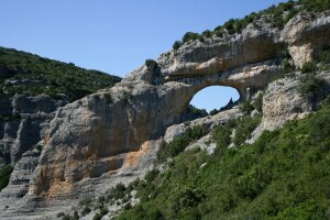
River Vero Canyon. Alquézar

Between the villages of Lecina and Alquézar, the River Vero has patiently carved its way through calcareous rock forming impressive rock walls peppered with hollows and caves. These are the result of water seeping through fractures in the ground and slowly dissolving the limestone.
The famous descents of the river Vero runs from Lecina to Alquézar. Several hiking trails can be practiced in the vicinity of this canyon:
- Camino del Rotizo
- Ruta de las Pasarelas del Vero
- Ruta al Tozal de Mallata
- Camino Natural del Somontano


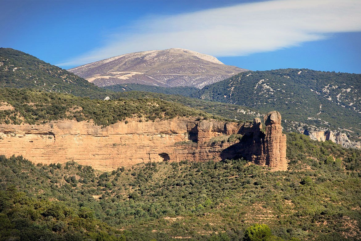
Señoritas de Lizana. Barbuñales
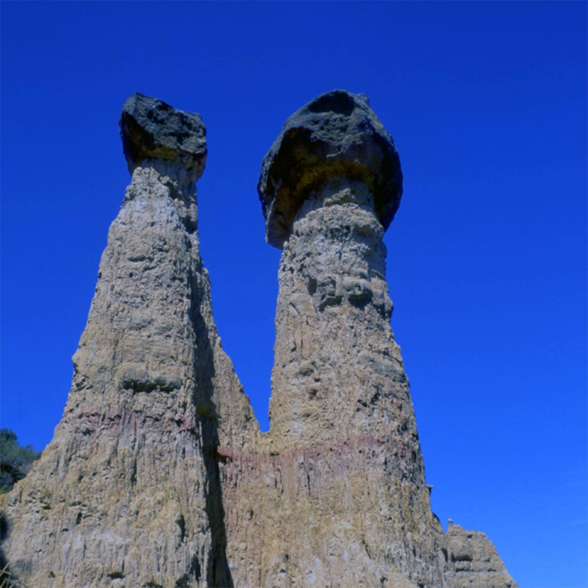
These unusual columns tower above the Alcanadre River on the right hand bank. They are formed from clay-based stone and are crowned with large sandstone boulders; a perfect example of differential erosion, which wears away clay-stone before sandstone. Large slabs at their base protect the structures and allow them to stay erect.