Rutas en el Somontano
The Chapels Route
Technical information
Type of route: lineal hiking and mountain bike route.
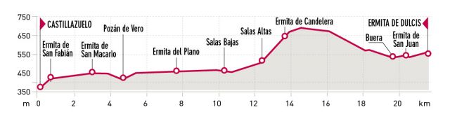
Departure point: Buera – Salas Altas – Salas Bajas – Pozán de Vero – Castillazuelo
KM:21,6
Duration: 6 h
Gradient: 450 m
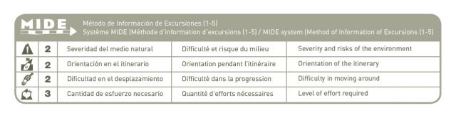
MIDE: 2-2-2-3
Difficulty:
Points of interest
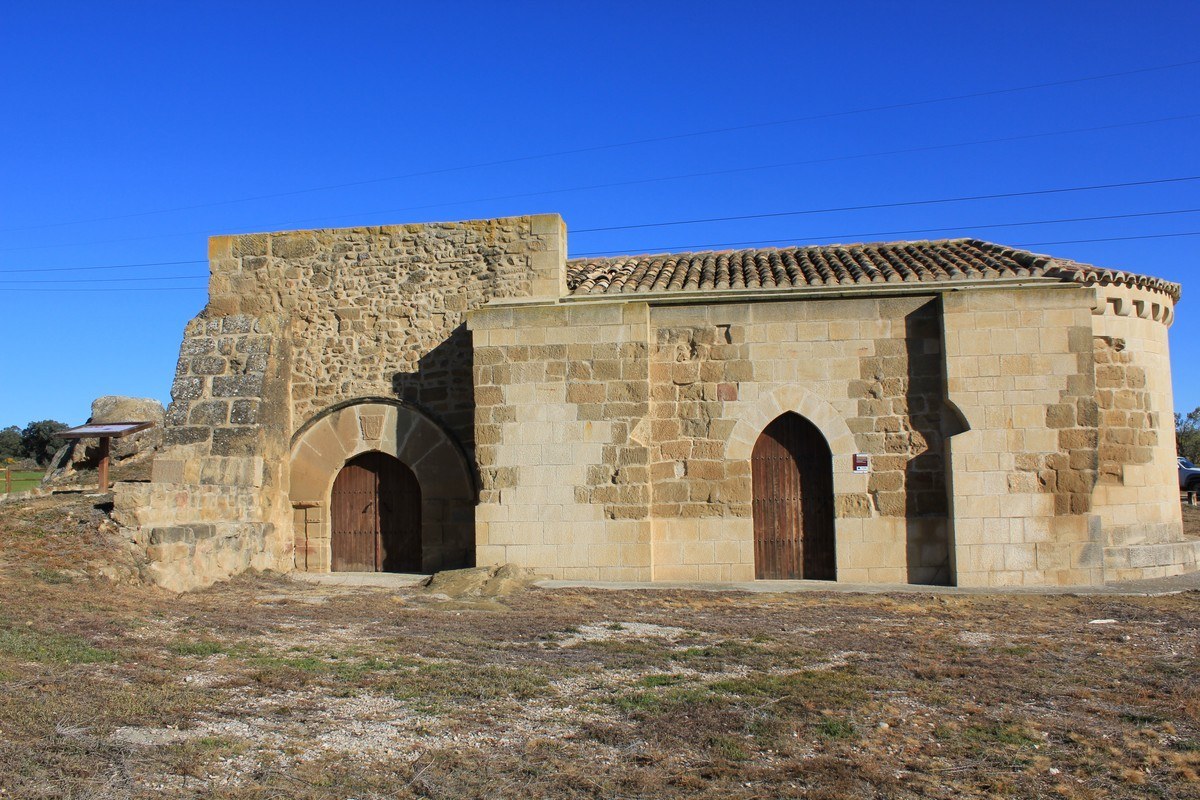
Santuary of Ntra.Sra. de Dulcis, Candelera chapel, Plano chapel, San Macario chapel andSan Fabián chapel.
Route description
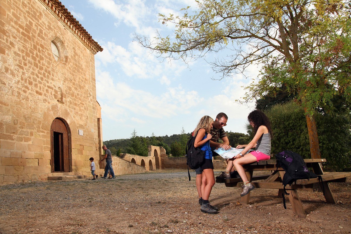
This signposted hiking trail, 13 kilometres in length, links the villages ofBuera, Salas Altas, Salas Bajas, Pozán de Vero and Castillazuelo.All of the villages have interesting chapels located near the village centre. Regardless of their small size, their artistic quality and historic value, these temples are an authentic spiritual epicentre for the local residents. The festive and religious calendar revolve around these chapels.
One can set off on the route from any of the five villages, with itinerary information boards in all the towns. These include: general information about the path, recommendations, details of each respective chapel, how to find the key for the chapels and maps etc.
New interpretive panels have been installed in El Plano and San Fabián chapels (Dulcis, La Candelera and San Macario to follow). The entireitinerary is marked at crossings and reminder points in the form of posted signs and arrows in areas where there may be some doubt. Also wooden hand rails in potentially dangerous areas(uneven surfaces, ponds or lakes and steep slopes).
Apart from the not to be missed chapels and the Sanctuary of Dulcis, the way is dotted with an array of interesting sights,such as churches, traditional Somontano village houses , vineyards of D.O. Somontano and century old olive trees…
Photo gallery


Map

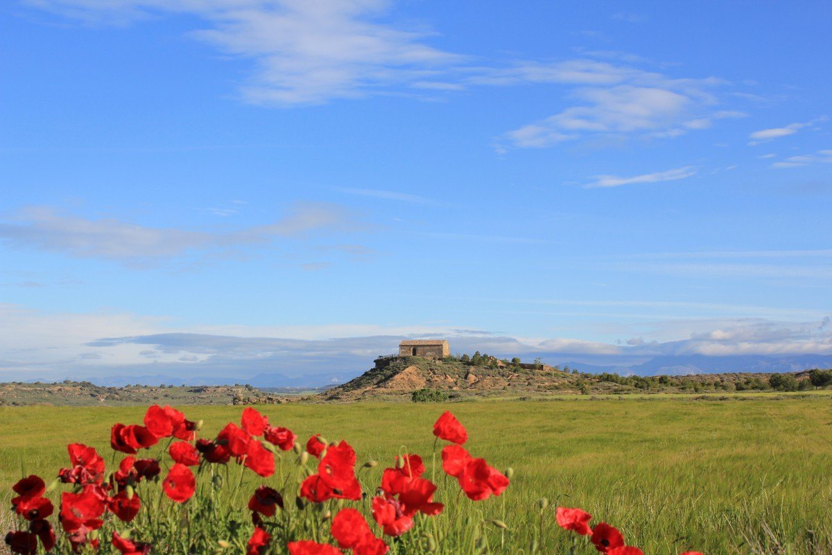
Vero riverside walk. Huerta de Vero
Technical information
Type of route: circular hiking and mountain bike route
Departure point: Huerta de Vero, playground
KM: 2,6
Duration: 1 hora
Gradient: 30m
MIDE: 1-2-2-1
Difficulty:

Points of interest
Riverside flora and fauna
Route description
Just walking in this environment is a pleasure; enjoy this simple route by the banks of the river, which is suitable for all the family.
The itinerary will take you to the remains of an old tile works, past the ruins of an ancient bridge and will allow you watch the energetic weaving of the white wagtail and the vibrant colours of the hoopoe and the chaffinch. Be prepared to be immersed in a world of sensations that will awaken your senses.
Photo gallery


Map

Hisotrical route of Berbegal
Technical information
Type of route: circular hiking route
Departure point: Berbegal
KM: 6,6
Duration: 2 h
Gradient: 150 m
MIDE: 1-2-2-2
Difficulty:

Points of interest
Traditional architecture, both Romanesque and Gothic; stretches of a Roman road and the St James’ Way; viewpoints.
Route description
From the village of Berbegal, head south towards the crossroads where the A-1223 and the HU-852 merge. The Balsas de Tejar (water reservoirs) are nearby and mark the start of the old path known locally as the ‘Camino de Morilla.’ Pick up the trail and follow it along to the point where it meets the Terreu canal. After crossing over the canal bridge, continue along the slowly descending path; as you reach the end, you will notice another that runs parallel to a small irrigation channel. Follow this until you reach the Santa Águeda Chapel and the Witch’s Rock.
From the chapel the route starts to climb until it reaches a crossroads. At this point, take the path to the left, which will shortly cross the A-1223 main road to Barbastro. The following section of the route is flanked by thick stone walls and forms part of the Catalan-Aragón branch of the pilgrim route known as the Camino de Santiago (Road to Santiago.) It is also thought to have once made up part of the old Roman road which linked the cities of Ilerida (Lérida) and Osca (Huesca.)
You will then meet up with the canal once more, and by following its course on the right hand bank for around 4 km, you will arrive at the enigmatic Muyed Rock. From here, retrace your steps along the same path until reaching a floodgate in the canal. Cross over the bridge to bring you onto a path know as the ‘Royal Zaragoza Way.’ The path continues to climb until it reaches the Balsa Galiana (a small reservoir) and at this point take the road to the left. This is the final stretch of the walk, which brings you back to the starting point of Berbegal.
Photo gallery


Map

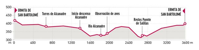
David Gómez Route. Torres de Alcanadre
Technical information
Type of route: circular hiking route.
Departure point: Torres de Alcanadre, Hermitage of San Bartolomé.
KM: 3,6
Duration: 2 h
Gradient: 150 m
MIDE: 1-3-2-2
Difficulty:

Points of interest
Geomorphology and relief of the land;prairie landscapes and riverside forests.
Route description
Spring of 2005, the naturalist, David Gómez Samitier passed away. This area to the south of Somontano is known as “pre-Monegros” due to its proximity to the desert-like Los Monegros region. The flat landscape that surrounds the village holds many surprises; distinctive areas of sandstone, vertical cliffs and ledges and scatterings of stone monoliths.The distinctive sandstone and loam shapes reveal an unusual relieve of terraced sand-like formations and stone towers as well as other extraordinary geological shapes such as the “Fairies’ Chimney,” saucepan-like craters and honeycombed walls.
However, this route is also a journey into a peaceful corner of the region between forests of thicket and the river, and between plateaus and cultivated plains. Birds that visit this area include the griffon vulture, the buzzard, red kites, cormorant, coots, crag martins and bee-eaters.
Photo gallery


Map


