Patrimonio Hidráulico
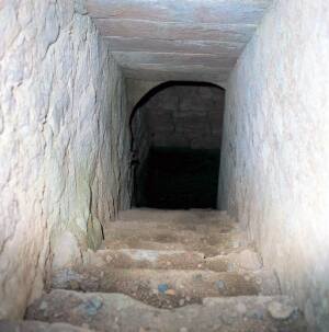
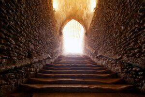
Medieval Bridges. Olvena
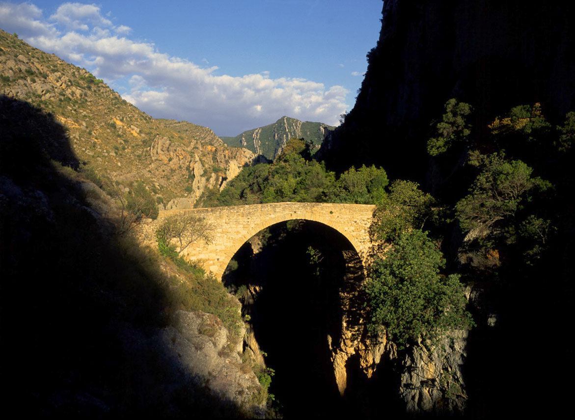
With its many rivers and a population scattered amongst small villages, Somontano has traditionally been covered by a multitude of paths, many of which had to cross gorges such as the one at Olvena.
During the medieval era, the construction of a bridge was a luxury due to the high cost involved. Their construction was only considered once other more important necessities had been taken care of, such as churches or defences, and only in places of high water flow or great drops to reach the water.
Only kings, the wealthy and the powerful could assume the costs of construction. As a result they were often financed by donations, which were solicited from the large cities and villages of the kingdom in exchange for indulgences, and by money from bequests, although these brought relatively trivial amounts.
The scale of the constructions and the fact that they lasted beyond generations gave them a magical and supernatural character. Because of this, and also because of the technical expertise that was required to build them, many legends arose placing the devil as their architect, as is the case here.It is said that a beautiful young girl from Olvena, fed up with having to wade through the river as were the rest of her neighbours, offered her soul to the Devil in return for a bridge, on the condition that he was able to construct it in just one night. Satan accepted the deal and they agreed that if the bridge was finished before the cockerel’s crow the following morning, the young girl would hand over her soul.
Despite the fact that the Devil’s cunning helped him to build the bridge in just one night, the girl placed a candle in front of the cockerel a little before dawn. Thinking that it was already day, he started to crow. The Devil didn’t quite finish the bridge (he left out the last stone) and so lost his bet and had to return to the fires of hell without achieving his mission.
This legend is told in many other places in Aragon with almost exactly the same plot but with different names and the scenery. However this dramatic spot is one of the easiest places to envisage the Devil having a hand in the construction of the bridge.
Medieval bridges are narrow because at that time the roads were no more than footpaths. Wider bridges were only built once the use of the cart became more widespread. They usually sit on rock as it provided good support for the foundations. This meant that their construction was more complex and required more effort than modern day bridges, which are often built on the river bed. The stronger the construction and finish, the longer the bridge would withstand the sudden rises of water level in the rivers of Somontano.
Medieval bridges (such as the bridges in Olvena) usually have a single arch but appear high and light giving them an attractive and slender silhouette. The Devil’s Bridge has a large central arch supported by rock and seats have been carved out on both banks. The smaller arches to the side served as spillways.
The Sierra Bridge is located a little further upstream; after leaving the car in a small lay-by at the end of large tunnel, walk for around 100 metres to reach the site of this magnificent construction. It is more impressive due to its great height.


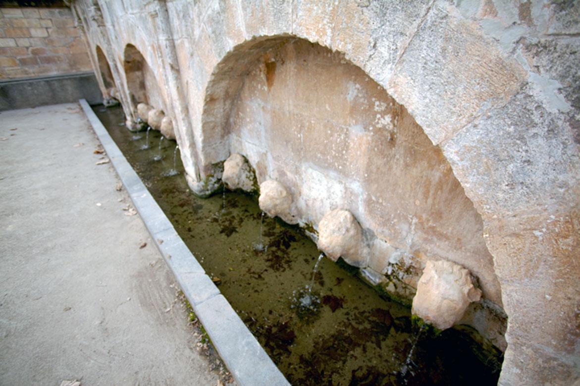
Public Fountain. Abiego
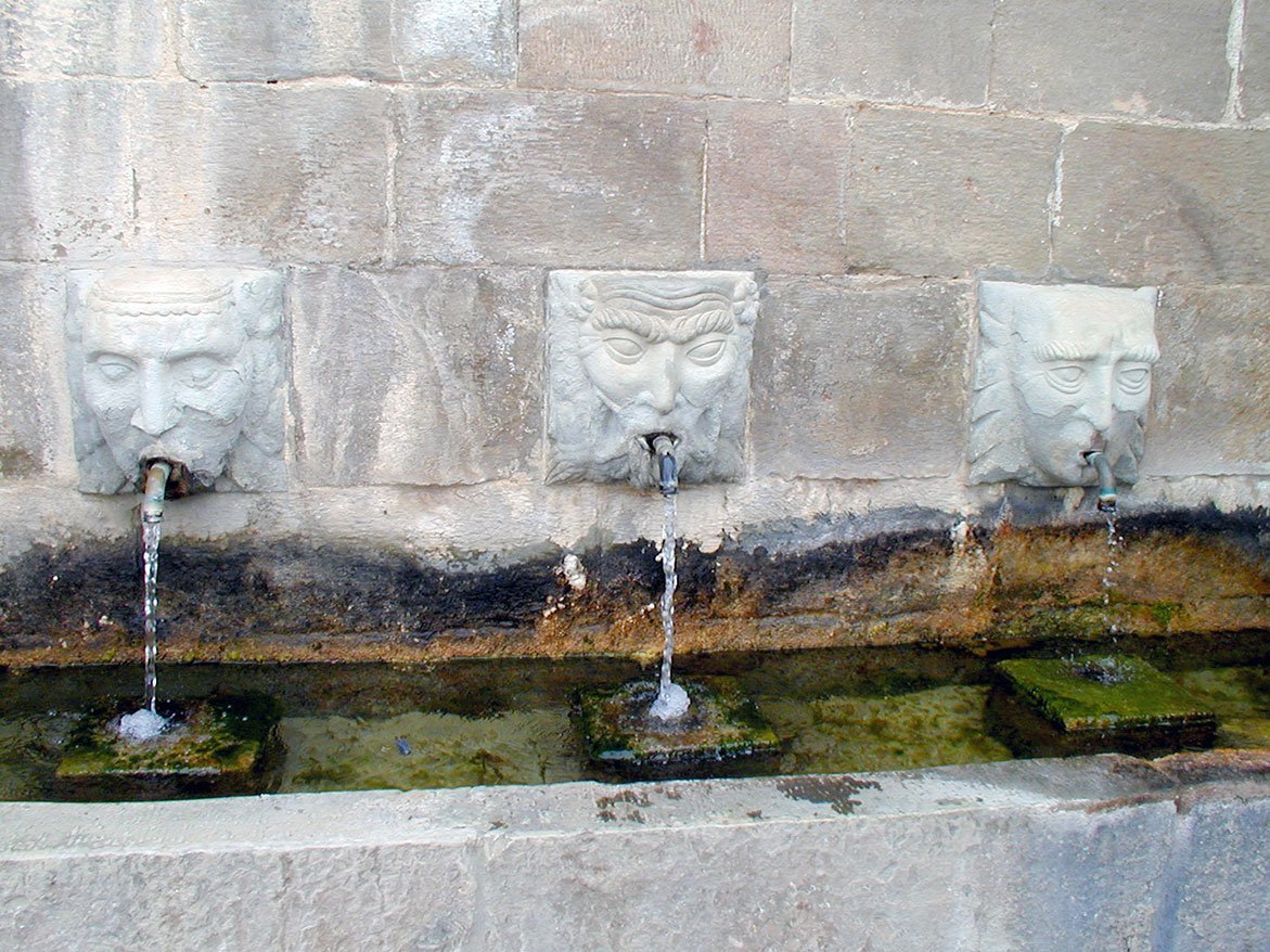
The traditional fountains of Somontano were built in a style that was popular in the 16th century. The design proved so successful that it was used for hundreds of years with little change, right up until the 19th century.
The construction was designed to meet a number of needs; the central piece was the main fountain built for human use; a channel distributed the precious water to various spouts and a little further away there was the washing area. On some occasions, water was stored in reservoirs to be used in mills and factories. A series of irrigation ditches used for watering crops in nearby fields and allotments was the final addition to the system.
Almost all of the fountains in Somontano follow the same model. The structures are always crowned with a cornice whose design is simple, yet the geometric simplicity and careful creation contributes greatly to their beauty. Very few display ornate decoration; however the fountain of Abiego boasts carved masks from which the water spouts, imitating more cultured models.

Los Doce Caños fountain. Estadilla
The fountain lies near to the vegetable gardens and village allotments. It stands on the site of the most important spring in the area providing more than 60 litres of water per second. The water maintains a temperature of 15-16ºC throughout the year.
The water is brought to the surface by means of a 35 metre tunnel excavated from the rock. It is used to water the vegetable gardens in the immediate vicinity and, by means of underground irrigation channels, also carries water to olive groves, orchards and vineyards.
The fountain dates to 1735 as can be seen from the date etched on its façade and was one of the biggest to be constructed in the Somontano region. In addition to moulded pilasters, capitals with rosettes, chunky leaves and scrolls, it also boasts twelve lions’ heads that open up into water spouts. This style denotes a significant knowledge of classicism on the part of the stone masons.
Due to its structure and decoration it is more representative of an ornamental model of fountain rather than the traditional and more functional style. These were built with a decorative and symbolic function in villages and towns, representing the pride of a society and of the municipal authorities who built them. The patronage of this model is reflected in the coat of arms that crowns the structure, leaving no doubt who was responsible for bringing water and prosperity to the villagers.


Reservoir. El Grado
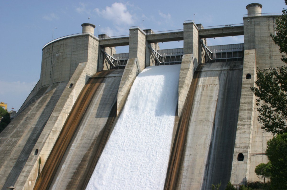
The construction of this huge reservoir and that of the El Grado dam (1969) marked an important change in both the landscape and lifestyle of the village.
It covers a total area of 1,273 hectares and holds 400 Hm3 of water. It is part of the extensive irrigation system of the Alto Aragon region as the Cinca canal originates here. It also has a hydro-electric element thanks to the water that pours over the large dam.
The reservoir offers the visitor an unforgettable spectacle; the size and setting are dramatic and the blue of the sky is perfectly reflected in the deep blue surface of the water. The top of the dam is an excellent place to take in views of the reservoir; the unmistakable Torreciudad shrine set against the background of the Pyrenees and the Cinca valley with its characteristic riverside vegetation. In addition, patient observers will see trout and other fish jumping from the water.
A number of competitions related to sub-aquatic orientation are traditionally held in the El Grado dam, as organised by the Aragonese Federation of Sub-Aquatic Activities (FARAS.) Over the last few years, it is also been one of the venues to carry out the sub-aquatic manoeuvres of the Section of Amphibious Activities (SAA) and the Pontoon Regiment of Monzalbarba (Zaragoza.)
Visits:
Mail: [email protected]
Teléfono: 976 711 045