Trail Running
Trail Running
In the last few years, trail running has undergone impressive growth and more and more people are fond of running on mountain trails, looking for new races or routes and new challenges. In short: new adventures.
Located in the outskirts of the Pyrenees, Guara Somontano has an awesome orography with long climbs and steep descents, to practice this sport year-round.
The range of possibilities offered by this territory for trail running is so wide that each year, two sporting events are organized: the Trail Sierra de la Carrodilla in June in Estadilla and the Ultra Trail Guara Somontano in Alquézar in October.
Enjoy Guara Somontano with our new trail running routes.
Prepirenaica Trail
Guara Somontano together with the Hoya de Huesca and Cinco Villas in the province of Zaragoza is Prepyr365 area. This consists of territories in the heart of the Pre Pyrenees that allow us to enjoy natural and patrimonial resources and explore natural surroundings such as the Sierra de Guara, the Reino de los Mallos or the Sierra de Santo Domingo.
Prepirenaica Trail is a 12 stages tour going through the great trails of Santo Domingo, Reino de los Mallos and Sierra de Guara ranges located on the Aragonese Southern Pyrenees.
Prepirenaica is a challenge that every hiker and trail runner must experience. We have designed the tour including the best spots of this wonderful and remote land including ancient trails, pre-historic hermitages, medieval and uninhabited villages, deep canyons and overwhelming natural areas. A series of trails that will for sure delight you.
Of the 12 stages, 3 stages cover the most beautiful corners of the Sierra de Guara:
Enjoy the PrePyrenees 365 days a year!


Guara Somontano Trail. Alquézar
Technical information
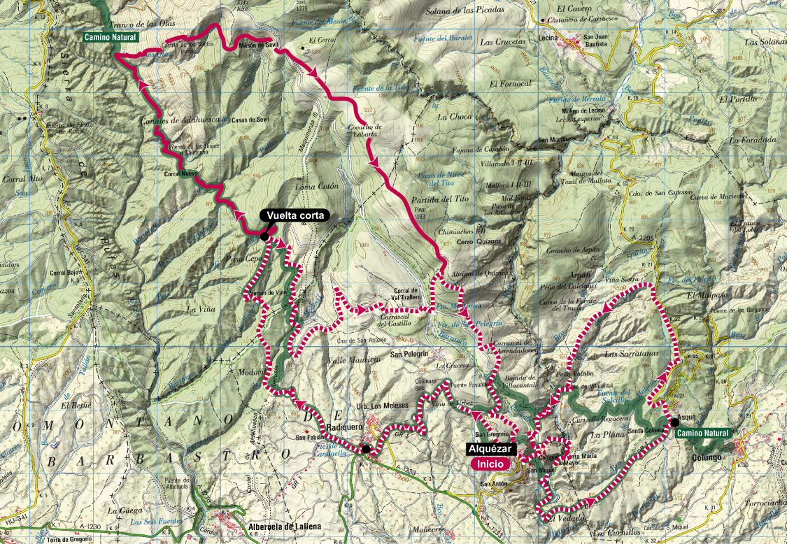
Type of route: circular
Strating point: Alquézar
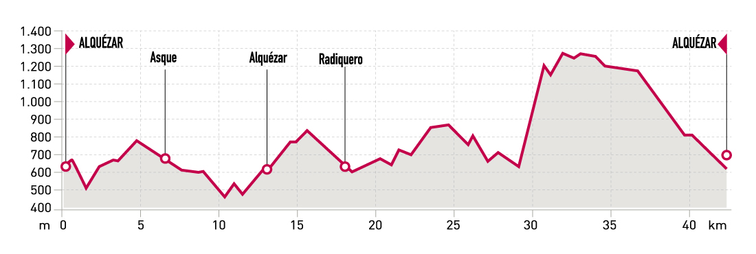
KM: 43.4
Duration: 6 - 9 horas
Gradient: 2216 m
Difficulty:
Route description
Guara Somontano Trail is a trail running event held since 2010 on the same weekend than the popular Ultra Trail Guara-Somontano. It was specially designed as an event for long-distance trail running beginners. Long Trail Guara Somontano, an extended version of the race has been held since 2013.
This leafl et presents both alternatives: the fi rst one, featuring 38 km and 1890 m of elevation gain and the second one featuring 43,4 km, going up to Mesón de Sevil and Castillo de los Santos. Both trails will let you discover the great surroundings of Alquézar and Vero River as well as the trails of Sierra y los Cañones de Guara Natural Park.
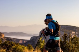
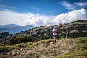
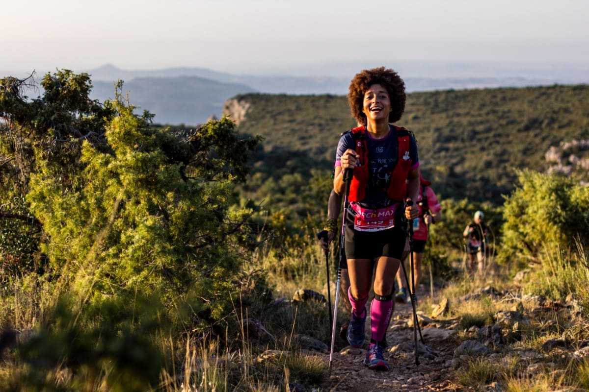
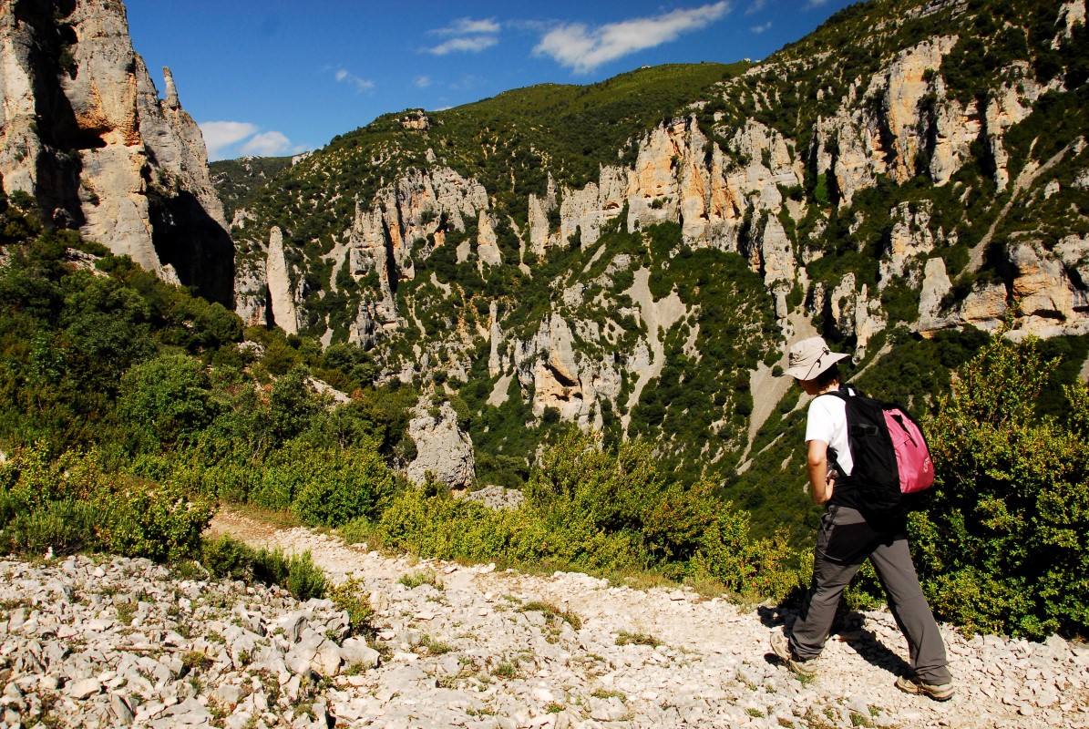
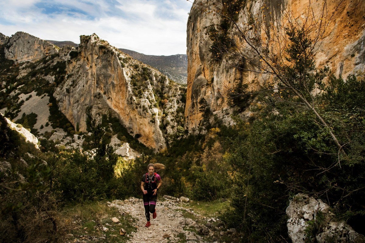
Photo gallery


Map
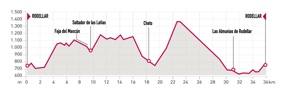
Mascún Canyon Trail. Rodellar
Technical information
Type of route: circular
Starting point: Rodellar
KM: 36,6
Duration: 5 - 8 horas
Gradient: 2030 m
Difficulty: +
Route description
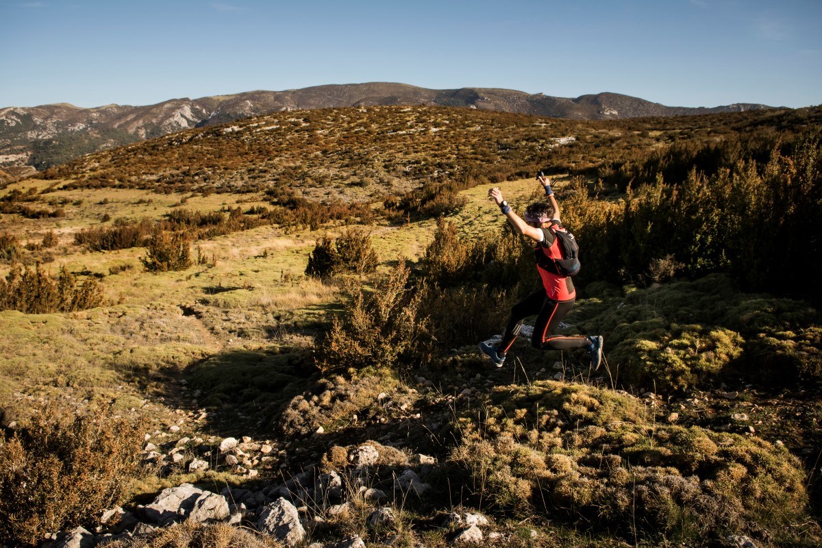
Mascún River Canyon is one of the most spectacular and stunning natural areas of Southern Pyrenees. It features an endless amount of limestone needles and vertical walls that stand over the pristine waters of Mascún River. The best way to discover this privileged area is by running on its high trails offering to the runner wonderful panoramic views of the river canyon.
Starting from Rodellar, the route consists of two joined loops. The fi rst of them ascends through Mascún River Canyon by the so-called «Costera de Otín» passing by the beautiful «Ciudadela». After leaving Otín, the trail head towards «Saltador de las Lañas» crossing Vero river course and leading to Cheto. The second loop departs from Rodellar and climbs to the top of Sierra de Balcés heading towards Las Almunias and Pedruel before going back to Rodellar.
Photo gallery
Map