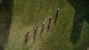
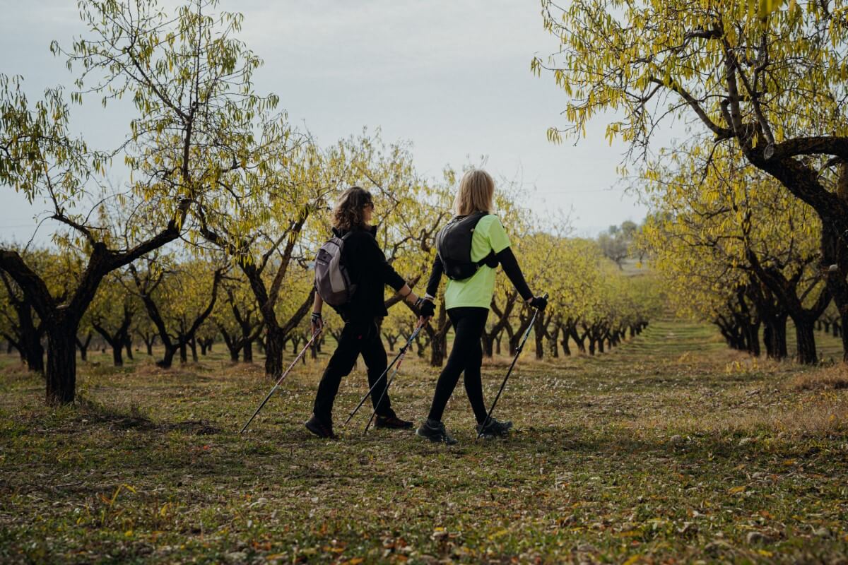
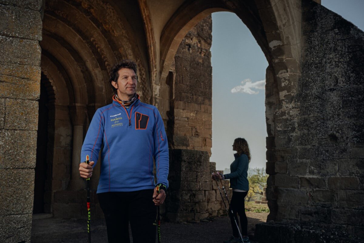
Marcha nórdica
Nordic walking
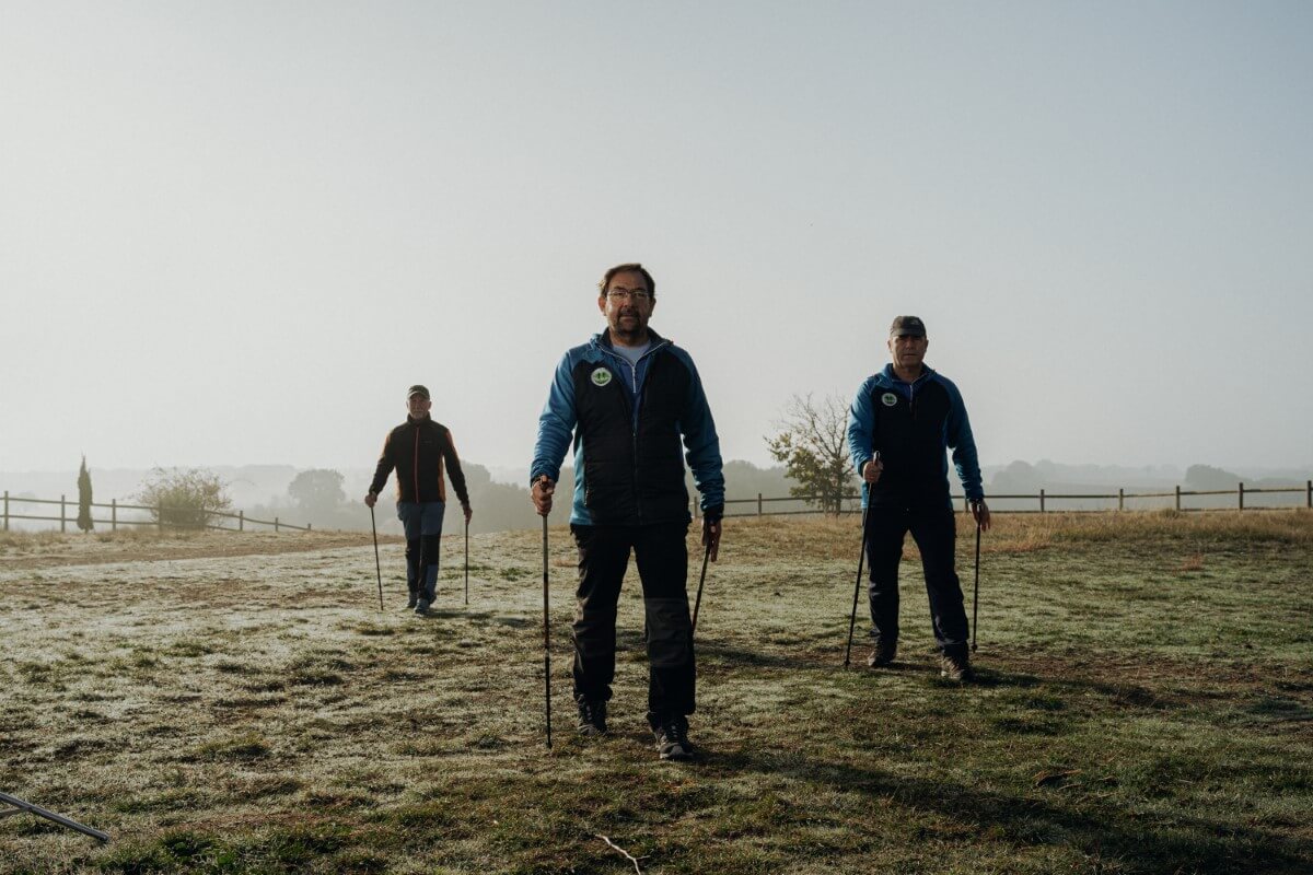
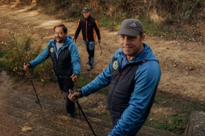
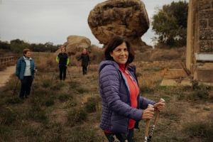
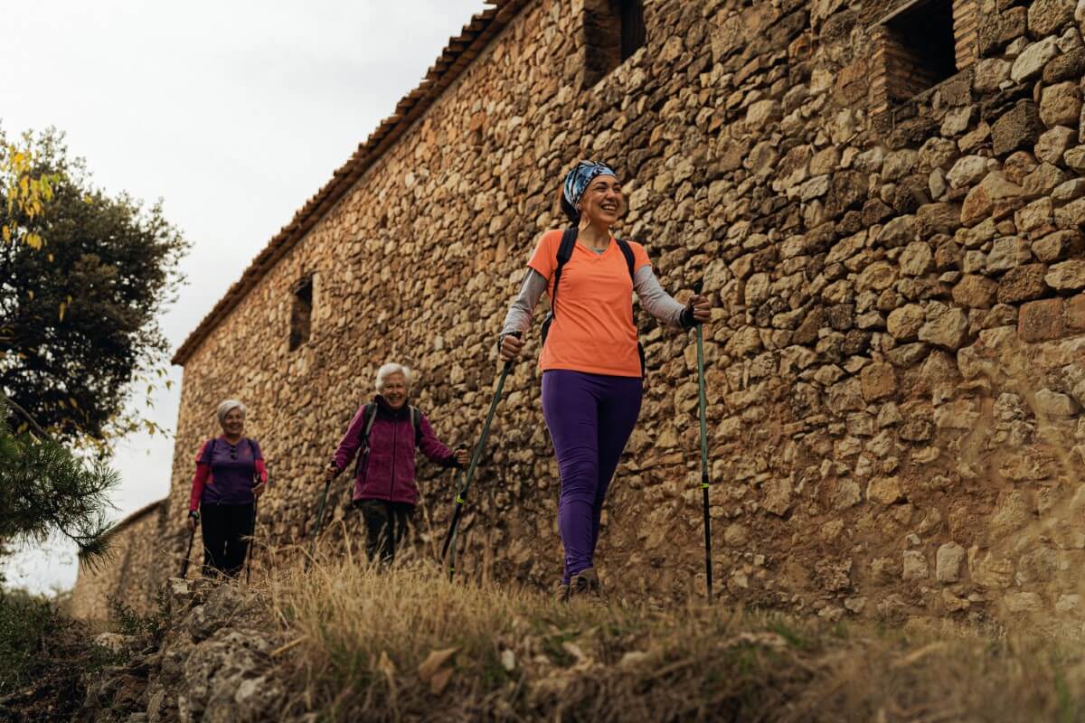
La marcha nórdica es el deporte perfecto.
Ayuda a contener el peso, alivia tensiones, combate problemas posturales y no provoca daños en las articulaciones, entre otros beneficios.
Es un ejercicio completo que si, además, lo practicas con amigos o en familia y en Guara Somontano, tienes asegurada una gran experiencia.
Solo necesitas unos bastones y zapatillas y descargarte toda la información de las nueve rutas que hemos planificado por toda la comarca, con diversas longitudes y niveles.
Además de practicar una actividad sana para tu cuerpo y mente, podrás conocer algunos de los paisajes más singulares de Guara Somontano, con espacios de gran interés natural y patrimonial.
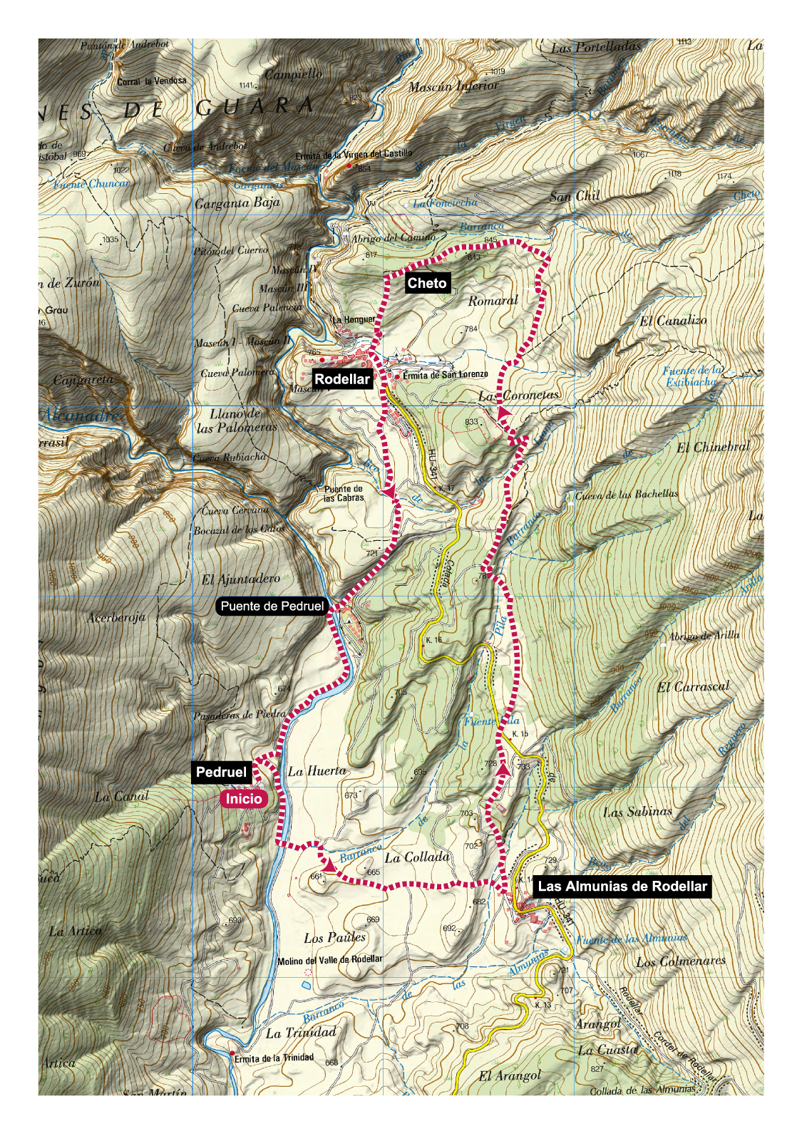
Dry stone walls. Pedruel
Technical Information
Type of route: circular
Departure point: Pedruel
KM: 10,1
Duration: 2 h 15 min
Gradient: 335 m
Difficulty: ?
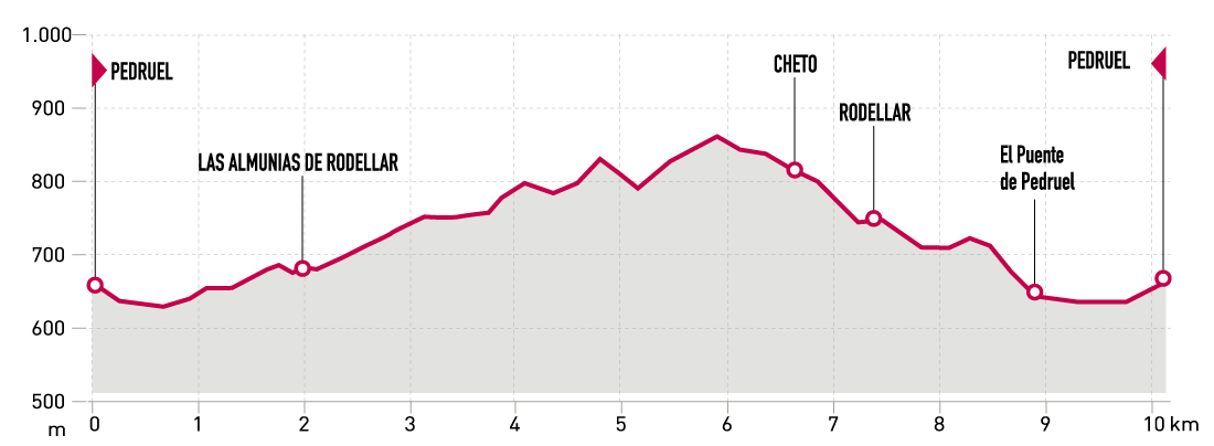
Points of interest
World Heritage dry stone walls, Pedruel bridge and the villages of Las Almunias de Rodellar, Cheto, Rodellar and Pedruel.
Route description
The Rodellar Valley, located in the heart of the Sierra de Guara, still preserves many of the old paths between walls that once connected the villages of the valley.
Some of these dry stone walls are little works of art in themselves, especially those around Cheto.
The suggested route has a large number of paths and can be started from Pedruel, Rodellar or Las Almunias.
Starting from Pedruel, the route begins by going up the road to Las Almunias, and from there a succession of footpaths and tracks to the pretty village of Cheto. From Cheto to Rodellar and from Rodellar to Pedruel, the route continues mainly on narrow paths, which are surprisingly flat and accommodating in comparison to the usual routes in the Sierra de Guara.
Gallery photo


Map

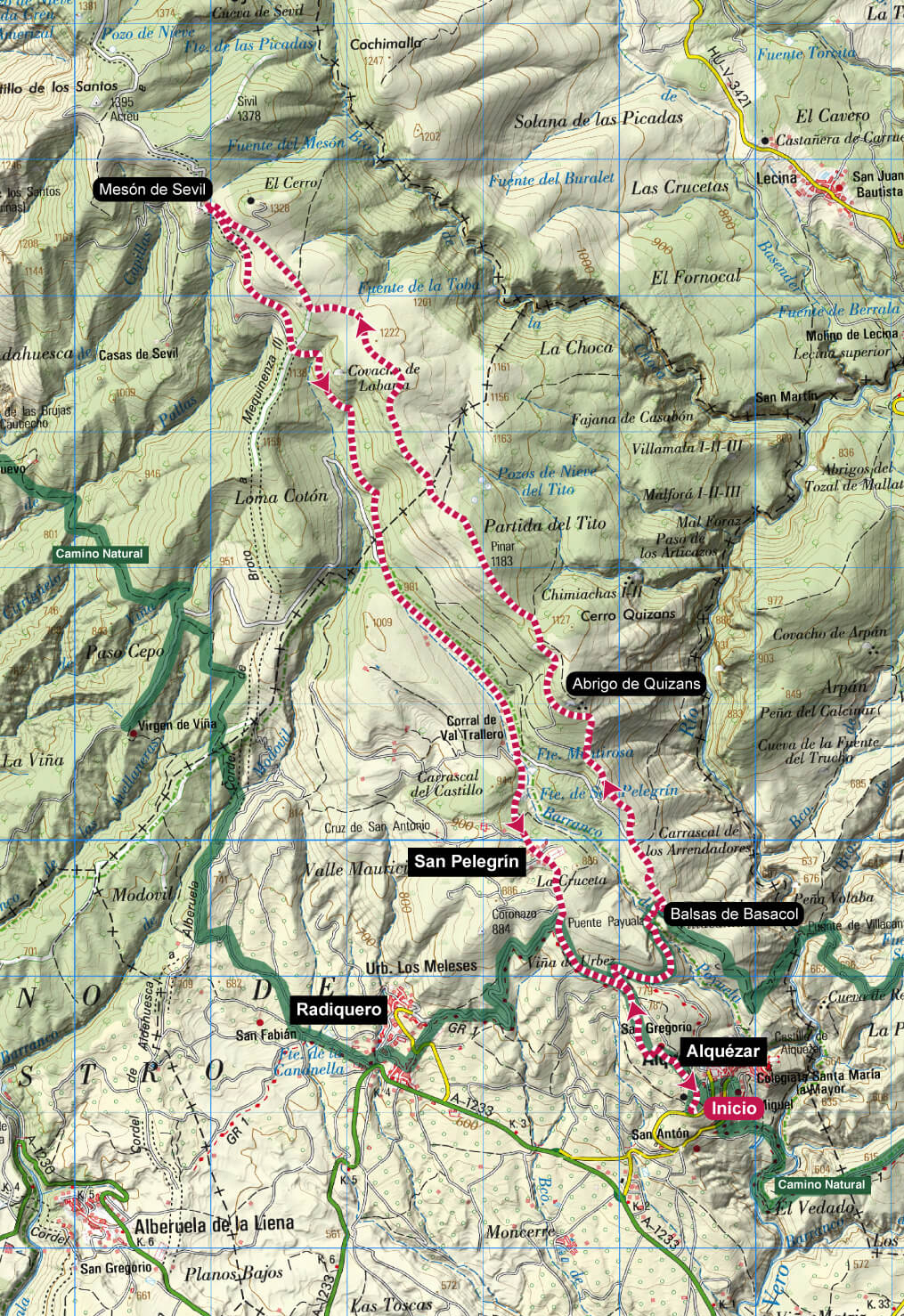
Sevil Mountain Range. Alquézar
Technical information
Type of route: circular
Departure point: Alquézar
KM: 18,1
Duration: 4 h
Gradient: 640 m
Difficulty:

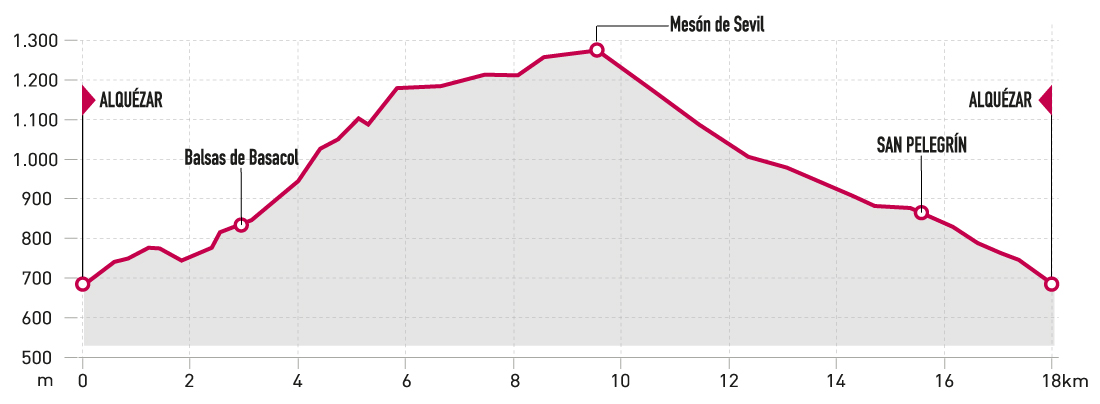
Points of interest
Balsas de Basacol, Quizáns shelter and the villages of Alquézar, Radiquero and San Pelegrín.
Route description
This long-distance route combines sections of forest track with short stretches of stony path typical of theSierra de Guara.
There are beautiful panoramic views to enjoy, from the Vero river canyon to the Pyrenees to the Somontano plains.
Starting from the car park in Alquézar, the route startsgoing uphill along a track to San Gregorio, and shortly after it joins the Camino Natural del Somontano until it reaches the Balsas de Basacol. From there, the route gains altitude, alternating between sections of track and path, passing by the shelters of Quizans and some oldshepherds’ huts. At the Mesón de Sevil, a well-deserved rest undercover is in order. From there, you’ll fi nd a descent along a track inexcellent condition down to Alquézar.
Photo gallery
Map
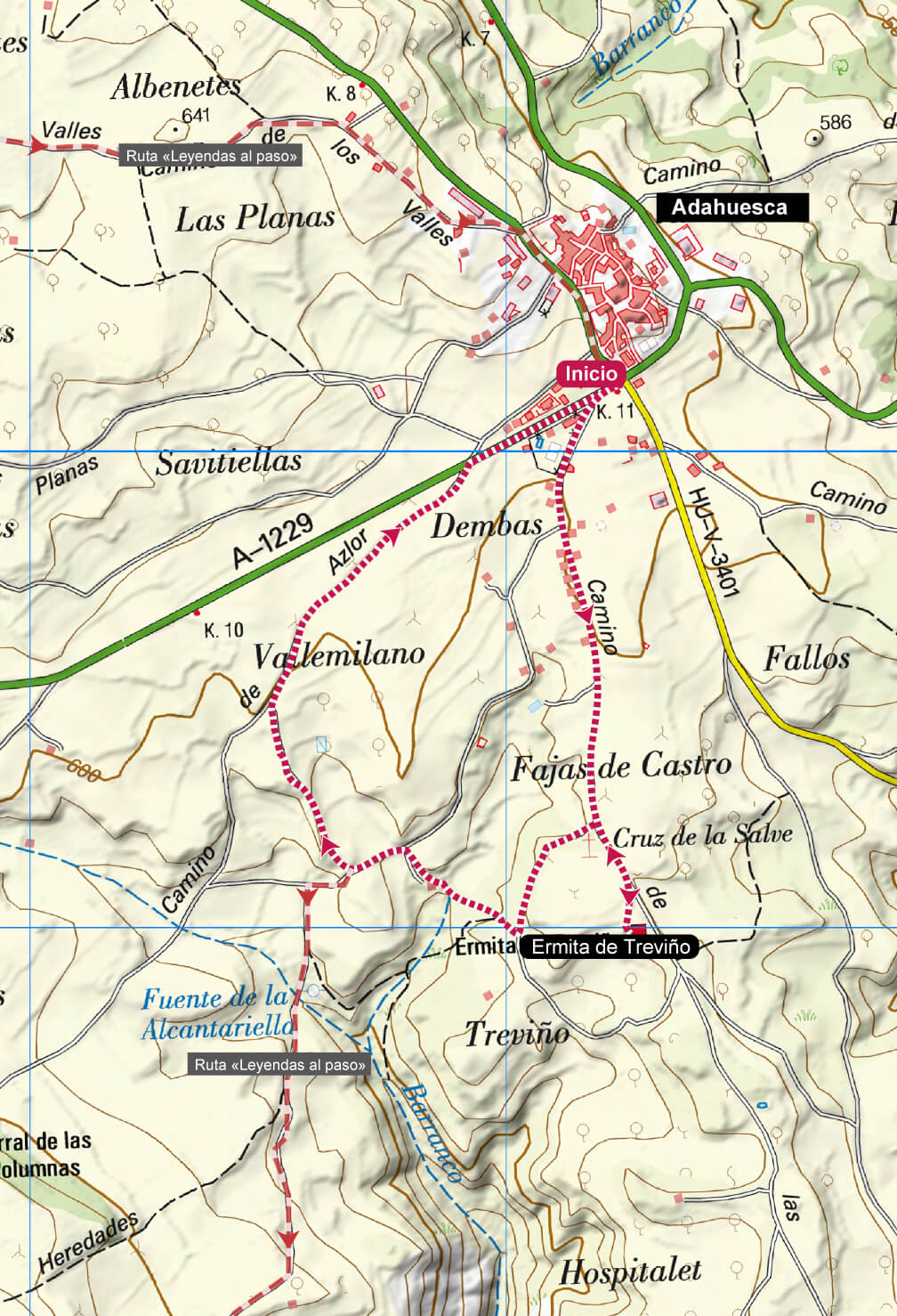
Treviño Hermitage and Adahuesca Fountains
Technical Information
Type of route: circular
Departure point: Adahuesca
KM: 3,7
Duration: 1 h
Gradient: 40 m
Difficulty:

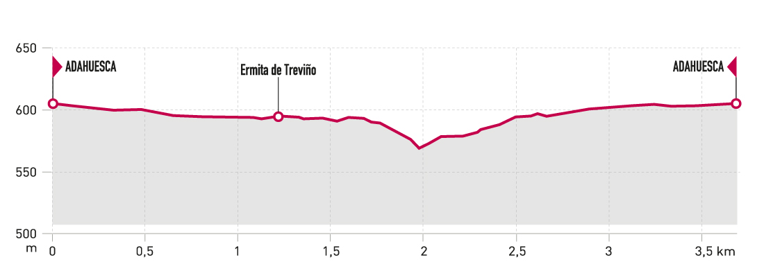
Points of interest
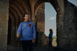
Fountains and hermitage de Treviño.
Route description
A simple, short route that allows you to discover the surroundings of Adahuesca, where the Treviño hermitage, listed as an Asset of Cultural Interest, and the fountains that supplied water to the village are located.
The route begins at the car park located on the road from Abiego, and follows the Leyendas al Paso route towards the Treviño hermitage, where you can see the Romanesque church and its cloister. Then, you must retrace a stretch of the path until you find the signpost to the springs. After a beautiful stretch of path, you leave the signposted route to return along a comfortable track to Adahuesca.
If you wish to extend the route, it is possible to continue from there along the Leyendas al Paso, which is 11.2 km and suitable for nordic walking.
Photo gallery
Map