Technical information
Type of route: return hiking route
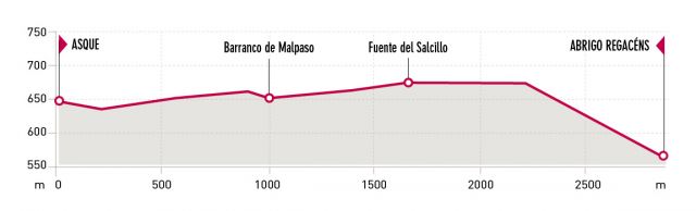
Departure point: Asque
KM: 5,8
Duration: 2 h
Gradient: 180 m
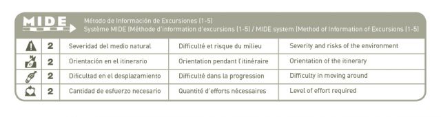
MIDE: 2-2-2-2
Difficulty:
Points of interest
Route description
After leaving Asque, the path zigzags through olive groves and almond tree orchards before arriving at a valley that marks the entrance to the protected area of the Sierra and Canyons of Guara Natural Park.
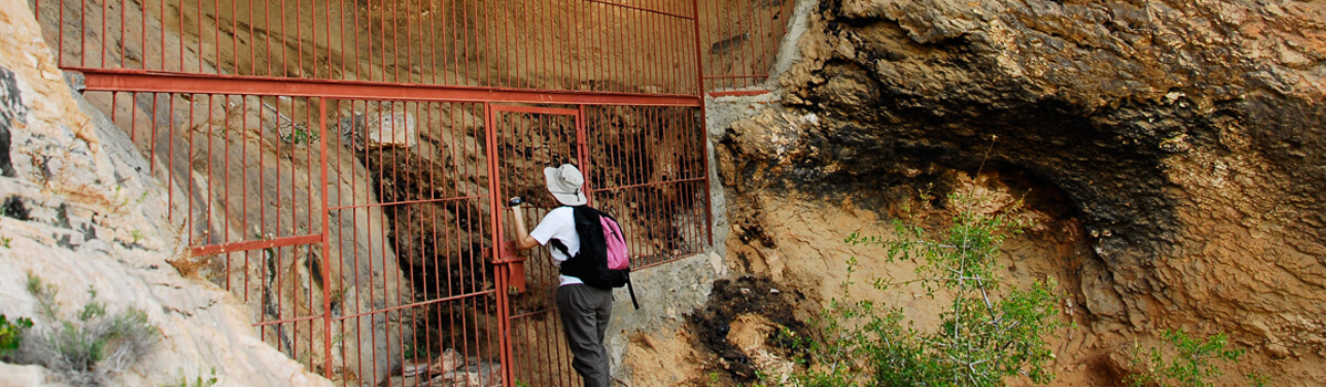
From here the path continues through the countryside, passing thickets of holm-oak, low brush and scrub typical of the area. Watch out for the place where the path branches off to descend steeply into the canyon to reach the Regacens shelter. The opening to the shelter faces the Fuente canyon.
This enormous fissure in the rock appears to have fractured the mountain range into two halves, and allows a secretive glimpse of the village of Alquézar.Here, it is often possible to see falcons and the occasional golden eagle flying over the limestone cliffs; however, the lammergeyer is considered to be the true king of the skies above Guara.
Photo gallery


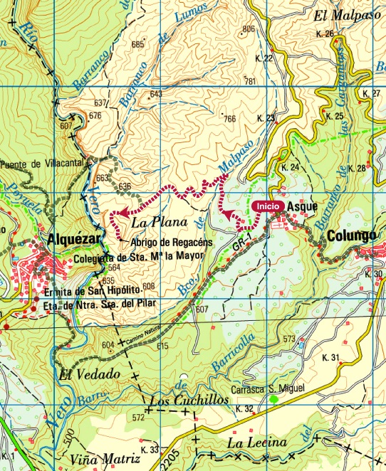
Map